Download
1 / 31
310 likes | 319 Views
Coastal Process. Chapter 9:. Wave Dynamics. Wave length (L) = Distance between crests, Wave height (H) = Vertical distance between the crest and the trough Wave base = depth below which waves have no effect = ½ * wave length.

E N D
Coastal Process Chapter 9:
Wave Dynamics • Wave length (L)= Distance between crests, • Wave height (H) = Vertical distance between the crest and the trough • Wave base = depth below which waves have no effect = ½ * wave length Period (T)= Time taken for two successive waves to pass a point Velocity (V) = L/T
Breakers form when the sea-bottom is at a depth less than the wave base • Surf Zone = Zone along which breaking waves collapse • Swash and backwash = up and down movement of water along the shore line
Sydney, Australia Notice the surf zone and also the rip currents
Berm Offshore = Farthest out, beyond surf zone Foreshore = surf zone, tidal flat and swash zone Backshore = Inwards from Foreshore upto the coastal dunes
Virginia Keys What is the direction of the Longshore Current?
Commenced 1970 s • $62 million over 10 years, 160 K m3 of sand • 18 million m3 of sand dredged and pumped • 200 m wide beach by 1980s
Miami Beach Berm Swash Zone
Nature of Coast Line • Active Margin • Western Coast of USA • Steep Continental Shelf • Narrow beach • Rocky cliffs • Passive Margin • East Coast • Wide, gentle beach, sandy offshore islands • Broad Continental Shelf
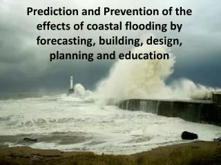
Coastal Hazards • Sea Level Rise • Hurricanes, Storm surge • Recognition of coastal hazards
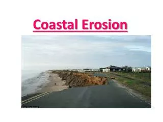
Coastal Erosion • Human modification has accelarated erosion • Coastal Engineering structures e.g., sea walls • Damming of rivers • Subsidence due to withdrawal of groundwater, oil etc
Do you know this place? Spit • Depositional Landforms: • Spits = narrow extension of beach formed by longshore current • Barrier Island = sandy offshore islands parallel to the shoreline
Safety concerns • High elevation (>5 m) above normal high tide • Well developed beach dunes between the site and the water-line • Overall water level – maximum storm-surge limit • Emergent or Submergent coast? • Rate of coastal erosion (from USGS and county maps)