Download
1 / 10
110 likes | 260 Views
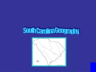
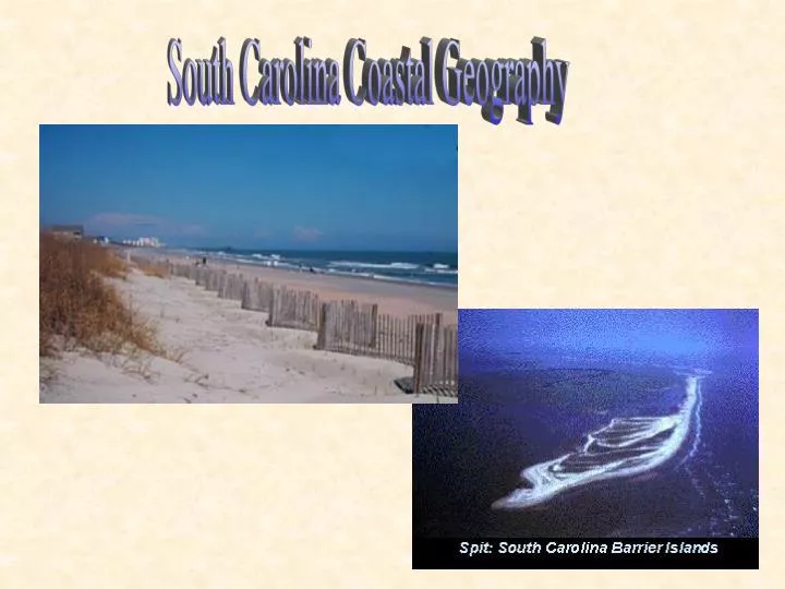
South Carolina Coastal Geography. SC Fast Facts: Borders - Atlantic Ocean, Georgia, North Carolina Total area - 31,189 square miles - 41st largest state - Land area - 30,111 square miles - 96.5% - Inland water area - 1,006 square miles - Coastal water area - 72 square miles

E N D
SC Fast Facts: • Borders - Atlantic Ocean, Georgia, North Carolina • Total area - 31,189 square miles - 41st largest state- Land area - 30,111 square miles - 96.5%- Inland water area - 1,006 square miles- Coastal water area - 72 square miles • Miles of coast - 187Miles of coastal shoreline - 2,876 - 11th longestMiles of oceanfront beaches – 182 • Low Country- Coastal area from Pawley’s Island south to the Savannah River • Tidal Range: 4.6 ft • Largest Barrier Island - Hilton Head Island • Major Rivers - Santee River, Edisto River, Savannah RiverLongest river - Savannah River - 238 miles, Largest river - Santee - drains 40% of the state • Major Lakes - Lake Marion (172.8 sq.mi )*, Lake Moultrie, Lake Murray, Hartwell Lake • Climate: Jan 55-32, July 71-92 , Annual precip: 48 inches • Major Industries - farming (tobacco, soybeans), textiles, manufacturing chemicals, processed foods, machinery, electronics, paper products, tourism
3 Marine Terminals Served 2472 ships/ barges in ‘02 Georgetown Charleston #4 nationally Busiest port in SE & Gulf Coast Port Royal
The arcuate strand is a crescent-shaped beach stretching from the North Carolina –South Carolina border south to Winyah Bay, SC. • This area is generally considered the most stable region along the S.C. coast. It is a wide, continuous beach approximately 60 miles long with few tidal inlets. The absence of inlets in this region is also associated with the lack of barrier island and salt marsh. • Suitable for development- higher elevations • Extensive development and erosion • Tourism impact - ex: 12 million tourists 1994 • High shoreline erosion • Dunes, vegetation, and elevation vary Myrtle Beach area
The cuspate delta, south of the arcuate strand between Winyah Bay and Bulls Bay, is referred to as the Santee River Delta. • It is the largest deltaic complex located on the eastern seaboard of the United States and is 18 miles long. Here, headlands (or capes) extend into the ocean and form elongate spits. • Borders- Santee Point to Isle of Palms • Coastline - 50 miles • Characteristics- • Primarily Santee River Delta- largest on east coast • Lowest portions are covered by salt marsh • Coast unsuited for development • Many undeveloped barrier islands • State and national refuges and coastal reserves
Beach-ridge barrier islands (also referred to as prograding barrier islands) are larger islands that contain a beach, vegetated sand dunes, shrubs, and a maritime forest. Kiawah Island is an example of this type of barrier island. • Transgressive barrier islands are long, narrow islands that are extremely unstable because they lack heavy vegetation and healthy dune systems. • They are referred to as retrograding islands because they retreat landward. Folly and Morris Islands are typical examples of this type of barrier island.
The barrier island complex, south of Bulls Bay to the Georgia border, includes transgressive barrier islands and beach ridge barrier islands. • These relatively thin, elongate islands are located along the majority of South Carolina’s central and southern shoreline. • approx 75 mi of coastline • They protect our coastal areas from storm forces and rising sea level. • Characteristics- • Many highly developed barrier islands • Marginally to non-suitable for development • Loss of natural dunes and maritime forests • Extreme erosion
Hilton Head • 12 mi long and 7 mi wide- largest barrier island on SC coast • Extensively developed • Eroding and accreting shoreline • Varying topography • Well forested areas at higher elevations • Lower elevated areas- flood risk
South Carolina is no stranger to hurricanes. Meteorologists predict 4 hurricanes each season to strike the eastern and southern U.S. The most damaging hurricanes struck landfall in 1752, 1885, 1893, 1911, 1940, 1959 and 1989 Hurricane Hugo is one of most memorable. On September 21, 1989, Hugo hit the U.S. mainland just north of Charleston, South Carolina, costing $5.9 billion in damage and the lives of 29 people. It was one of the U.S.'s most expensive hurricane disasters in history. Sustained winds of 134mph and a storm surge of 20 ft.
References: http://www.cofc.edu/CGOInquiry/tutorialindex.htm http://www.sciway.net/ http://www.sciway.net/gov/ports_auth.html http://search.enchantedlearning.com/cgi-bin/uncgi/search?key=south+carolina Office of Ocean and Coastal Resource Management. (2000). Understanding Our Coastal Environment. Charleston, SC:OCRM Press.