Download
1 / 17
170 likes | 256 Views
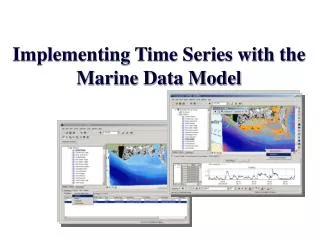
Implementing Marine XML for NOAA Observing Data. Nazila Merati and Eugene Burger NOAA/Pacific Marine Environmental Laboratory Seattle, WA. Ocean observation systems (OOS) and data transformations.

E N D
Implementing Marine XML for NOAA Observing Data Nazila Merati and Eugene Burger NOAA/Pacific Marine Environmental Laboratory Seattle, WA
Ocean observation systems (OOS)and data transformations • PMEL and its partners carry out several large scale ocean monitoring programs (TAO, FOCI, Tsunami, Argo) with hundreds of instruments and thousands of observations.
Data transformations and data sharing • Scientists spend a great majority of their time formatting data, transferring data and developing transfer protocols before starting data analysis and sharing.
History of the project • In 2003, we went to the ESRI User Conference and heard that XML would play an important role in the new ArcGIS architecture. • Also in 2003, NOAA IT and web developers began to discuss the need for standards when using XML. • We found that others had started looking at XML standards and defining XML standards for observational Marine data – XBTs and meteorological observations • We identified a project at PMEL and NODC that we could use to test XML – Argo Profiling Floats.
Test case– Argo Profiling Float Data • The Argo program is broad-scale global ocean observing system of temperature and salinity • Floats are designed to drift at a fixed pressure for a fixed period and then move to a profiling pressure. As they rise, they collect profiles of pressure, temperature and salinity on their way to the surface. • Each float can produce up to 150 profiles during its life time
Why use Argo Profiling Floats? • Argo Profiling Floats were selected because they are a good example of a profiling data type, have only a few attributes associated with each profile and are integral to the ocean observing system architecture • NODC’s data manager is interested in using XML as a method of data sharing between Argo Data Centers • Integration of Argo Profile data into GIS will introduce the data to a new group of users that are more GIS savvy
Project objectives • To work with NODC to identify key data sets and define which file formats to work with • Using data specifications from example libraries, to define optimal parameters for a MarineXML dictionary • To build schema that works the best with Floats • To test the schema, assess bandwidth versus file size issues, and test feasibility of web transfers • To load data into ArcGIS 9.x and personal geodatabase • To test the metadata creator in ArcGIS for compatibility with MarineXML schema
Why use XML? • Platform independent tool that makes data exchange and communication between organizations easier – its not just for science • Extensible • Data management - allows preservation of data, metadata, quality flags and edited data • It can serve as the “basis of a data management framework”
Different types of XML • Marine XML – different flavors – strong community component, been in use since 2001 • ESML – Earth Sciences Markup Language – works with netCDF, HDF, good community backing • Borehole XML - good as it has a z-value, may be better as a descriptor of actual location rather than data – boreholes are also more shallow that the float data, not quite sure what borehole data are stored as, mostly text files • NcML – good open source standard, data already are stored as netCDF, it’s the marine standard for data storage, most translators are for gridded data • Sensor ML – still written within the OGC specs, again more for descriptor, but not necessarily for data transfer
How does this fit in with GIS? • Currently, PMEL has ways of getting data into GIS that are great, but this still requires data formatting and the use of several different packages. • The output is a shapefile to be used by ESRI products.
ESRI and the geodatabase • Changes are happening in the way GIS data are managed. We are moving from shapefiles and coverages to geodatabases for data management and data storage. • Geodatabases can be useful if you are building data models for a specific industry.
Geodatabases and data transformations • ArcGIS 9 has the ability to take XML encapsulated data and transfer the data into the geodatabase. • The Geodatabase XML format will allow you to import and export items and data to/from the geodatabase. Transfers include domains, rules and topologies and adding behaviors
Potential problems • netCDF to ncML or to MarineXML – no need to do a double jump • Bandwidth and compression, XML may supersize data • What if the geodatabase goes away? • Is MarineXML better than ESML? • Can it be applied to legacy data?
Next steps • Look at MarineXML specifications and meet with AODC folks next week. Identify key data sets to test and talk to ESRI about netCDF translators. • Determine if the existing EPIC in-situ XML DTD and schemas can be modified to work with Argo Profiling Floats and can handle data. • Test the new XSLT tools from ESRI and test transfer times – is this just as clunky as before?