Download
1 / 10
100 likes | 255 Views
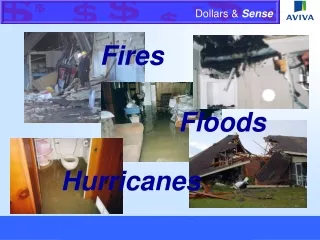
Emissions Estimation for Wildland Fires. PM2.5 Emissions Inventory Workshop Denver, CO March 2004 Thompson G. Pace USEPA. Wildland Fires. Overview of Wildland Fire Inventory. Wildland Burning Burners: NPS, USFS, BLM, USFWS, State & Tribal Forests, Private burners

E N D
Emissions Estimation for Wildland Fires PM2.5 Emissions Inventory Workshop Denver, CO March 2004 Thompson G. Pace USEPA Denver 2004 TGP
Wildland Fires Denver 2004 TGP
Overview of Wildland Fire Inventory • Wildland Burning • Burners: • NPS, USFS, BLM, USFWS, State & Tribal Forests, Private burners • Types: Wildfires, Managed (Prescribed) Burns • Focus of this Section of Workshop • How are Wildland Burning emissions estimated in NEI ? • What’s Happening Nationally & Regionally ? • Suggestions for State & Tribal focus ? • Fire Links & Contacts Denver 2004 TGP
How are Wildfire Emissions Estimated in the ’99 – ’02V1 NEI? A very rudimentary approach Note: Prescribed fire approach is similar (but not identical) • Pollutants • PM10, PM2.5, NOx, CO, VOC, SO2, 30 HAPS • Emission Factors (AP-42) • Regional Fuel Loading Factors (AP-42) • Annual Activity Data ~ State (or regional) level • USFS, BIA, BLM, NPS, FWS • Some States provide private / State burn data • Spatial allocation to counties using forested area • Emissions Processor ~ Allocates Diurnal & Monthly Denver 2004 TGP
What Needs to Happen Nationally / Regionally to Improve Wildland Fire Emissions? Improve Regional / National Databases & Models: • Fire Event: area burned, when, where • Develop, refine national & regional models & databases to estimate pre-burn fuel loading • Refine, expand use of fuel consumption models • Provide guidance on estimating impact of mitigation measures on emissions Denver 2004 TGP
What Is Happening Nationally / Regionally to Improve Wildland Fire Emissions ? Fire Events Database Development Federal MOU (FYI) • Includes: EPA, DOI, USDA • Broad Scope: Fire Management Activities • Status: In Progress Investigation of the role of national databases • USDA / DOI efforts • NEISGEI http://capita.wustl.edu/NEISGEI/ • B-RAINS (Pacific NW Database) • Much more work is needed to move toward real time data collection, QA & sharing Denver 2004 TGP
What Is Happening Nationally / Regionally to Improve Wildland Fire Emissions (Cont’d)? Investigating the Potential Use of Satellites • EPA • EIIP-funded Overview of Using Satellites in AQ • http://www.epa.gov/ttn/chief/eiip/pm25inventory/remsens.pdf • Collaboration w/ NASA • Interagency • NIFC • Work at Missoula Fire Research Center & Salt Lake City • Collaboration w/ NASA • Others • CAMFER Denver 2004 TGP
What Is Happening Nationally / Regionally to Improve Wildland Fire Emissions (Cont’d)? Emission Estimation Tools & Inventories • EPA • Recent Report: Fire Emission Estimation Methods • USFS • Work at the Fire Sciences Lab (Missoula) • Work at Pacific NW Research Station (Corvallis) • Collaboration • WRAP - Fire Emissions Joint Forum • RPO-led 2002 Wildland Fire EI development • Nat’l Fire Emissions Workshop (in planning stages) • Nat’l FCC coverage @ 1 km2 resolution • Emissions model to interface with grid models Denver 2004 TGP
Wildland Fire Emissions Module(under development) • Modular input to Emission Models (e.g., SMOKE, OpEM) to interface with the CMAQ modeling system. • User Inputs: Fire locations, duration, size • Model Components (Modules from the BlueSky system) • Fuel loading default: NFDRS / FCC map • Fuel Moisture: Calculates using MM5 met data • Fuel Consumption: CONSUME / FOFEM • Emissions, Heat Release & Plume Rise: EPM & Briggs (modified) • Outputs:Gridded hourly emissions, plume characteristics • Integrate, Test & Release Module (late 2004) Denver 2004 TGP
Questions ? Denver 2004 TGP