Download
1 / 32
320 likes | 471 Views
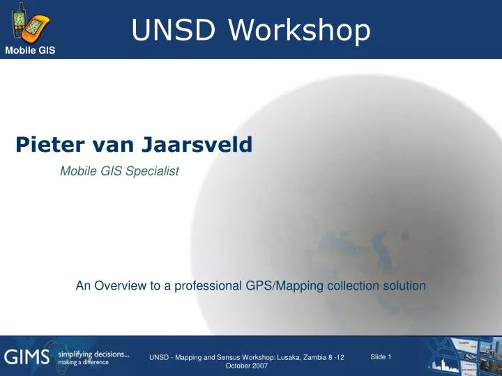
UNSD Workshop. Pieter van Jaarsveld. Mobile GIS Specialist. An Overview to a professional GPS/Mapping collection solution. Survey. Recreational GPS users? In-car navigation users? Capturing GPS data in the field for GIS use? Plan to in the next year?. Global Positioning System.

E N D
UNSD Workshop Pieter van Jaarsveld Mobile GIS Specialist An Overview to a professional GPS/Mapping collection solution UNSD - Mapping and Sensus Workshop: Lusaka, Zambia 8 -12 October 2007
Survey • Recreational GPS users? • In-car navigation users? • Capturing GPS data in the field for GIS use? • Plan to in the next year? UNSD - Mapping and Sensus Workshop: Lusaka, Zambia 8 -12 October 2007
Global Positioning System UNSD - Mapping and Sensus Workshop: Lusaka, Zambia 8 -12 October 2007
What is GPS? • Global Positioning System • Where on earth am I ? • Constellation of satellites • Handheld devices • Various Applications • Accuracy UNSD - Mapping and Sensus Workshop: Lusaka, Zambia 8 -12 October 2007
GPS in 5 Basic Steps 4 Correct for Atmosphere & Ionosphere 3 Use ephemeris for satellites’ location 5 2 Differential Corrections Accurate clocks are required 1 Trilateration using speed of light UNSD - Mapping and Sensus Workshop: Lusaka, Zambia 8 -12 October 2007
UNSD - Mapping and Sensus Workshop: Lusaka, Zambia 8 -12 October 2007
Control Segment • Provides worldwide coverage and control • 365/24/7 • Master Control station • Colorado • Four support stations • Hawaii • Kwajalein • Diego Garcia • Ascension Island UNSD - Mapping and Sensus Workshop: Lusaka, Zambia 8 -12 October 2007
Space Segment • GPS satellite constellation • 24 satellites • Replenishment occurring • Satellite design • Lifetime 7.3 years • 16 satellites over 9 years old UNSD - Mapping and Sensus Workshop: Lusaka, Zambia 8 -12 October 2007
User Segment • Equipment produced by Military and Private companies • Receives signal and computes • Position • Time • Velocity UNSD - Mapping and Sensus Workshop: Lusaka, Zambia 8 -12 October 2007
How do we position ourselves? • Simple Geometry • Velocity times vs travel time • Determine Radio Wave Time Travel • Accurate timing • Measure Distances • Known orbit locations • Trilateration • Distances not angles UNSD - Mapping and Sensus Workshop: Lusaka, Zambia 8 -12 October 2007
Sources of Positioning Error • Ionosphere and Atmospheric delays • Satelite and receiver Clock Error • Multipathing • Dilution of Precision • Receiver Issues • Selective Availability UNSD - Mapping and Sensus Workshop: Lusaka, Zambia 8 -12 October 2007
Differential GPS • Two receivers track the SAME signals and errors at the SAME time • Derived corrections are then applied to the data during postprocessing • GPS Analyst contains tools for DC • Does not correct multipath Data Collector Base UNSD - Mapping and Sensus Workshop: Lusaka, Zambia 8 -12 October 2007
Differential Correction Red = Uncorrected GPS Green = GPS after differential correction UNSD - Mapping and Sensus Workshop: Lusaka, Zambia 8 -12 October 2007
Selecting a GPS • Recreational versus Professional GPS • Accuracy • Tens of meters versus sub meter • GIS data integration • Format conversion • Attribute collection • Customised forms, business rules UNSD - Mapping and Sensus Workshop: Lusaka, Zambia 8 -12 October 2007
Data Collection Software UNSD - Mapping and Sensus Workshop: Lusaka, Zambia 8 -12 October 2007
Data Collection Workflow (server to server) Mobile Server Desktop Desktop Server Export to PGDB Check out Copy to device Copy to Desktop Check In Post process Import to Enterprise Data validation ArcPad Enterprise Geodatabase UNSD - Mapping and Sensus Workshop: Lusaka, Zambia 8 -12 October 2007
Data - things to remember • Check out and post processing is performed on a personal geodatabase NOT directly from enterprise. WHY? • GPS detail not required in enterprise • Topology not supported in GPS Analyst • Carefully choose extents. WHY? • Large extent limits the amount of data capture • Current only personal geodatabase support, efforts to supporting file geodatabase underway. UNSD - Mapping and Sensus Workshop: Lusaka, Zambia 8 -12 October 2007 UC 2007 Tech Sessions 17
What is ArcPad? • Part of ESRI overall mobile strategy • A mobile GIS application for field mapping applications • Designed for broad range of mobile systems • Allows input from GPS receivers, rangefinders, digital cameras and other devices • Provides a generic set of mobile GIS functionality • Extensive customization capabilities • Extends Geodatabase to the field through disconnected editing UNSD - Mapping and Sensus Workshop: Lusaka, Zambia 8 -12 October 2007
What can you do with ArcPad? • Use your existing data • Add data from the Internet • Move around your map • Query your data • Edit your data • Measure distance, area, and bearings on your map • Navigate with your GPS • Customize ArcPad to streamline your workflow UNSD - Mapping and Sensus Workshop: Lusaka, Zambia 8 -12 October 2007
ArcPad Benefits • Streamlines the workflow • Smart, task oriented solutions • Increases productivity • Reduces office work and data entry time • Improves the accuracy of data • Resulting in more accurate and current data for analysis and decision making UNSD - Mapping and Sensus Workshop: Lusaka, Zambia 8 -12 October 2007
ArcPad Functionalities • Improved performance • Enhanced editing tools • Snapping • Undo • offsets for points, lines, polygons • repeated features • segmented line features • Camera and rangefinder support • Improved symbology and labeling • Support for Graphics layer • for redlining or mark-up • Import/export tools for ArcGIS • Customization • wizard for creating custom forms UNSD - Mapping and Sensus Workshop: Lusaka, Zambia 8 -12 October 2007
ArcPad Functionalities • Significant performance gains on startup time • Pre-buffering input • Affects Applets, Layers, Scripts etc. (i.e ALL XML and Scripts) • Delayed loading of projection data • Usability enhancement • Datum conversion wizard • Picture browsing capabilities on Windows Mobile 5 devices • Additional language packs available • Quality improvements • About 80 bugs have been identified and fixed! • Minor feature improvements • Object model improvements (Picture chooser, File object , Inter-process methods) UNSD - Mapping and Sensus Workshop: Lusaka, Zambia 8 -12 October 2007
Configuring the GPS • Protocol = “Trimble GPSCorrect” or “NMEA0183” • Port = “COM3: TSIP Serial Port (GeoExplorer) • Port = “COM7: TSIP Serial Port (JunoST) • Port = “COM2: TSIP Serial Port (Recon XC) UNSD - Mapping and Sensus Workshop: Lusaka, Zambia 8 -12 October 2007
Streaming and Averaging • Averaging • number of incoming GPS position coordinates that ArcPad uses for calculating an average coordinate • Streaming • Position Interval = How frequently ArcPad uses incoming GPS coordinates • Distance Interval = ArcPad uses incoming GPS coordinates only when greater than this distance from LAST coordinate used UNSD - Mapping and Sensus Workshop: Lusaka, Zambia 8 -12 October 2007
GPS Preferences • Quality • Minimum and maximum values can be predefined • Can be made compulsory to ensure data integrity • Warning and Alerts • Visual and Audio alerts • Constantly warns the user if not complying to presets • Will inform the user of GPS status • Can be annoying • Can be switched off UNSD - Mapping and Sensus Workshop: Lusaka, Zambia 8 -12 October 2007
Editing using the GPS • Firstly, make layer editable (one point, line, polygon, at a time) • Then select GPS capture tool • Then select feature type UNSD - Mapping and Sensus Workshop: Lusaka, Zambia 8 -12 October 2007
Ensuring data quality Elevation Mask Default 15 No. of Satellites Min of 4 SV’s SNR Signal to Noise Ratio High = Accurate Low = Productive DOP SV Geometry High = BAD Low = GOOD UNSD - Mapping and Sensus Workshop: Lusaka, Zambia 8 -12 October 2007 UC 2007 Tech Sessions 27
ArcPad with other devices • ArcPad can be used with: • Digital Cameras • WiFi enabled cameras • BT enabled camerasUse “Camera” tool • Photo Layer • Custom Form • Laser Rangefinders • What is your accuracy needs? • External GPS UNSD - Mapping and Sensus Workshop: Lusaka, Zambia 8 -12 October 2007
Data Collection Techniques • Where are the Satellites? • Your Body is an obstruction! • Point Data Collection • Position First and Attributes Second • Polyline & Polygon Collection • Streaming (less accurate but dynamic) • Vertex Averaging (more accurate and static) UNSD - Mapping and Sensus Workshop: Lusaka, Zambia 8 -12 October 2007 UC 2007 Tech Sessions 29
ArcPad Tips and Tricks • Do you understand Sticky Keys? • Have you used appropriate colours and line thicknesses? • Is your device locked? • Don’t you pick on me! (Avoid clicking on the map) • The art of using a stylus • Slow down and smell the flowers! UNSD - Mapping and Sensus Workshop: Lusaka, Zambia 8 -12 October 2007 UC 2007 Tech Sessions 30
ArcPad Orientation Demonstration UNSD - Mapping and Sensus Workshop: Lusaka, Zambia 8 -12 October 2007
Thank you • Mobile GIS Specialist • pvanjaarsveld@gims.com • (011) 238 6300 UNSD - Mapping and Sensus Workshop: Lusaka, Zambia 8 -12 October 2007