Download
1 / 22
230 likes | 361 Views
Introduction of ROCSAT-2 Program. Dr. Hung-Chih Wang July 24, 1998. Outline. Background of ROCSAT-1 Program Goals of ROCSAT-2 Program Mission Objectives of ROCSAT-2 Program An Overall Architecture of the ROCSAT-2 Program Operation Concepts of Mission

E N D
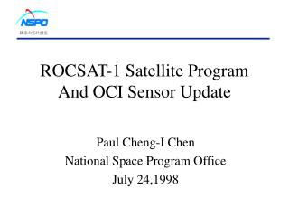
IntroductionofROCSAT-2 Program Dr. Hung-Chih Wang July 24, 1998
Outline • Background of ROCSAT-1 Program • Goals of ROCSAT-2 Program • Mission Objectives of ROCSAT-2 Program • An Overall Architecture of the ROCSAT-2 Program • Operation Concepts of Mission • Summary of ROCSAT-2 System Requirements • Acquisition Strategy of the ROCSAT-2 Program • Current Status of ROCSAT-2 Program • Concluding Remarks
Background of ROCSAT-1 • ROCSAT-1 is a LEO Satellite Containing Three Scientific Instrument; ECP, IPEI, and OCI • During the Development of the ROCSAT-1, NSPO Has Established the Following Capabilities: • human resource to execute a space program • satellite integration and testing facilities • the ground system infrastructure with mission operation center • the infrastructure of space researches at local universities • a successful flight component development program by domestic industry
Goals of ROCSAT-2 Program • To Build-Up a Complete Satellite System with the Achievement of both Civilian Applications and Scientific Research • To Develop and Establish the Core Technology of a Satellite System and Associated Capability at NSPO • To Establish Human Resource Capability in the Area of Both Satellite-Related Technologies and Large-Scale System Engineering • To Enhance the Research in the Space Science and Technology and to Promote the International Cooperation in the Space Community • To Maximize the Use of the Infrastructure and Technologies Developed at NSPO and Domestic Industry
Mission Objectivesofthe ROCSAT-2 Program • To Develop a Low-Earth-Orbit Satellite with the Associated Ground System for • Observing Taiwan Island and Surroundings in a Near Real-Time Scale • Conducting Scientific Research in the Area of Upper Atmosphere Lightning
Mission Objectives ofRemote Sensing Instrument • The ROCSAT-2 Satellite is Capable of Acquiring Image Data Throughout the Island with the Following Applications: • Agriculture and Forestry • Natural Disaster Evaluation • Urban Development and Land Use • Environmental Monitoring • Academic Researches and Education
Mission Objectives ofImger of Sprites • Investigation of the Electrodynamic Coupling Between Clouds and the Upper Atmosphere • To Identify the Global Distribution of Red Sprites • To Identify the Spatial-Temporal Dynamics of Red Sprites • To Explore and Identify the UV-Band Content in the Activity of Red Sprites • To Identify the Activity Degree of the Ionization of Red Sprites
Overall Architectureofthe ROCSAT-2 Program Space Segment Orbit Remote Sensing Instrument Spacecraft Communication Architecture Launch Segment Scientific Instrument Receiving Station TT&C Station Mission Objectives Ground Segment Back-Up TT&C Mission Operation Data Processing Users
Operation Conceptsof theRemote Sensing Instrument • Mission Orbit • Sun-Synchronous • Height: 891 Km • Inclination: 98.99º • One Day Re-Visit of the island • Equatorial Descending Time: 9:30 am - 10:30 am (TBR) • Communication Architecture • Tasking Agility • Viewing Angle at Cross-Track: 45º • Viewing Angle at Pitch: 45º • Image Type: Push-Broom
Mission Orbit • Mission Orbit: 14 rev/day, 891 km, 98.99 deg • Swath> 36 km; Cross-Track Viewing Angel ±45 deg • Parking: 791 km, 98.99 deg Mission Position Parking Position Taipei Latitude (deg N) Longitude (deg E)
Comminication Architecture 10O E/V Day Night AOS • Image Data Downlink • X-Band • Data Rate 150 Mbps • Imaging PAN and/or MSS Simultaneously • Downlink PAN or MSS Data in a Near-Real Time Receiving Station • SOH Data Downlink • Meet Existing S-Band Requirements • Data Downlink Rate 2Mbps • Store and Dump Operation • MSS data • PAN data (Stereo Imaging and when Viewing Angel 30O) Ground Track Receiving Station TT&C Station 20O E/V (Real-Time Downlink Image Data: when Viewing Angel 30O) LOS • Ground Station Requirements: • 8m Dual Channel Antenna • S-Band: G/T 21.0@10OE/V. Angle (clear sky) • X-Band: G/T 26.7@20OE/V. Angle (clear sky) • X-Band Image Data Downlink Rate 150Mbps
Tasking Agility Ground antenna elevation angle 10 deg Ground Track Multiple Strip Imaging Look Backward Pitch = 30 deg End Imaging FOR = 45 deg Rotation Stereo Imaging Look Forward Start Imaging Tasking Agility Cross-track : 30o/60sec 10o/25sec Changing Viewing Duration = 8.1 min Pitch = - 45 degree Basic Swath Swath > 36 km Pitch = + 45 degree 1610 km 968 公里 Ground antenna elevation angle 20 deg Complete three strips of different pitch & roll viewing
Operation Conceptsof theImager of Sprites • The Imager of Sprites will not be ON when Remote Sensing Instrument is Imaging • The Imager of Sprites is Limb-Viewing the Altitude and Lateral Extent of Optical Emissions from Upper Atmospheric Lightning • Viewing Direction: Right-Hand Side Along with the ROCSAT-2 Mission Orbit • One or Two Photometers Will be Used as a Trigger Source for the Imager of Sprites • Viewing Area: 1210 x 181.5 Km2 at a Distance 3467 Km
Acquisition Strategy (1)ofthe ROCSAT-2 Program • NSPO is the Overall System Integrator for the Complete ROCSAT-2 System, Including Spacecraft with Remote Sensing Instrument, Scientific Instrument, Ground System, and Launch Vehicle. Tasks to be Performed: • Define System Requirements • Design the ROCSAT-2 System • Define the Interface between Various Systems and Associated Requirements • Validate End-to-End ROCSAT-2 System
Acquisition Strategy (2)ofthe ROCSAT-2 Program • The ROCSAT-2 Spacecraft will be Designed and Developed Jointly by Both NSPO and Contractor’s Engineers. NSPO will be Responsible for Certain Subsystems, e.g., Primary Structure and Thermal Control. • NSPO will be Responsible for the Integration and Test of the Satellite by Using NSPO I&T Facilities. • Some Key Components and/or Subsystems will be Manufactured by Domestic Industry. • Key Technologies of the EO Sensor will be Transferred to Precision Instrument Development Center (PIDC)
Acquisition Strategy (3)ofthe ROCSAT-2 Program • The Ground Station at National Central University will be the Primary Receiving Station for ROCSAT-2 Image Data. This Ground Station will be Modified to Meet Current System Requirements. • NSPO will Establish a Back-up Image Data Receiving Station and Multi-Mission MOC to Operate ROCSAT-1, -2, and -3. • NSPO will be Responsible for the Overall System Integration of Each Receiving Station when Modified. • The Launch Service will be Small Class Launch Vehicle, e.g., Athena II, Rockot, Taurus-XL, and KOSMOS.
1997 1998 1999 2000 2001 2002 2003 J A S O N D J F M A M J J A S O N D J F M A M J J A S O N D J F M A M J J A S O N D J F M A M J J A S O N D J F M A M J J A S O N D J F M A M J J SRR PDR CDR IRR SAR Launch Milestone 2/28 6/30 1/31 11/30 7/31 6/30 1. Planning Mission Definition & System Design 8/31 S/C RFP 12/31 Satellite RFP's (S/C, P/L) LV RFP 10/15 Sci P/L Sel CA Science Mission Selection Ground System GS Review GS Planning 2. System Development WSD 29M TO P/L Del. P/L Del. CPT Bus & Remote Sensing Instrument 12/1 H/W to NSPO 4/30 7/31 WSD 30M P/L Del. Scientific P/L 1/1 6/30 WSD SAT Comp. Ground System 12/31 12/1 WSD 3. Launch Vehicle Service 3/31 4. Satellite Integration & Testing Spacecraft AIT H/W to NSPO S/C I&T Comp. 18M Ready Sci. P/L I&T TO L/V Site Satellite I&T 11/30 4/30 5. Mission Operations Launch & Early Orbit Flight Operation & Application Master Scheduleofthe ROCSAT-2 Program
Current StatusofROCSAT-2 Program • A Preliminary ROCSAT-2 RFP was Released to Potential Bidders. • A Bidder Conference Will be Held at NSPO on July 30-31. • The RFP of ROCSAT-2 Spacecraft and Remote Sensing Instrument Will Be Released by the End of August 1998. • The SOW of the Imager of Sprites is Under Preparation.
Concluding Remarks • The Entire Work Mentioned in This Presentation Package Was Accomplished Independently by NSPO Engineering Team. The Team Has Completed the Mission Definition Document and System Requirements Document for the ROCSAT-2 System, and the Spacecraft RFP. • The Results of This Effort Demonstrated the NSPO Technical Capability Has Been Established During the ROCSAT-1 Program.