Download
1 / 2
20 likes | 30 Views
The Pennar River, also known as the Uttar Pinakini. Pinaka refers to Shiva's 'bow'. The Pennar river is one of Peninsular India's major rivers. It rises from the Nandi Hills in the Karnataka district of Chikkaballapur. The waters of the Pennar River flow into the Bay of Bengal.<br>If you want to know more about Pennar River then click on this linku2026 https://bit.ly/3HE2VI5

E N D
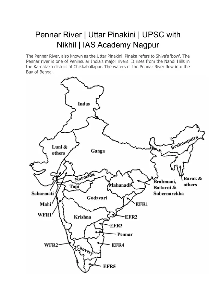
Pennar River | Uttar Pinakini | UPSC with Nikhil | IAS Academy Nagpur The Pennar River, also known as the Uttar Pinakini. Pinaka refers to Shiva's 'bow'. The Pennar river is one of Peninsular India's major rivers. It rises from the Nandi Hills in the Karnataka district of Chikkaballapur. The waters of the Pennar River flow into the Bay of Bengal.
FACTS ABOUT PENNAR RIVER • The Pennar also goes by the name Uttara Pinakini. • It is one of the Indian peninsula's most important rivers. • The Pennar River begins in the Nandidurg range's Chenna Kasava peak in Karnataka's Chikkaballapura district. • It runs east and drains into the Bay of Bengal. • The Pennar river is 597 kilometres. • The Pennar basin, located in peninsular India, flows through Andhra Pradesh and Karnataka. • It covers an area of 55 thousand square kilometres throughout its course. • The Erramala range on the north, the Nallamala and Velikonda ranges of the Eastern Ghats on the east, the Nandidurg hills on the south, and the short ridge separates it from the Krishna Basin's Vedavati valley on the west. • It is a fan-shaped basin. • The Seshachalam [renowned for Red Sanders] and Paliconda hills are the two hill ranges in the basin to the south of the river. • Agriculture covers the majority of the basin, accounting for 58.64 percent of the total area. • The Somasila Dam is built in Somasila village across the Pennar river. It is near Atmakur city, in the Sri Potti Sriramulu Nellore district of Andhra Pradesh. TRIBUTARIES OF THE PENNAR RIVER • The Jayamangali River • The Kunderu River • The Sagileru River • The Chiravati River • The Papagni River • The Cheyyeru River If you want to know more about Pennar River then click on this link… https://bit.ly/3HE2VI5