Download
1 / 21
210 likes | 312 Views
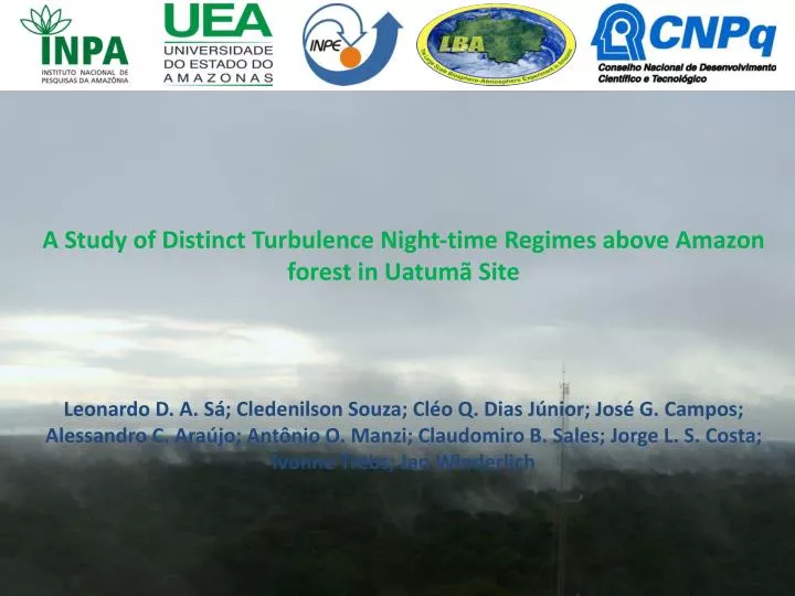
A Study of Distinct Turbulence Night-time Regimes above Amazon forest in Uatumã Site. Leonardo D. A. Sá; Cledenilson Souza; Cléo Q. Dias Júnior; José G. Campos; Alessandro C. Araújo; Antônio O. Manzi ; Claudomiro B. Sales; Jorge L. S. Costa; Ivonne Trebs ; Jan Winderlich. INTRODUCTION

E N D
A Study of Distinct Turbulence Night-time Regimes above Amazon forest in Uatumã Site Leonardo D. A. Sá; CledenilsonSouza;Cléo Q. Dias Júnior;José G. Campos; Alessandro C. Araújo;Antônio O. Manzi; Claudomiro B. Sales; Jorge L. S. Costa; IvonneTrebs; Jan Winderlich
INTRODUCTION • German - Brazilian scientific project “ATTO” (Amazonian Tall Tower Observatory). • Meteorological data were collected from a 80 m height tower (S 02°08’38.8” W 58°59’59.5”) located 130 m above the sea level.
Nocturnal boundary layer above Uatumã site. • Topographically Induced Gravity waves. • Under which situations would they be generated by terrain undulations? • (Steeneveld et al., 2009). • The “Scorer” number was calculated in order to provide dimensionless wave numbers of the terrain undulations and so, to classify internal gravity waves as forced by orographic effects or not. • 30 m resolution altimetric images of the experimental site provided useful information to detect horizontal characteristic length scales of the topographic height variability (terrain undulations) associated to several directions via wavelet transform (http://www.dsr.inpe.br/topodata/dados.php). • For the analysis of our results, concerning the nocturnal atmospheric surface layer, we have considered 3distinctstability regimes (according to Sun et al., 2012) and 2 classes of gravity waves occurrence.
THEORETICAL ELEMENTS • Internal gravity waves can be generated by several forcing mechanisms such as: sudden changes of surface roughness, topography, convection, undulations, etc. These features are able to reallocate energy and momentum and they significantly determine the vertical structure of the atmosphere and mesoscale - microscale phenomena coupling.
We define a parameter, R, which can be considered as being a dimensionless wave number associated with the undulations of the terrain in a specific horizontal direction, which is defined by: R = K / L. • where K is the wave number associated with the undulations of the terrain in the mean wind direction during the analyzed period and L is the Scorer parameter, defined by (Nappo, 2002, p. 61): • Where U is the mean wind speed and U” is the second derivative of the wind in relation to the height, z;N is the Brunt-Väissälä frequency. • According to Steeneveld et al. (2009) it would be possible to use L and K to determine whether gravity waves were or not forced by the terrain topography. The gravity waves would be forced when:
NOCTURNAL STABILITY REGIMES ACCORDING WITH SUN et al. (2012): Regime 1 shows weak turbulence generated by local shear instability and modulated by the vertical gradient of potential temperature. Regime 2 shows strong turbulence and wind speed surpassing a threshold value (Vλ), above which turbulence increases systematically with increasing wind speed, being the turbulence generated by bulk shear instability, defined as mean wind speed divided by the measuring height. Regime 3, the turbulence presents wind speed lower than Vλ being, but associated to occasional bursts of top-down turbulence. The regimes 1 and 2 are associated to a relationship between the scale of turbulent velocity (VTKE) and the mean wind velocity, U. VTKE is defined as:
Wavelet transform (WT) • We used the Wavelet Transform to detect gravity waves and to determine the wave number of the terrain undulations. • We used the Morlet’swavelet as analyzing function. It is a complex multiscaletransform. In this sense, one could use the phase and energy information of the transformed data to investigate its scale variability. Mathematically it is expressed by • where ψ * is the complex conjugateof the analyzing function ψ, s(x) the signal to be analyzed, a ≠ 0 is a scale parameter, b ∈ ℝ a translation parameter and the analyzing. • An important tool is the wavelet cross-spectrum to study the inter-variability between two time series, in particular the the vertical component of wind speed (w) and the air temperature (T):
Detection of gravity waves: The complex segment of WwT provide information about phase difference (DFwT) between (w) and (T) defined as
Detectionofthesurfaceundulationswavenumber: In this study altimetric data have been used to detect real terrain undulation patterns and the wave number Kof the terrain topography was calculated for several previously chosen directions of the Uatumã experimental site. The Morlet’scontinuous wavelet transform has been used to determine the scale on which the terrain undulations are varying more strongly, and this, for each one of the specific directions. For this, a methodology similar to that of detection of coherent structures in turbulent flows has been used, but modified for the detection of ground "spatial structures”.
RESULTS: • Detection of dominant scales of the terrain undulation. • 1)one image of 30 m resolution of an area of 15,99 x 15,99 km was taken to evaluate ground features and topography information as well. 2)axes pointing from the tower towards north-east have been built for every 15 º (0º, 15º, 30º,45º, 60º, 75º, 90º), the region in which the climatological wind direction prevails. A space series with evenly spaced topographical data has been formed. The complex wavelet transform was applied to these space series to calculate and identify the greatest variance of the real part of the wavelet coefficients for all series mentioned and for each scale and direction of the axes determined above. This work picked the wave number associated with the maximum variance contained in data referring to the series of 266 dot (7.98 km) being measured from the tower location. These conditions were applied to the analyses of this study.
Fig. 2 presents an image of 30 m resolution of an area of 15,99 x 15,99 km was taken to evaluate ground features and topography information as well. Fig. 3 presents an example of the topographic height for the specific direction of 30°. It is noticeable that undulations are not perfectly homogeneous, but the tower surroundings show oscillations from 80 m to 140 m height. °
Scale characteristics of ground undulations Fig. 4 presents the maximum scale-variance of the topographic height of the ground for each associated direction, considering an imaginary line containing 266 dots corresponding to 7,98 Km, starting from the tower
Our results show that, following the criteria of Steeneveld, all detected events of gravity waves (GW) would be of the kind forced by topography. However, we notice that, depending on the value of the parameter R = K / L, there is a threshold value for it, Rt. For R < Rt, the nocturnal boundary layer (NBL) is at the stability regime 1, characterized by the occurrence of light winds, lower turbulent kinetic energy (TKE) and with predominantly local turbulent mixing. For R > Rt, the NBL is under the stability regime 2, characterized by stronger winds, greater TKE values and with a global turbulent mixing up to the height where the measurements have been performed (80m). The third kind of stability regime is characterized by the occurrence of mixing effects forced by top-down mixing processes.
Figure 5 and Table 1 depict results for the 13 episodes of GWS, which have presented features of the three regimes of stability. The two classes of gravity waves: 1) with R <Rt and 2) with R> Rt. Interestingly GW classes 1 and 2 are associated with stability regimes 1 and 2, respectively. The physical parameters shown in Table 1 present clear differences regarding the stability regimes in which have been generated and provide physical insights to explain them.
Figure 5. Histogram of K/L,where class I is in “grey” and class II is in “black.
Figure 6. Turbulent velocity scale, VTKE as a function of the mean wind velocity, u, for all detected gravity wave events, with its respective GW classes and stability regimes.
Table1: Gravity wave events and some of their physical parameters.
Figure 7. Buoyancy length scale (in meters) for each gravity wave event.
CONCLUSIONS Our results are still preliminary, they should be extended to more terrain directions, most of the tower heights and contain much more experimental data in order to provide robust statistical estimations. Still, they showed that: 1) There are many variations of the wave number associated with rolling terrain, depending on the considered specific direction; 2) There seems to be a clear relationship between the mean wind direction and the wave number associated with terrain undulations and the dimensionless wave number R = K / L; 3) There is a threshold value of R = K / L = 0.4 to sort gravity waves of type 1 and 2; 4) For each class of gravity waves, there is clearly different values of parameters such as: buoyancy length scale (associated with the size of the largest turbulent eddies), turbulent kinetic energy, the average wind intensity, etc.
ACKNOWLEDGEMENTS • This work is part of thelarge scale biosphere-atmosphere experiment in amazônia (LBA) and was also supported by the Fundação do Amparo à Pesquisa do Estado do Amazonas (FAPEAM)/Brazil and by the University of the Amazon State (UEA). The authors gratefully acknowledge financial support by the Max Planck Society to construct the 80 m tower. We are indebted to Hermes Braga Xavier and his team for the tower construction and the establishment of the infrastructure at the ATTO site. We also thank R. Ditz and J. Schöngart for logistical support. Leonardo Sá thanksthe Conselho Nacional de Pesquisas e Desenvolvimento Tecnológico (CNPq) byhisresearchgrant (process No 303.728/2010-8).
REFERENCES • Farge, M., The wavelet transform and its applications to turbulence, Annual. Review of Fluid Mechanics, v. 24, p. 395-457, 1992. • Nappo, C. J., An Introduction to Atmospheric Gravity Waves, Academic-Press, 276 pp., Amsterdam, 2002. • Steeneveld, G. J., C. J. Nappo, and Holtslag A. A. M., Estimation of Orographically Induced Wave Drag in the Stable Boundary Layer during the CASES-99 Experimental Campaign, ActaGeophysica vol. 57, no. 4, pp. 857-881,DOI: 10.2478/s11600-009-0028-3, 2009. • Sun, J.;Mahrt, L.; Banta, R. M. and Y. Pichugina, Turbulence Regimes and Turbulence Intermittency in the Stable Boundary Layer during CASES-99. Journal of the Atmospheric Sciences, v. 69, p. 338-351. DOI: 10.1175/JAS-D-11-082.1, 2012.