Download
1 / 12
120 likes | 359 Views
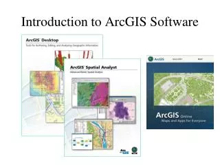
Introduction to ArcGIS 9. Before you can start on your school mapping project, you will need to become acquainted with some of the basics of ArcGIS 9. . This lesson will introduce you to starting and working in the ArcGIS 9 environment.

E N D
Introduction to ArcGIS 9 Before you can start on your school mapping project, you will need to become acquainted with some of the basics of ArcGIS 9. This lesson will introduce you to starting and working in the ArcGIS 9 environment.
1. To launch ArcGIS, go to the start menu and go to “All Programs”. Look for the “ArcGIS” folder and then select the “ArcMap” icon. Alternately, there may be an ArcGIS icon on the desktop.
2. When you see this window pop up, browse for an existing map. Click OK. 3. Browse for the map file (.mxd suffix) that came with the data you downloaded for this tutorial. It will be in the C: drive in the “GeoWorkspaces” folder, named after your school and state, i.e. C:\GeoWorkspaces\monticello_AR.mxd . Click OK.
4. When your project opens, it should look something like this. If your image is in color you may be wondering why there is so much red. This is a color infrared image. For image interpretation and visualization purposes, green vegetation appears red.
5. These are called layers. They represent groups of features on your map. They are broken into features of the same type such as lines, points, and polygons. As with all base maps the aerial photo should be on bottom. If it isn’t, then click and hold on the image name and then drag it to the bottom.
There are two ways to zoom in and out of the map. One way is to use the two buttons circled, zoom in and zoom out. 7. The other is to use the buttons that resemble magnifying glasses. For example, to zoom in, click on the magnifying glass with the “+.” Then either click in the view or click and drag an area in the view to zoom to a specific location. 8. The extent icons allow you to navigate back through previous views with the left arrow and then forward with the right arrow to the most recent view.
8. To zoom out to the full extent of the map, click the globe button. 9. To move the around the map without changing the zoom, use the pan tool (hand).
10. You can turn a set of features in the map “On” or “Off” by clicking the check box of that layer.
11. Notice in this map, the layer Road Data is not checked and it does not appear on the map as in the previous slide.
12. You can change the style of your feature by clicking on the symbol next to the layer name. 13. With the Symbol Selector you can use the various options to change the style, color and size.
14. To save your ArcMap project, click the button with the disk icon on it. 15. If you would like to make a backup copy of your project go to the File menu and click “Save As.” 16. Give your new file a name and note the location it is stored. Don’t forget to save your work, often!
Learning how to navigate around a map is a very important step. When you feel comfortable doing this, move on to chapter 3 where we start editing data.