Download
1 / 24
240 likes | 314 Views
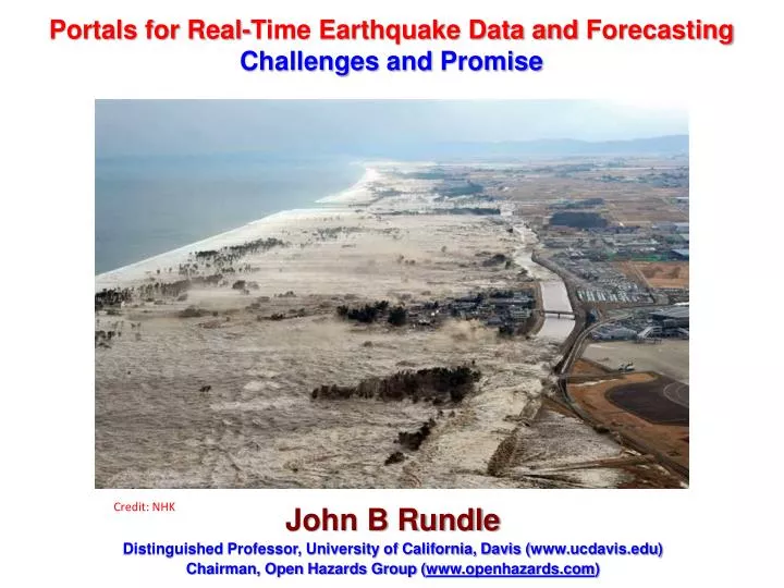
Portals for Real-Time Earthquake Data and Forecasting Challenges and Promise. Credit: NHK. John B Rundle Distinguished Professor, University of California, Davis ( www.ucdavis.edu ) Chairman, Open Hazards Group ( www.openhazards.com ). Major Contributors. University of California:

E N D
Portals for Real-Time Earthquake Data and Forecasting Challenges and Promise Credit: NHK John B Rundle Distinguished Professor, University of California, Davis (www.ucdavis.edu) Chairman, Open Hazards Group (www.openhazards.com)
Major Contributors • University of California: • James Holliday (University of California) • Mark Yoder (University of Calfornia) • Steven Ward (and University of California) • Open Hazards Group: • William Graves • Paul Rundle • QuakeSim (NASA and Jet Propulsion Laboratory): • Andrea Donnellan • Jay Parker • E-Decider (NASA and Jet Propulsion Laboratory): • Maggi Glasscoe • Other: • Marlon Pierce (IU) • Geoffrey Fox (IU) • Jun Wang (IU)
Impacts Loss Trends (Munich Re, 2012)
Web-Based Resources For Risk Awareness and Management OpenHazards A Resource for the Public E-Decider A Resource for Responders QuakeSim A Resource for Researchers
Systemic-level risk is growing exponentially from a variety of natural hazards Currently, risk management is done by big corporations for big corporations Modern social networking technology together with web-based information and tools has enabled a new era of Personal Risk Management Risk Management
QuakeSim/E-DECIDER Goals • Reduce, Transform and Distribute NASA Earth Science Data in support of Earthquake Research, Mitigation and Response • Produce results that have immediate utility for disaster response UICDS-Connected Applications UICDS-Connected Applications UICDS-Connected Applications UICDS-Connected Applications UICDS-Connected Applications • Simplified workflow
Data Distribution Examples QuakeSim E-DECIDER
Hazard Viewer Japan Region
Spatial Contours of Forecast Probabilities in the Japan Region M>6.5 for the Next 1 Year beginning June 27, 2013
Chance of a Another Major or Great Earthquake in Japan Region in the Near Future is High All Aftershocks Since M7.9 on March 11, 2011 1000 km Radius Circle Around Tokyo
Earthquake Forecasts (Probability in %): Eight Cities Probability of Magnitude ≥ 7 -- Within 1 Year and Within 100 miles 6/26/2013 Sendai 79% Tokyo 58% Shizuoka 38% Osaka 18% Miyazaki 24% Nagasaki 11% Kyoto 18% Niigata 23%
Earthquake Forecasts (Probability in %): Eight Cities Probability of Magnitude ≥ 7 -- Within 1 Year and Within 100 miles 10/21/2013 Sendai 42% Tokyo 13% Shizuoka 4% Osaka 1% Miyazaki 4% Nagasaki 1% Kyoto 1% Niigata 3%
Sendai Earthquake Forecast (Probability in % vs. Time) Probability of Magnitude ≥ 7 -- Within 1 Year and Within 100 miles May 24 M8.3 D600km Kamchatka Earthquake
Social Networkinghttp://social.openhazards.com Communication and collaboration is critical to building global resilient communities
Components of GIS Server • GeoServer: thematic mapping and data distribution • Geospatial Database: storage and spatial analysis • Web Service API: simple use REST API for complex GIS functionalities • Geoprocessing Tool: Python scripts to produce standard-compliant data products Web/Mobile GIS GIS Server (Virtual Machine) GeoServer Web Service API Desktop GIS 3D Visualization GeoprocessTool Geospatial Database Other Applications