Download
1 / 23
230 likes | 330 Views
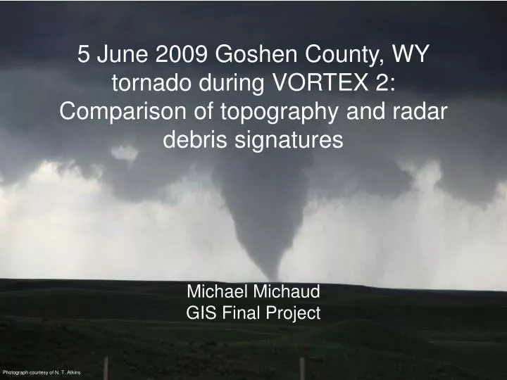
5 June 2009 Goshen County, WY tornado during VORTEX 2: Comparison of topography and radar debris signatures. Michael Michaud GIS Final Project. Photograph courtesy of N. T. Atkins. Abstract.

E N D
5 June 2009 Goshen County, WY tornado during VORTEX 2: Comparison of topography and radar debris signatures • Michael Michaud • GIS Final Project Photograph courtesy of N. T. Atkins
Abstract On 5 June, 2009 the VORTEX2 armada intercepted a tornadic supercell in Goshen County, Wyoming. The team collected a variety of data, including the Doppler On Wheels (DOW5). DOW5 is a rapid scan radar that can collect scans every seven seconds. In this data set three elevation scans were collected. The radar was located in close proximity to the tornadic circulation, resulting in high temporal and spatial resolution. Reflectivity scans will be superimposed over topographic maps to compare the existence of a debris signature within the weak echo hole to the land surface. Radar images will be compared to United States Geological Service topography maps, as well as imagery from ARCGlobe. The primary question is if land surface type has an effect on a debris signature on radar. Results will show debris signature developing over a land feature, appears to be a gully from imagery, as the center of circulation passes over. Similar land features had been passed by the tornado without the formation of a debris signature.
Georeferencing • Make a point for DOW5 location • Georeference location in image to actual location
Using a buffer, line up the range rings • The image is now georeferenced
Reclass • Reclass the image so the values are the correct reflectivity
Re-color • Make the color scheme cold to warm • Remove color from lower reflectivity to make the weak echo hole clearer
Topography • USGS Topography Map • Points made for each corner • georeference each corner to each point • ARCGlobe • Radar image 80% transparency
Conclusions • A debris signature first became evident as the weak echo hole region passed over a land feature. • The tornado passed over similar features prior to the gneiss of the debris signature. • More comparison needed to develop a conclusion.