Download
1 / 60
600 likes | 766 Views
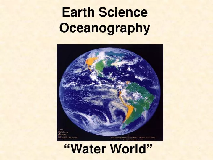
Earth Science Oceanography. “Water World”. เนื้อหา มหาสมุทรของโลก สมดุลความร้อนของโลก กระแสน้ำในมหาสมุทร คลื่น น้ำขึ้นน้ำลง สมุทรศาสตร์ใกล้ฝั่ง เอลนินโญ ลานินญา. แรงภายนอกที่กระทำต่อมหาสมุทร เช่น ลม (คลื่น ความปั่นป่วน คลื่นในเสกลใหญ่ การไหลเวียน

E N D
Earth Science Oceanography “Water World”
เนื้อหา • มหาสมุทรของโลก • สมดุลความร้อนของโลก • กระแสน้ำในมหาสมุทร • คลื่น • น้ำขึ้นน้ำลง • สมุทรศาสตร์ใกล้ฝั่ง • เอลนินโญ ลานินญา
แรงภายนอกที่กระทำต่อมหาสมุทร เช่น • ลม (คลื่น ความปั่นป่วน คลื่นในเสกลใหญ่ การไหลเวียน • การอุ่นขึ้นเนื่องมาจากดวงอาทิตย์และพลังงานความร้อนจากภายในโลก • การเย็นลง การระเหย เนื่องจากดวงอาทิตย์และลม • หยาดน้ำฟ้า (precipitation) • แรงจากดวงจันทร์และดวงอาทิตย์ที่ทำให้เกิดการขึ้นลง (tidal potential) • แผ่นดินไหว แรงดึงดูดของโลก แรงเสียดทาน • แรงภายในที่ต่อมหาสมุทร? • ความแตกต่างของแรงกดดัน (pressure gradients) • ความหนืด (viscosity ) หรือ แรงเสียดทาน (friction)
1. มหาสมุทรของโลก บนผิวหน้าโลกมีน้ำปกคลุมถึง 70.8 % ในบริเวณที่มีแต่ผืนน้ำ ไม่มีแผ่นดินในแนวขนานกับละติจูด (zonal) เลย อยู่ระหว่าง 85-90 0 เหนือ และ 55-60 0 ใต้ ที่ละติจูด 45-70 0 เหนือ มีแผ่นดินมากกว่าแผ่นน้ำ ที่ละติจูด 70-90 0 ใต้ มีแต่เพียงแผ่นดิน (แอนทาร์คติก้า) zonal :แนวตะวันออก-ตะวันตก ขนานกับละติจูด Meridional :แนวเหนือ-ใต้ ขนานกับลองจิจูด
Pacific Ocean • The Pacific Ocean is • the largest of the • world's five oceans • body of water between • the Southern Ocean, • Asia, Australia, and the • WesternHemisphere • 155.557 million sq km
Atlantic Ocean • The Atlantic Ocean is the second largest of the world's five oceans • body of water between Africa, Europe, the Southern Ocean, and the Western Hemisphere • 76.762 million sq km
Indian Ocean • The Indian Ocean is the third largest of the world's five oceans • body of water between Africa, the Southern Ocean, Asia, and Australia • 68.556 million sq km
Arctic Ocean • The Arctic Ocean is the smallest of the world's five oceans • body of water between Europe, Asia, and North America, mostly north of the Arctic Circle • 14.056 million sq km
Arctic Ocean Bathy-metry (NOAA image). The ocean areas are all in blue with the darker blues the deeper areas. The green indicates lowlands and the browns indicate in-creasing altitude as the browns turn darker and get to greys. All the white on Green-land is permanent ice. Image has been edited to include the tree line (yellow) and the 10 isotherm (red).
Southern Ocean • The International Hydrographic Organization in the spring of 2000 delimited a fifth world ocean now the fourth largest of the world's five oceans • body of water between 60 degrees south latitude and Antarctica • 20.327 million sq km
GeometryDistribution Tarbuck & Lutgens (1997)
Marine Morphology สัณฐานใต้ทะเล Continental marginขอบทวีป • Coastline ชายฝั่งทะเล • Continental shelf บ่าทวีป • Continentalslope ไหล่ทวีป • Continentalrise ลาดทวีป Ocean basin floorพื้นท้องสมุทร • Abyssal plain ที่ราบใต้ทะเลลึก • Sea mount เขาใต้สมุทร Mid ocean ridgeสันกลางมหาสมุทร
Continental marginขอบทวีป Coastline ชายฝั่งทะเล • a line on a map indicating the disposition of a coast Continental shelf บ่าทวีป • The width of the continental shelf varies significantlyThe largest shelf—the Siberian shelf in the Arctic Oceanstretches to 1500 km • average depth being ~130 m • flat topography (0.1° gradient)
Continental margin ขอบทวีป Continentalslopeไหล่ทวีป • separated from the continental slope by the shelfedge or shelf-break • Approximately 200 m depth • The gradient of the slope (4° on an average) but it can be as low as 1° or as high as 10°
Continental margin ขอบทวีป Continentalrise ลาดทวีป • Extending as far as 500 km from the slope • consists of thick sediments deposited • Its gradient is intermediate between the slope and the shelf, on the order of 0.5-1°
Ocean basin floor พื้นท้องสมุทร http://www.nio.org/aroundus/Sagar/ocean_floor.jsp
http://www-aviso.cls.fr/html/applications/geophysique/geoid_uk.htmlhttp://www-aviso.cls.fr/html/applications/geophysique/geoid_uk.html
Mediterranean sea mediterranean seamostly enclosed sea that has limited exchange of deep water with outer oceans and where the water circulation is dominated by salinityand temperature differences rather than winds ทะเลเมดิเตอเรเนียน มักมีแผ่นดินล้อมรอบเป็นส่วนมาก มีร่องน้ำ 2-3 ช่อง บางครั้งมีชื่อว่า ทะเล(ยุโรป)เมดิเตอเรเนียน ถ้าหยาดน้ำฟ้าที่เข้ามามากทำให้การสมดุลของน้ำเป็นบวกดังนั้น ด้วยคำจำกัดความนี้ ทั้งทะเลอาร์คติคและแคริบเบียนจึงเป็นทะเลเมดิเตอเรเนียน เรียกทะเลอาร์คติคเมดิเตอเรเนียน และทะเลแคริบเบียนเมดิเตอเรเนียน
Mediterranean sea The mediterranean seas of the Atlantic Ocean • The European Mediterranean Sea including theBlack Sea , the Sea of Azov, the Aegean Sea and the Sea of Marmara • Baffin Bay • The Baltic Sea The mediterranean seas of the Indian Ocean • The Persian Gulf • The Red Sea
Marginal Seas ทะเลริมทวีป • A marginal sea is a part of ocean partially enclosed by land such as islands, archipelagos or peninsulas.Unlike mediterranean seas, marginal seas have ocean currents caused by ocean winds • เป็นแอ่งน้ำทะเลขนาดใหญ่ ที่ต่อกับมหาสมุทรเปิดโดยร่องน้ำแคบๆหนึ่งแห่งหรือมากกว่า ทะเลริมทวีปอื่นๆ ที่แยกออกจากมหาสมุทรเปิดโดยช่องแคบ (straits) หรือ หมู่เกาะ
Marginal Seas ทะเลริมทวีป Marginal seas of the Pacific Ocean • The Bering Sea (separated by the Aleutian Islands) • The Sea of Japan (by the Japanese Archipelago) Marginal seas of the Atlantic Ocean • The North Sea (separated by Great Britain) A marginal sea of the Indian Ocean • The Andaman Sea (separated by the Andaman and Nicobar Islands)
2. การขนส่งความร้อน • การโยกย้ายความร้อนมี 3 วิธี คือ • การนำความร้อน conduction • การพาความร้อน convection • การแผ่รังสี radiation • ความร้อนมี 2 ชนิด คือ • ความร้อนสัมผัสSensible heatและ • ความร้อนแฝงLatent heat
3. กระแสน้ำในมหาสมุทร • ชนิดของกระแสน้ำในมหาสมุทร • กระแสน้ำที่ถูกขับดันด้วยลม • กระแสน้ำที่ถูกขับดันด้วยความหนาแน่น (เช่น turbidity current กับ thermohaline circulation • กระแสน้ำที่ถูกขับดันด้วยแรงดึงดูดของโลก • กระแสน้ำขึ้นน้ำลง และ • กระแสน้ำที่ถูกขับดันด้วยคลื่น (สองพวกนี้มีความสำคัญแถวใกล้ฝั่ง)
Six major circulation cells in the global ocean (modified from Garrison,1995).
Currents-Horizontal • Surface (Shallow Circulation) • Driven by Winds • Global Patterns • Effect of Coriolis Force • Ekman Spiral • Effect of Landmasses • Ekman Transport