Download
1 / 39
390 likes | 563 Views
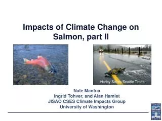
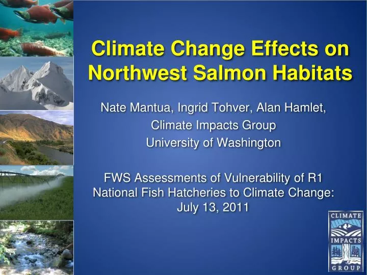
Climate Change Effects on Northwest Salmon Habitats. Nate Mantua, Ingrid Tohver , Alan Hamlet, Climate Impacts Group University of Washington FWS Assessments of Vulnerability of R1 National Fish Hatcheries to Climate Change: July 13, 2011.

E N D
Climate Change Effects on Northwest Salmon Habitats Nate Mantua, Ingrid Tohver, Alan Hamlet, Climate Impacts Group University of Washington FWS Assessments of Vulnerability of R1 National Fish Hatcheries to Climate Change: July 13, 2011
A chain of assumptions and models are needed for regional climate change scenarios • Start with a greenhouse gas emissions scenario • either specify atmospheric concentrations, or use a carbon cycle model to develop them • Choose a global climate model - • 20 were used in the IPCC’s Fourth Assessment • Downscale the coarse resolution climate model output • Do this to develop more realistic regional temperature and precipitation fields required for impacts (e.g. hydrologic, stream temperature) model inputs
How much Carbon Dioxide will be released into the atmosphere? CO2 Emissions Scenarios CO2 Concentrations A1FI A2 A1FI A2 A1B A1B B1 B1 Estimates depend on population and economic projections, future choices for energy, governance/policy options in development (e.g., regional vs. global governance)
21st Century PNW Temperature and Precipitation Change Scenarios • Projected changes in temperature are large compared to historic variability • Changes in annual precipitation are generally small compared to past variations, but some models show large seasonal changes (wetter autumnsand winters and drier summers)
21st century PNW climate scenarios relative to past variability
A robust impact of climate warming: less snow } for a ~ 2 °C warming Snoqualmie Pass 3022 ft
3 basic streamflow patterns Historical 2080s A1B rain-dominated “transient” basins with an early winter peak from rainfall, and a spring peak from snowmelt snowmelt-dominated basins, where streamflow peaks in late spring and early summer
Downscaling Relates the “Large” to the “Small” ~200 km (~125 mi) resolution ~5 km (~3 mi) resolution
Schematic of VIC Hydrologic Model and Energy Balance Snow Model A physically based approach for translating temperature and precipitaiton scenarios into snowpack, streamflow, soil moisture, etc., but there are other hydrologic models and approaches Snow Model
Hydrologic Products http://www.hydro.washington.edu/2860/
Available PNW Scenarios (80!) 2020s – mean 2010-2039; 2040s – mean 2030-2059; 2080s – mean 2070-2099
Changing Watershed Classifications: Transformation From Snow to Rain * Based on Composite Delta Method scenarios (multimodel average change in T & P) Source: Alan Hamlet, Columbia Basin Climate Change Scenarios Project Map: Rob Norheim
(Hybrid Delta) Summer base flows are projected to drop substantially (5 to 50%) for most streams in western WA and the Cascades • The duration of the summer low flow season is also projected to increase in snowmelt and transient runoff rivers, and this reduces rearing habitat for coldwater fish Source: Alan Hamlet, Columbia Basin Climate Change Scenarios Project Map: Rob Norheim
A warmer climate and flooding • At mid-elevations, more precipitation will fall as rain and less as snow • a warmer atmosphere holds more moisture: theory and climate models suggest an increased intensity of precipitation, stronger storms (but maybe fewer) • This combination points to an increased frequency of river flooding in fall and winter
Models project more winter flooding in sensitive “transient runoff” river basins that are common in the Cascades, eastern OR and Idaho • Increased fall/winter flooding would likely reduce survival rates for incubating eggs and rearing parr Source: Alan Hamlet, Columbia Basin Climate Change Scenarios Project Map: Rob Norheim
http://www.hydro.washington.edu/2860/products/sites/?site=4013http://www.hydro.washington.edu/2860/products/sites/?site=4013
Snow and Runoff Scenarios (Grande Ronde at Troy) A1B and B1 emissions, 10 GCMs, HD downscaling Snowpack (swe) A1B B1 All these scenarios have less accumulated snowpack and a shorter snow season They also show increased winter/spring flows, earlier snowmelt, and an earlier snowmelt recession Stream flow A1B B1 Scenario Ensembles Ensemble Mean Historical Mean
Flooding and low flows (Grande Ronde at Troy) A1B emissions, 10 GCMs, HD downscaling Peak flows Low flows 2080s scenarios historical These scenarios show daily peak flow magnitudes increasing, while 7Q10 low flow magnitudes decline. Different climate model scenarios (in red and yellow) have different impacts, however.
Western Washington’s “maritime” summer climate becomes as warm as today’s interior Columbia Basin, temperatures in the interior Columbia Basin become as warm as today’s Central Valley in California 1980s Mantua, Tohver and Hamlet 2010: Climatic Change
Number of weeks T > 21C Thermal stress season • Extended periods with weekly average water temperatures > 21C • the season of thermal migration barriers for migrating salmon predicted to last up to 12 weeks in the mainstem Columbia River Weeks with T > 21C
Thermal stress season • Under this scenario, the season of thermal migration barriers for migrating salmon projected to last up to 11 weeks in the upper Yakima River Mantua, Tohver and Hamlet 2010: Climatic Change
Upwelling food webs in our coastal ocean Cool water, weak stratification high nutrients, a productive “subarctic” food-chain with abundant forage fish and few warm water predators Warm stratified ocean, few nutrients, low productivity “subtropical” food web, a lack of forage fish and abundant predators Recently, warm ocean years have generally been poor for NW chinook, coho and sockeye, but good for Puget Sound pink and chum salmon.
Impacts summary for PNW salmon Flooding and increased mean flows, warmer water Warmer and lower streamflow Warmer lower flows in summer; winter flooding acidification, warming, range changes upwelling winds? sea level rise warming altered river discharge
Impacts will vary depending on life history and watershed types • Low flows+warmer water = increased pre-spawn mortality for summer run and stream-type salmon and steelhead • Clear indications for increased stress on Columbia Basin sockeye, summer steelhead, summer Chinook, and coho more generally • Increased winter flooding in transient rain+snow watersheds • a limiting factor for egg-fry survival for fall spawners + yearling parr overwinter survival in high-gradient reaches Harley Soltes/Seattle Times
Acknowledgements • Members of the UW Climate Impacts Group provided most of the material used in this presentation cses.washington.edu/cig • Columbia Basin Scenarios Project www.hydro.washington.edu/2860 • Washington Climate Change Impacts Assessment cses.washington.edu/cig/res/ia/waccia.shtml
Many new scenarios are being generated for the IPCC’s 5th Assessment (due in 2013) • A torrent of climate model scenarios will be unleashed over the next few years! • Will any one, or any group, be equipped to make use of all these in impacts assessments? • Should anyone try?
Another way forward: the vulnerability assessment approach • Evaluate a system’s vulnerability to climate by evaluating component parts: Vulnerability = (sensitivity x exposure)/adaptability Climate change scenarios provide information only about exposure to future climate events; the system you’re interested in can tell you about adaptability and sensitivity
Start with a sensitivity analysis In this case, an ecological model is used to evaluate the sensitivity of extinction risk for Early Stuart Fraser R. sockeye as a consequence of warming water temperatures and the heritability of migration timing. Future climate scenarios from any source can then be mapped onto this sensitivity analysis to provide an impacts assessment Probability of quasi-extinction Increase in mean river temp by 2100 (°C) Figure from Reed et al. (in prep)
Some closing thoughts • All climate model projections for the future will be wrong • Emissions scenarios are stories about what might happen; informing climate system models with these stories yields “scenarios”, not predictions, for future climate • There are good reasons for screening GCM scenarios, using weighted average ensembles, selecting specific methods for downscaling, and choosing specific tools for impacts assessments • Even with all these careful steps, you still end up with scenarios about future climate
the vulnerability assessment approach (at the least) compliments a “top-down” impacts assessment approach • In my opinion, this “bottom-up” framework is superior for many reasons including an explicit recognition that there are and will always be many future scenarios to choose from, and our ability to narrow down future climate uncertainties is sharply limited
Climate Change Scenarios for the Pacific Northwest All of these scenarios show warming for the 2040s, but some more than others Most (not all) show increasing precipitation in winter, spring and fall, and decreasing precipitation in summer Mote and Salathe (2010)
Climate model + scenario combinations yield a range of temperature and precipitation changes Temperature change (ºC) Precipitation change (%)
Models project more winter flooding in sensitive “transient runoff” river basins that are common in the Cascades • Likely reducing survival rates for incubating eggs and rearing parr
Summer base flows are projected to drop substantially (5 to 50%) for most streams in western WA and the Cascades • The duration of the summer low flow season is also projected to increase in snowmelt and transient runoff rivers, and this reduces rearing habitat Mantua et al. 2010: Climate change impacts on streamflow extremes and summertime stream temperature and their possible consequences for freshwater salmon habitat in Washington State (Climatic Change)
Number of weeks T > 21C Thermal stress season • Extended periods with weekly average water temperatures > 21C • the season of thermal migration barriers for migrating salmon predicted to last up to 12 weeks in the mainstem Columbia River Weeks with T > 21C
Impacts summary for PNW salmon Flooding and increased mean flows, warmer water Warmer and lower streamflow Warmer lower flows in summer; winter flooding acidification, warming, range changes upwelling winds? sea level rise warming altered river discharge
Statistical Downscaling Approaches Composite Delta Method Strengths: Limitations: • Incorporates only average changes in mean monthly T and P, not extremes • Changes are assumed to be the same throughout the region Simple, easy to explain “snapshot” of average future conditions Incorporates realistic historical daily time series and spatial variability Provides 91 years of historical variability combined with changes in T and P for each future time frame and emissions scenario Projections are easily relate to stakeholder knowledge of historical impacts
Statistical Downscaling Approaches Bias Corrected and Spatially Downscaled (BCSD) Strengths: Limitations: • Quality of downscaled realizations is dependent on GCM performance – What you get out is only as good as what you put in! • Ensemble analysis needed to account for decadal P variability due to relatively small sample size in future time slices (~30 years) • Daily time series characteristics are not suitable for some kinds of analyses (e.g. analysis of hydrologic extremes) Incorporates more information from the monthly output of GCMs, including altered monthly T and P variability in space and time Produces a transient (i.e. continually varying) daily time series for 150 years (1950-2098+) Simulates rates of change in hydrologic variables Offers flexible time period of analysis (one run gives all future time periods)
Statistical Downscaling Approaches Hybrid Delta Method Strengths: Limitations: • Quality of downscaled realizations is dependent on GCM performance (spatial patterns only) • Constrained by the time series behavior in the historic record Combines the strengths of the Composite Delta and BCSD methods, while avoiding most of the weaknesses of both Incorporates more information from the monthly GCMs, including altered spatial patterns of T and P changes Incorporates realistic historical daily time series and spatial variability Provides 91 years of historical variability combined with changes in T and P for each future time frame and emissions scenario Arguably the best method for evaluating hydrologic extremes (floods and low flows)