Download

1 / 25
250 likes | 259 Views
Explore the legendary migration route of the Oregon Trail, which brought settlers from Missouri to Oregon during the era of westward expansion in the 1800s. Discover the historical landmarks and experiences of life on the trail.

E N D
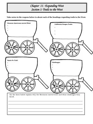
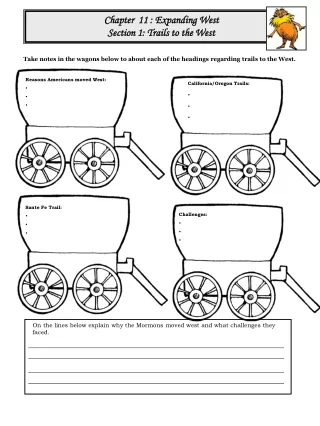
Trails West 1850 Assignment • Be sure to see slides 23-24 for some information. • The original ppt credit is on slide 25 • Students dot not have permission to print, download or share this ppt.
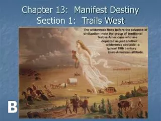
WESTWARD TRAILS Life on the Trails
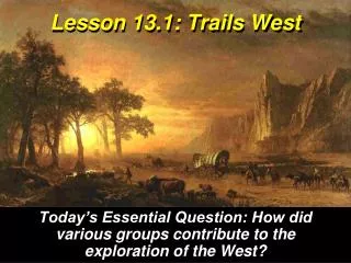
The Oregon Trail The Oregon Trail was legendary migration route that brought settlers from Missouri to Oregon during the ear of westward expansion in the 1800’s. The trail spanned over 2,170 miles through Missouri, Kansas, Nebraska, Wyoming, Idaho and Oregon (through the Great plains and over the Rocky Mountains). Settlers were offered free land (until 1854) in Oregon’s Willamette Valley for making the brutal journey on their prairie schooners. The trail was used from 1841 to 1869. The average family made it to Oregon City in about four months. The trail was no longer needed in 1869, with the completion of the Transcontinental Railroad, a railroad that crosses a continent from "coast-to-coast".
Independence was founded in 1827 and quickly became an important frontier town. As the farthest place west of the Missouri River that steamboats could carry cargo, it was essential as a transportation port, and would become the starting point for the Oregon, Santa Fe, and California Trails. In 1831, Joseph Smith and his church of Jesus Christ of the Latter-day Saints (Mormons) attempted to construct their temple in the city. Because of tensions with the local population they were expelled, and the Mormons would eventually settle in Utah. Today, the city of Independence holds the annual Santa-Caligon Days Festival, a celebration of the city’s history as the starting point for the Santa-Fe, California, and Oregon Trails.
Chimney Rock, located in the badlands of the western Nebraska, is one of the most famous symbols of the old west. The rock itself is a towering geologic formation that looks like a hill that has a chimney. It towers some 300 feet above the North Platte River valley. Chimney Rock was an important landmark for travelers on the Oregon, California and Mormon Trails. Today, it stands forever as a symbol of the great westward migration on the 1800’s. It is estimated that over 500,000 travelers passed the rock on their way to destinations in the west.
Fort Laramie, located in eastern Wyoming, was an important 19th century fur trading post and U.S. military installation. During the 1850’s, it was the primary stopping point for settlers traveling on the Oregon and Mormon Trails. Many of the Army’s military campaigns in the Indian Wars were conducted from the headquarters at the fort. The Fort’s name was immortalized in two treaties, both known as the Treaty of Fort Laramie, in 1851 and 1868, regarding Indians and White settlement. After the railroads came to Wyoming, the fort lost importance. It was decommissioned in 1889, and now stands as a landmark in the Fort Laramie National Historic Site.
Soda Springs, located in eastern Idaho, was a well known landmark to both Native Americans and the travelers on the Oregon Trail. The town is named for the thousands of carbonated water springs that are located in the area. Today, in Hooper Springs Park, visitors can sample the carbonated water just as westward-bound travelers did some 160 years ago. Soda Springs is also the home of the worlds largest man-made geyser. The geyser was created in 1937, after engineers unintentionally drilled into a carbonated spring-shooting water 100 feet into the sky. Today, the geyser has been programmed to shoot water into the air once every hour. According to the Guinness Book of World Records, it is the only Captive geyser
Fort Boise, located about 40 miles from the site of the present-day capitol of Idaho, was a fur-trading post of the Hudson-Bay Company of England. Built in 1834, the small adobe hut was meant to compete in the local fur-trading market with nearby Fort Hall. Although it ultimately failed in the fur-trading industry, it became an important supply line along the Oregon Trail until 1854, when it was abandoned due to severe flooding and frequent Indian raids. In 1863, the U.S. military built a second Fort Boise to protect gold-seekers and travelers on the trail from Indian raids. The present-day city of Boise developed along this newly- built fort. Today, it is the capital of and largest city in Idaho.
The Dalles, located on the Columbia River, was first explored by Meriwether Lewis and William Clark in 1805. They named the area Rockport. Soon, fur-traders and missionaries came to the area, and the region became known as “The Dalles,” meaning “flagstone” in French. In 1838, a Methodist mission was built in the area to give aid to sick and desperate travelers along the Oregon Trail. The Dalles served as a transition point on the trail. For nearly 2,00 miles, travelers trekked through the Great Plains and Mountain passes. Past the Dalles, however, most travelers would have to pack up their belongings and float down the Columbia River to makes it to their final destination of Oregon City. However, those who could afford to pay a toll could take the Barlow Road, which permitted a land passage to Oregon Country.
Oregon City was the first incorporated city west of the Rocky Mountains. It was established in 1829 by Dr. John McLoughlin. His goal was to take advantage of the potential hydroelectric power from the falls of the Willamette River to build a lumber mill. In the 1840’s, the city was the final destination for travelers along the Oregon Trail. Once they reached Oregon City, they could file land claims promised by the U.S. Government. From 1848 to 1851, Oregon City was the capital of Oregon Territory. Today, Oregon City is a fascinating place with several museums dedicated to its rich history, including the End of the Oregon Trail Interpretive Center, which features presentations, films, and interactive exhibits on a variety of trail related topics.
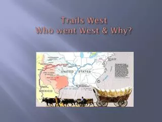
The Santa Fe Trail was an historic trail from Independence, Missouri to Santa Fe, New Mexico used in the 1800’s for trade and military purposes. It was about 780 miles in length. It was first used in 1880, after the railroads came to New Mexico. The vast majority of the Santa Fe Trail ran through Kansas, much of it along the Arkansas River. A small portion of the trail went through the Oklahoma Panhandle (No Man’s Land), before terminating in northern New Mexico. After the United States acquired the southwest following the Mexican War, the trail helped open the region to residential and commercial development. Today, the route is commemorated as the Santa Fe National Historic Trail. Ruts from the Santa Fe Trail can still be seen in Morton County, Kansas
Dodge City, Kansas was one of America’s most famous “wild west” towns. The famous television show Gunsmoke was even filmed here. Born in 1859 as Fort Dodge, the site was established along the Santa Fe Trail to provide westward bound travelers shelter from attacking Indians. Dodge City was established in 1872, five miles west of Fort Dodge. After the railroad was extended through Dodge City, the settlement attracted cowboys, buffalo hunters, soldiers, and railroad workers. Saloons, general stores and blacksmith shops lined the dirt roads. Because there was no local law enforcement, disagreements were settled by fight or duel. Eventually, the famous sheriff Wyatt Earp brought law, before the town was virtually abandoned in 1886. Fort Dodge in 1867.
Bent’s Fort was built in 1833 by William and Charles Bent for use as a trading post with Plains Indians and trappers. As the brothers’ trading empire grew to the Mexican trade centers of Taos and Santa Fe, Bent’s Fort became the center of operations. Trade was primarily conducted with Cheyenne and Arapaho Indians for buffalo robes. Because the fort was the only White settlement on the Santa Fe Trail, it served explores, adventures, and the U.S. Army as a place to get needed supplies, wagon repairs, livestock, food, water, rest, and protection from the Indians. In 1849, the fort was destroyed. Some researches believe it was attacked by Indians, while others believe it was blown up by the Bent Brothers after a failed attempt to sell it to the U.S. Army. Replica of Bent’s Fort
Santa Fe is the capital of New Mexico. It was founded in 1598 as the capital of the province of Nuevo Mexico, an area claimed for Spain by Spanish explorer Francisco Vasquez de Coronado. It is the second oldest settlement in America. Santa Fe was the western terminus of the Santa Fe Trail, which was used from 1821-1880. The city was the site of a large international trading market, where American merchants took manufactured goods and traded them for furs and other valuable items. Santa Fe was captured by the U.S. Army in 1846 in the Mexican War. Santa Fe was officially made capital of New Mexico upon its statehood. Sculpture in Santa Fe, the end of the Santa Fe trail
Fort Hall was built in 1834 by fur-trapper Nathaniel Jarvis Wyelth and as many as seventy other men as a point along the Snake River in which they could sell supplies to mountain men and trappers. In 1837, Wyelth sold the fort to the Hudson Bay Company of England. Despite the company’s attempts to discourage westward-bound travelers from stopping at the fort, wagon travel dramatically increased in the vicinity in the 1840’s, as it was located at the junction of the Oregon and California Trails. Fort Hall became a popular resting point for thousands of trail travelers, as well as an important trading post for the Shoshone Indians. By 1863, however, the fort was completely abandoned. Today, the site of the original fort is now on a Shoshone reservation Fort Hall Replica
Sutter’s Fort was built in 1839 by John Sutter as an agricultural and trading colony in the Sierra Nevada Range of northern California. It was the western end of the California Trail, and marked the final destination for California-bound travelers on the trail, as well as for fortune-seekers during the California Gold Rush of 1849. Today, Sutter’s Fort State Historic Park lies within the city of limits of Sacramento, the capital of California. Sutter’s Fort became Sacramento in the 1850’s. The City’s geographic location, on the junction of the Sacramento and American Rivers, made it the perfect location for the western end of both the Pony Express and the Transcontinental Railroad. Sutter’s Fort
Nauvoo, located in Illinois, was founded in 1839 by the leader of the Mormons, Joseph Smith. Smith named the town Nauvoo, because it was an ancient biblical word meaning “How beautiful upon the Mountains”. The Mormons worked hard, shared their goods and prospered. The Mormons though also made some enemies. Some people reacted angrily to the Mormon teachings. They saw the Mormon practice of polygamy-allowing a man to have more than one wife at a time-as immoral. Others objected to their holding common property together. An anti-Mormon mob in Illinois killed Joseph Smith. Brigham Young, the next Mormon leader, moved his people out of the United States, His destination was Utah, then part of Mexico. The Mormons followed part of the Oregon Trail to Utah. There they built a new settlement by the Great Salt Lake. Joseph Smith Mormon pioneers leaving Nauvoo in 1846.
Located on the bluffs overlooking the Missouri River, Council Bluffs was settled in 1846 as the main outfitting point on the Mormon Trail. It was here where thousands of Mormons spent the winter of 1846, before embarking toward the west on the Mormon Trail. The city was also a major “jumping off point” for people embarking on the Oregon and California Trails. In 1863, Council Bluffs was made the eastern end of the Union Pacific Railroads. Today, Council Bluffs is an important economic center, home to agricultural companies and riverboat casinos.
Great Salt Lake City was founded by Brigham Young and members of the the Mormon Church in 1847. It marked the end of the 1,300 mile long Mormon Trail. The Mormons were looking for an isolated place to practice their religious beliefs without being persecuted, and they had also been expelled from Missouri and Illinois. Immediately, the settlers began building their church, which was completed 40 years later. The settlers organized a new state, which they called Deseret. Congress denied their petition for statehood and instead created the Utah Territory. Salt lake City (the “Great” was dropped) was named capital of the territory in 1858. Brigham Young The Great Salt Lake
Major Western Trails The first major western trail was the Santa Fe Trail, which stretched 800 miles from Independence, Missouri, to the town of Santa Fe, the capital of Spanish New Mexico. It began as a trade route. Santa Fe Trail The 2,000-mile Oregon Trail stretched from Independence, Missouri, to the rich farming lands of the Willamette Valley in Oregon. It was used by Native Americans, Lewis and Clark, fur traders and mountain men, and finally migrants. Oregon Trail Between 1847 and 1853, some 16,000 Mormons migrated west following the 1,300-mile route that became known as the Mormon Trail. It ran from Nauvoo, Illinois, to Salt Lake City in present-day Utah. Mormon Trail