Download
1 / 22
220 likes | 324 Views
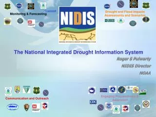
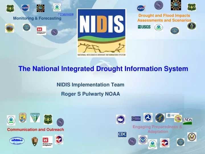
NIDIS Implementation Team Roger S Pulwarty NOAA. Monitoring & Forecasting. Drought and Flood Impacts Assessments and Scenarios. The National Integrated Drought Information System. Engaging Preparedness & Adaptation. Communication and Outreach.

E N D
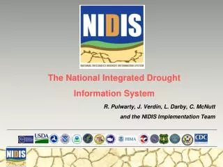
NIDIS Implementation Team Roger S Pulwarty NOAA Monitoring & Forecasting Drought and Flood ImpactsAssessments and Scenarios The National Integrated Drought Information System Engaging Preparedness & Adaptation Communication and Outreach
Climate Services: “The timely production and delivery of useful climate data, information and knowledge to decision makers” (NRC, 2001) VISION “An informed society anticipating and responding to climate and its impacts” Mission: “to develop and deliver research, information, and services to enhance society's ability to understand, anticipate, mitigate, and adapt to climate variability and change”
NIDIS Goals & Objectives Public Law (109-430, 2006) “better informed and more timely drought-related decisions leading to reduced impacts and costs”
NIDIS PL109-430-Three tasks (1) provide an effective drought early warning system that— (1 A) is a comprehensive system that collects and integrates information on the key indicators of drought in order to make usable, reliable, and timely drought forecasts and assessments of drought, including assessments of the severity of drought conditions and impacts; (1 B) communicates drought forecasts, drought conditions, and drought impacts on an ongoing basis to— (i) decision-makers at the Federal, regional, State, tribal, and local levels of government; (ii) the private sector; and (iii) the public
NIDIS Act PL109-430 continued…… (1C) includes timely (where possible real-time) data, information, and products that reflect local, regional, and State differences in drought conditions; (2) coordinate, and integrate as practicable, Federal research in support of a drought early warning system; and (3) build upon existing forecasting and assessment programs and partnerships
NIDIS Components 1. NIDIS Program Office 2. U.S. Drought Portal 3. Climate Test Beds/Drought • Integrating data and forecasts 4. Coping with Drought • Integrated Applications Research 5. NIDIS Early Warning Information Systems • Design,Prototype, Implementation, Process sustainability
NATIONAL NIDIS Governance: Executive Council NIDIS Program Office NIDIS Implementation Team: Over 50 Federal, state, tribal and private sector representatives REGIONAL NIDIS Technical Working Groups U.S. Drought Portal Public Awareness And Education WATERSHED/URBAN/LOCAL Engaging Preparedness Communities Interdisciplinary Research and Applications Integrated Monitoring and Forecasting Integrated Drought Information Systems Drought Early Warning System Design-Information clearinghouse, Pilots, and Implementation
NIDIS Early Warning Systems Pilots – Blue-first round;yellow-second round of prototypes/transferabilty Columbia River Basin Upper Missouri Basin Great Lakes Region California Lower CO Basin +Texas Southeast
Upper Basin down to Lake Mead • Coordinated reservoir operations: Low flow shortage triggering criteria (Powell/Mead) • Inter- and Intra-basin transfers; Front range urban-agriculture • Ecosystem health/services Lake Powell Kremmling Lake Mead
Upper Colorado River Basin (UCRB) EWS Design Workshop UCRB Monitoring Gaps Assessment US Drought Portal Upgrades sub-portal Assimilate and characterize indicators and triggers in the UCRB ESP improvements and Assessment of water demand in UCRB (ongoing) Webinar launched as part of RFC Annual Operating Plan Outlook Drought Index Planning support-Surface Water Supply Index
NIDIS Newsletter released-circulated across disaster management community, agencies and states Drought, Climate change and Early Warning on Western Native Lands June 09 Centers for Disease Control-Drought and Public Health Report Climate Change and Water Resources: Federal Perspectives (USGS 1331)
Coping with Drought: TRACS Ensemble Hydrologic Forecasts over the Southeast in Support of the NIDIS Pilot Drought Index Evaluation and Implementation in a Geospatial Framework Linked to Hydrologic Data Web Services Evaluating Adaptation Policies For Urban Water Resource Management Between Short-Term Drought Responses And Long-Term Planning Integrating Socioeconomic Assessments to Build Community Resilience in Mitigating Drought A Climate Information System to Enhance Drought Preparedness by Underserved Farmers in the SE U.S.
Apalachicola-Chattahoochee-Flint Early Warning System Yr1 ACF Monitoring Gaps Assessment Carolinas Catawba-Wateree Early Warning System FY10 Priority
Planning and information workshops- Peachtree Georgia May 08 Chapel Hill NC June 09 Columbus Georgia Sept 09 Design workshop Lake Blackshear Dec 1-2
Apalachicola-Coosa-Tallapoosa (ACT) and Apalachicola-Chattahoochee-Flint (ACF) Basins 15
NIDIS INFORMATION MANAGEMENT Coordinating federal, state, and local drought-related activities (e.g., within watersheds and states) Prediction Monitoring Applications Research Integrating Tools:e.g. Drought Portal Identifying and transferring innovative strategies for drought risk assessment, communication and preparedness ImpactMitigation ImprovedAdaptation ProactivePlanning
Drought stages including preparedness Indicators,triggers, response and impact avoidance Declaring drought accurately Declaring drought early enough Minimizing the duration of a declaration Informing an equitable and reasonable response Where to go for help
Drought and Water Resources Federal Partnerships Drought and Flood ImpactsAssessments and Scenarios Monitoring & Forecasting Information Services in support of Adaptation Engaging Preparedness & Adaptation Communication and Outreach
Drought and Water Resources Services Mission: Implement a dynamic, accessible, authoritative drought information system
U.S. Bureau of Reclamation (USBR), U.S. Army Corps of Engineers (USACE), U.S. Department of Agriculture (USDA): Natural Resources Conservation Service (NRCS), U.S. Geologic Survey (USGS), Department of Energy (DOE), U.S. Aid for International Development (USAID): Famine Early Warning System Network (FEWS NET)