Download
1 / 31
310 likes | 319 Views
Beyond "press Ctrl-P" in web map printing Jan De Moerloose– co-creator of Geomajas FOSS4G 2009, Sydney. The company:.

E N D
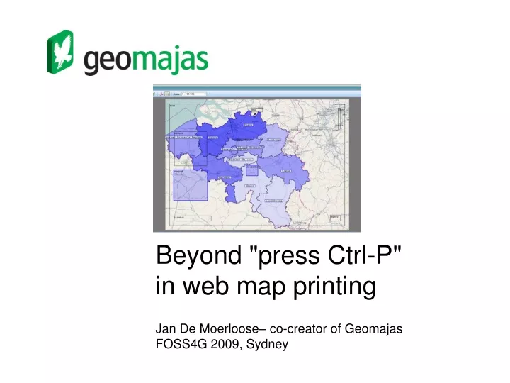
Beyond "press Ctrl-P" in web map printing Jan De Moerloose– co-creator of Geomajas FOSS4G 2009, Sydney
The company: Geosparc commercially supports Geomajas, the Open Source GIS application framework, coupling the innovation of Open Source with the reliability of a true enterprise-class platform. www.geosparc.com 2
The product: • Open Source GIS application framework • It is downloadable at http://www.geomajas.org/ • Integrated client-server architecture • Geometry editing + validation • Custom attribute definitions • Advanced querying capabilities 3
Reprint of the historical atlas Ferraris • Weighs 12.5 kg • 14000 copies sold • All of them to male individuals !
Problems • Use of Ctrl-P : the nature of HTML • Several other problems • fixed page size/orientation • fixed component arrangements • fixed component sizes • fixed resolution • no storage or reuse • These are inherent limitations of the form-based approach !
Form-based approach Title left/right Map Legend size (A0, A1, …)
Form-based approach • What ? • small set of parameters in an HTML form • send to the server for interpretation • Result • very limited impact on the outcome • fixed template • fixed component placement • no storage or reuse
Component-based approach Title Map Legend Viewport Title Map Legend Viewport
Component-based approach • What ? • client-side representation of the printed map • using SVG/VML (true vector graphics) • component model is sent to the server • Advantages • possibility to drag/resize individual parts/components of the map • possibility to add components • customizable templates/layouts • limitless storage/reuse • and so much more…
Component zoölogy • Map component • Legend component • Vector layer component • Raster layer component • Scalebar component • Label component • Image component • View port component
Component layout Parent Child Top Left Right marginX Bottom marginY
Component Layout North arrow Title map Legend viewport scalebar
User freedom: editing components • Dragging • Resizing
User freedom: panning modes • Pan the map • Pan the print
User freedom: view ports • Zooms into interesting part of the map • Combination of 2 rectangular boxes: • View port • Map region • Resizing view port changes the zoom scale • Resizing map region changes the aspect ratio
User freedom: persistence and reuse • Simple XML format • Based on annotated Java objects • Persisted in a PostGIS database
Rendering technology: PDF with iText • Why PDF ? • Html is not printable • most portable format • that supports raster and vector representations ! • Why iText ? • easy to use and performant • low-level pdf access • PdfGraphics component with great drawing support
Real world project: Westtoer • Tourism organisation (Flanders/Belgium) • Management of bicycle networks/hiking trails • System of voluntary maintainers • Need to produce printed maps for a large number of routes on a weekly basis based on the latest route information
What’s next ? • Better usability • Editing colors, fonts and layout properties in the browser • Uploading images • Batch processing • Multipage maps • Multilayer pdfs
Conclusion • Printed maps matter ! • Component-based approach offers • Power to the end user • Persistence and reuse • Desktop-like stuff: view ports • better prints ! 30
Thank you ! • http://www.geomajas.org