Download
1 / 39
390 likes | 400 Views
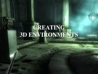
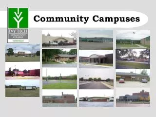
Creating 3D Campuses. Craig McCabe Jeff Archer. Agenda. Value of a 3D campus Data Migration Making a good campus map Transportation networks Publishing Grand Finale. Value of a 3D Campus. Why a 3D Campus?. Common workflows. Security and Safety Space Optimization

E N D
Creating 3D Campuses Craig McCabe Jeff Archer
Agenda • Value of a 3D campus • Data Migration • Making a good campus map • Transportation networks • Publishing • Grand Finale
Why a 3D Campus? Common workflows • Security and Safety • Space Optimization • Guest Routing and Directions • Employee Routing and Directions • Office Finder • Sensor Networks
CAD GIS Omni 4th Floor Import CAD
CAD GIS 3D Cities Information Model Omni 4th Floor Import CAD Georeference
CAD GIS 3D Cities Information Model Omni 4th Floor Import CAD Georeference Build Polygons
CAD GIS 3D Cities Information Model Omni 4th Floor Import CAD Georeference Build Polygons Attribute Spaces Hallways Meeting Spaces Restrooms
CAD GIS 3D Cities Information Model Omni 4th Floor Import CAD Georeference Build Polygons Attribute Spaces Attribute Structure
CAD GIS 3D Cities Information Model Omni 4th Floor Import CAD Georeference Build Polygons Attribute Spaces Attribute Structure Doors Walls Creating Interior 3D Web Scenes and 3D Base Layers
CAD GIS 3D Cities Information Model Omni 4th Floor Import CAD Georeference Build Polygons Attribute Spaces Attribute Structure Stairs Creating Interior 3D Web Scenes and 3D Base Layers
CAD GIS 3D Cities Information Model Omni 4th Floor Import CAD Georeference Build Polygons Attribute Spaces Attribute Structure Stairs Creating Interior 3D Web Scenes and 3D Base Layers
CAD GIS 3D Cities Information Model Common Issues CAD Topology Curves Line Gap Door Closure
Feature Extraction from LiDAR Trees and Buildings w h h
Feature Height Extraction from LiDAR Demo – Craig McCabe
Procedural 3D Buildings In CityEngine Building footprint Rule Package Textured 3D façade Height Base elevation Number of floors Land use Key attributes
Procedural 3D Trees In ArcGIS Pro Tree Points Pre-Set Pro Layer 3D Trees Key attributes
Making a Good Campus Map Jeff Archer
Campus Map Examples Demo - Jeff Archer
Transportation Networks Jeff Archer Creating Interior 3D Web Scenes and 3D Base Layers
2015: In-building Route Creation – single floor Inputs Space Polys Floor Lines Doors Space Points
In-building routing network generation – whole building 1. Create fishnet 2. Clip to floor 3. Add wall lines 4. Erase walls & calculate wall distance 5. Add spaces 6. Tag primary paths & add space centroids 7. Calculate floor paths 8. Calculate all paths 9. Deploy network
3D Routing Resources & Examples • Campus Transportation Schema (beta) • bit.ly/esri3dnetwork • 3D Routing Development Demo: • http://nadev.arcgis.com/arcgis/samples/4.0/3d-basic3d.html
Network Analysis – Beyond Routing Vehicle Routing Problem Location-Allocation Service Area Points Service Area Lines Service Area Polygons
What About Real-Time Navigation? • The “blue dot” experience • Predominantly a hardware solution • Radio triangulation • Beacons • You still need the map • Several 3rd party solutions • GISi Indoors/GeoMetri • Pen Bay • RF Spot • Newaer
Publishing Jeff Archer
Publishing • 2D is pretty easy • Networks • Floor spaces • 3D is not so much • Story is fluid and changing • True for all 3D data, not just campus/indoor • Shoot for Pro and publish to AGOL or Portal • Web Scene functionality will continue to grow • City Engine is an option for those who are savvy • Scene services can be an option • New at 10.3
3D Campus Demos Craig McCabe
Grand Finale Why build a 3D Campus? • CityEngine Web Scene • Coffee Station Inspection / ArcScene • Campus Data • Transportation Network • VRP Solver • Publish to web • Full on ArcGIS Stack solution
Upcoming Workshops Routing in Buildings with 3D Networks in ArcGIS Pro (Demo Theatre) Wednesday 9:30am SDCC Hall B 3D – The Next Generation of Emergency Response (Demo Theatre) Wednesday 9:30am Security Showcase – SDCC Hall B 5 Tips to Make Your 3D Life Easier (Demo Theater) Wednesday 10:00am Tech Theater 15, SDCC Hall A Spatially-Enabled Asset and Facility Management from IBM Wednesday 12:00pm Room 24B Using ArcGIS to Manage Military Bases and Facilities (Demo Theatre) Thursday 9:30am Security Showcase – SDCC Hall D
Special Interest Group Meetings Facilities and Indoor Mapping SIG Wednesday 5:30pm SDCC Room 28A – Plaza Terrace Upper Level 3D Campus and Facility Modeling Thursday 8:30am SDCC Room 27B Moderated Paper Sessions
Please fill out the session survey: Offering ID: 1630 Online – www.esri.com/ucsessionsurveys Paper – pick up and put in drop box
Thank you! Questions?