Download
1 / 30
300 likes | 309 Views
Methods of Downscaling Future Climate Information and Applications Linda O. Mearns National Center for Atmospheric Research. NARCCAP Users’ Meeting Boulder, CO September 10-11, 2009. Global forecast models. Climate Models. Regional models. Global models in 5 yrs.

E N D
Methods of Downscaling Future Climate Information and Applications Linda O. Mearns National Center for Atmospheric Research NARCCAP Users’ Meeting Boulder, CO September 10-11, 2009
Global forecast models Climate Models Regional models Global models in 5 yrs
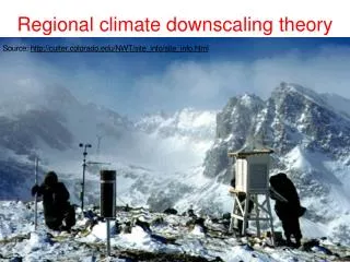
Objective of Downscaling • Bridge mismatch of spatial scale between the scale of global climate models and the resolution needed for impacts assessments
The ‘Mismatch’ of Scale Issue “Most GCMs neither incorporate nor provide information on scales smaller than a few hundred kilometers. The effective size or scale of the ecosystem on which climatic impacts actually occur is usually much smaller than this. We are therefore faced with the problem of estimating climate changes on a local scale from the essentially large-scale results of a GCM.” Gates (1985) “One major problem faced in applying GCM projections to regional impact assessments is the coarse spatial scale of the estimates.” Carter et al. (1994) ‘downscaling techniques are commonly used to address the scale mismatch between coarse resolution GCMs … and the local catchment scales required for … hydrologic modeling’ Fowler and Wilby (2007)
Different Kinds of Downscaling • Simple (Giorgi and Mearns, 1991) • Adding coarse scale climate changes to higher resolution observations (the delta approach) • More sophisticated - interpolation of coarser resolution results (Maurer et al. 2002, 2007) • Statistical • Statistically relating large scale climate features (e.g., 500 mb heights), predictors, to local climate (e.g, daily, monthly temperature at a point), predictands • Dynamical • Application of regional climate model using global climate model boundary conditions • Confusion can arise when the term ‘downscaling’ is used – could mean any of the above
But, once we have more regional detail, what difference does it make in any given impacts assessment? What is the added value? Do we have more confidence in the more detailed results?
Simple DownscalingEcology Example • Projected climate-induced faunal change in the Western Hemisphere. Lawler et al. 2009, Ecology • Used 10 AOGCMs, 3 emissions scenarios, essentially interpolated to 50 km scale • Applied to bioclimatic models (associates current range of species to current climate)
Sample Results ‘Predictions’ of climate-induced species turnover for three emissions scenarios (G=B1, H=A1B, I=A2) for 2071-2100. Conclusion: projected severe faunal change – even lowest scenarios indicates substantial change in biodiversity
Statistical Downscaling • Various sub-methods • Weather classification schemes • Regression methods – multiple regression, artificial neural networks, canonical correlation • Weather generators
Statistical Downscaling • Caveats • Predictor variables should be adequately reproduced by GCM • Relationship between predictor and predictand remains valid for periods outside calibration period • Predictor set captures the signal of future climate
Weather Classification • Relate weather classes or categorizations to local climate variable • Discrete weather types are grouped according to cluster techniques • Typical example is relating different pressure patterns to surface temperature • Assumes same weather pattern in the future will be associated with the same local responses in the future • Changes in frequency of types
Regression Methods • Earliest efforts related a variable at coarse scale to same variable at local scale (e.g., regional temperature used to estimate local temperature, Wigley et al. 1990) • More typical, multiple regression relating pressure, humidity fields to local precipitation • Common problem of underestimating variance of predictand
Weather Generators • Statistically reproduce attributes of a climate variable, e.g, mean and variance, and usually used to produce time series (e.g., daily) of a climate variable or sets of climate variables (precipitation, temperature, solar radiation) • Parameters of weather generator are then conditioned on large scale predictors, such as the NAO or ENSO.
Dynamical Downscaling Application of Regional Climate Models Atmospheric Time-slice Experiments Stretched Grid Experiments
Atmospheric Time-slice experiments – only the atmospheric (and land surface) models are used – lower boundary conditions are provided for sea surface temperatures and sea ice. • Stretched Grid experiments - full atmosphere-ocean model is used but grid is made high resolution in only one part of the global domain
Regional Modeling Strategy Nested regional modeling technique • Global model provides: • initial conditions – soil moisture, sea surface temperatures, sea ice • lateral meteorological conditions (temperature, pressure, humidity) every 6-8 hours. • Large scale response to forcing (100s kms) • Regional model provides finer scale (10s km) response
Physical Contexts for Regional Modeling • Regions with small irregular land masses (e.g., the Caribbean) • Complex topography (mountains) • Complex coastlines (e.g., Italy) • Heterogeneous landscapes
Spatial Resolution of Quebec in GCMs and RCMs Land-sea Mask Annual Precip Totals
What high res is useful for • For coupling climate models to other models that require high resolution (e.g. air quality models – for air pollution studies) • In certain specific contexts, provides insights on realistic climate response to high resolution forcing (e.g. mountains)
Global and Regional Simulations of SnowpackGCM under-predicted and misplaced snow Regional Simulation Global Simulation
Climate Change Signals Temperature Precipitation PCM RCM
Effects of Climate Change on Water Resources of the Columbia River Basin • Change in snow water equivalent: • PCM: - 16% • RCM: - 32% • Change in average annual runoff: • PCM: 0% • RCM: - 10% Payne et al., 2004
Modeling the Impact of Global Climate and Regional Land Use Change on Regional Climate and Air Quality over the Northeastern United States C. Hogrefe, J.-Y. Ku, K. Civerolo, J. Biswas, B. Lynn, D. Werth, R. Avissar, C. Rosenzweig, R. Goldberg, C. Small, W.D. Solecki, S. Gaffin, T. Holloway, J. Rosenthal, K. Knowlton, and P.L. Kinney Hogrefe et al., 2004 U.S. EPA STAR Program
Changes in Ozone with Climate Change Current (ppb) 2020 2080 2050 Hogrefe et al. 2004
Putting spatial resolution in the context of other uncertainties • Must consider the other major uncertainties regarding future climate in addition to the issue of spatial scale – what is the relative importance of uncertainty due to spatial scale? • These include: • Specifying alternative future emissions of ghgs and aerosols • Modeling the global climate response to the forcings (i.e., differences among GCMs)
Oleson et al., 2007, Suitability for Maize cultivation Based on PRUDENCE Experiments over Europe Uncertainties in projected impacts of climate change on European agriculture and terrestrial ecosystems based on scenarios from regional climate models a. 7 RCMs, one Global model, one scenario b. 24 scenarios, 6 GCMs, 4 emission scenarios Conclusion: uncertainty across GCMs (considering large number of GCMs) larger than across RCMs, BUT uncertainty from RCMs larger than uncertainty from only GCMs used in PRUDENCE
GCM ensemblemember GCM ensemble member GCM GCM GCM RCM RCM RCM ensemble member RCM ensemble member RCM ensemble member Mother Of All Ensembles The Future scenario scenario scenario GCM ensemble member RCM
Final Thoughts • GCM boundary conditions are a main source of uncertainty for most downscaling techniques • Different downscaling methods can yield different scenarios even when forced with the same GCM • Ability to downscale the current climate does not guarantee accuracy about downscaling the future