Download
1 / 57
570 likes | 575 Views
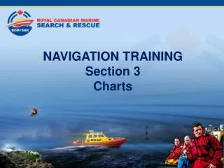
NAVIGATION TRAINING Section 11 Weather. Table of Contents. Section 1 Types of Navigation Section 2 Terrestial Coordinates Section 3 Charts Section 4 Compass Section 5 Nautical Publications Section 6 Navigational Aids. Table of Contents. Section 7 Buoyage

E N D
NAVIGATION TRAINING Section 11 Weather
Table of Contents • Section 1 Types of Navigation • Section 2 Terrestial Coordinates • Section 3 Charts • Section 4 Compass • Section 5 Nautical Publications • Section 6 Navigational Aids
Table of Contents • Section 7 Buoyage • Section 8 Position Lines and Fixes • Section 9 Tides • Section 10 Currents • Section 11 Weather
Atmospheric Pressure • The standard atmosphere (symbol: atm) is a unit of pressure and is defined as being precisely equal to 101.325 kilopascals, 1013.25 millibars, or 29.92 inches of mercury. • The pressure gradient between a high pressure area and a low pressure area governs the strength of the wind, the wind blowing from high pressure to low pressure. • The greater the gradient the stronger the wind.
Atmospheric Pressure • An extreme example is the centre of a hurricane which can go as low as 94.8 kilopascals. The pressure gradient is huge, causing the winds to blow at 100 to 150 knots (nautical miles per hour).
Mean Sea Level Pressure • Where air masses meet, there are well-marked boundary zones called fronts. This is where most cloud and precipitation occurs. • In the northern hemisphere the circulation is anticlockwise around low pressure and clockwise around high pressure. The air flows almost parallel to the isobars but actually 10-15 degrees inwards towards the low pressure.
Mean Sea Level Pressure 15 year average Mean Sea Level Pressure for June July August 15 year average Mean Sea Level Pressure for December January February
Global Circulation • The Earth rotates at a constant rate, and the winds blow, the transfer of momentum between Earth/atmosphere /Earth must be in balance; and the angular velocity of the system maintained. • The atmosphere is rotating in the same direction as the Earth but westerly winds move faster and easterly winds move slower than the Earth's surface.
Global Circulation Remember winds are identified by the direction they are coming from, not heading to!
Weather Fronts • Where air masses meet, there are well-marked boundary zones called fronts. This is where most cloud and precipitation occurs. • In the northern hemisphere the circulation is anticlockwise around low pressure and clockwise around high pressure. The air flows almost parallel to the isobars but actually 10-15 degrees inwards towards the low pressure.
Weather Fronts • There are three types of front: • 1. Warm front • 2. Cold front • 3. Occlusions and Occluded Fronts
Warm Fronts • When a warm moist air mass rises above a cold air mass, a warm front forms. The gradient of the front is very shallow. Warm fronts occur at the forward edge of a depression (a low-pressure system).
Cold Fronts A cold front marks the advance of colder air undercutting warm air. The gradient of the cold front is steeper than that of a warm front, and the rainfall is usually heavier. Thunderstorms sometimes form along a cold front.
Occluded Fronts • Depressions and other frontal systems have a three-dimensional structure. • Most depressions weaken when the cold front catches up with the warm front and cuts it off from the ground. • If the cold front rises over the warm front, this is a warm occlusion. • If the cold front undercuts the warm front this is a cold occlusion.
Occluded Fronts • Weather systems grow mature and decay and as they do, new ones are created. This creates families of weather systems.
Wind Wind is primarily the result of uneven heating of the earth’s surface, which causes large hotter areas and large cooler areas.
Wind Force FORCE EQUIVALENT SPEED DESCRIPTION SPECIFICATIONS FOR USE AT SEA 10 m above ground miles/hour knots 0 0-1 0-1 Calm Sea like a mirror
Wind Force FORCE EQUIVALENT SPEED DESCRIPTION SPECIFICATIONS FOR USE AT SEA 10 m above ground miles/hour knots 1 1-3 1-3 Light air Ripples with the appearance of scales are formed, but without foam crests.
Wind Force FORCE EQUIVALENT SPEED DESCRIPTION SPECIFICATIONS FOR USE AT SEA 10 m above ground miles/hour knots 2 4-7 4-6 Light Breeze Small wavelets, still short, but more pronounced. Crests have a glassy appearance and do not break.
Wind Force FORCE EQUIVALENT SPEED DESCRIPTION SPECIFICATIONS FOR USE AT SEA 10 m above ground miles/hour knots 3 8-12 7-10 Gentle Breeze Large wavelets. Crests begin to break. Foam of glassy appearance. Perhaps scattered white horses.
Wind Force FORCE EQUIVALENT SPEED DESCRIPTION SPECIFICATIONS FOR USE AT SEA 10 m above ground miles/hour knots 4 13-18 11-16 Moderate Breeze Small waves, becoming larger; fairly frequent white horses.
Wind Force FORCE EQUIVALENT SPEED DESCRIPTION SPECIFICATIONS FOR USE AT SEA 10 m above ground miles/hour knots 5 19-24 17-21 Fresh Breeze Moderate waves, taking a more pronounced long form; many white horses are formed. Chance of some spray.
Wind Force FORCE EQUIVALENT SPEED DESCRIPTION SPECIFICATIONS FOR USE AT SEA 10 m above ground miles/hour knots 6 25-31 22-27 Strong Breeze Large waves begin to form; the white foam crests are more extensive everywhere. Probably some spray.
Wind Force FORCE EQUIVALENT SPEED DESCRIPTION SPECIFICATIONS FOR USE AT SEA 10 m above ground miles/hour knots 7 32-38 28-33 Near Gale Sea heaps up and white foam from breaking waves begins to be blown in streaks along the direction of the wind.
Wind Force FORCE EQUIVALENT SPEED DESCRIPTION SPECIFICATIONS FOR USE AT SEA 10 m above ground miles/hour knots 8 39-46 34-40 Gale Moderately high waves of greater length; edges of crests begin to break into spindrift. The foam is blown in well-marked streaks along the direction of the wind.
Wind Force FORCE EQUIVALENT SPEED DESCRIPTION SPECIFICATIONS FOR USE AT SEA 10 m above ground miles/hour knots 9 47-54 41-47 Severe Gale High waves. Dense streaks of foam along the direction of the wind. Crests of waves begin to topple, tumble and roll over. Spray may affect visibility.
Wind Force FORCE EQUIVALENT SPEED DESCRIPTION SPECIFICATIONS FOR USE AT SEA 10 m above ground miles/hour knots 10 55-63 48-55 Storm Very high waves with long over- hanging crests. The resulting foam, in great patches, is blown in dense white streaks along the direction of the wind. On the whole the surface of the sea takes on a white appearance. The 'tumbling' of the sea becomes heavy and shock-like. Visibility affected.
Wind Force FORCE EQUIVALENT SPEED DESCRIPTION SPECIFICATIONS FOR USE AT SEA 10 m above ground miles/hour knots 11 64-72 56-63 Violent Storm Exceptionally high waves (small and medium-size ships might be for a time lost to view behind the waves). The sea is completely covered with long white patches of foam lying along the direction of the wind. Everywhere the edges of the wave crests are blown into froth. Visibility affected.
Wind Force FORCE EQUIVALENT SPEED DESCRIPTION SPECIFICATIONS FOR USE AT SEA 10 m above ground miles/hour knots 12 73-83 64-71 Hurricane The air is filled with foam and spray. Sea completely white with driving spray; visibility very seriously affected.
Sea Breeze • A sea-breeze (or onshore breeze) is a wind from the sea that develops over land near coasts. • It is formed by increasing temperature differences between the land (which heats up faster) and water (which warms slower) which create a pressure minimum over the land due to its relative warmth and forces higher pressure, cooler air from the sea to move inland.
Sea Breeze It generally occurs in the afternoon.
Land Breeze • A land-breeze (or offshore breeze) is a wind to the sea that develops over land near coasts. • It is formed by increasing temperature differences between the land (which cools faster) and water (which cools slower) which create a pressure minimum over the sea due to its relative warmth and forces higher pressure, cooler air from the land to move offshore.
Land Breeze It generally occurs in the very early morning.
Katabatic Winds • A katabatic wind, from the Greek word katabatikos meaning "going downhill", is a wind that blows down a topographic incline such as a hill, mountain, or glacier. • The cold form of katabatic wind originates in a cooling, either radiatively or through vertical motion, of air at the top of the mountain, glacier, or hill.
Katabatic Winds • Since the density of air increases with lower temperature, the air will flow downwards, warming adiabatically as it descends, but still remaining relatively cold.
Wind Force & Sea State • The visible effects of the wind on the sea will be modified by the relative directions of wind and tide. • If the wind and tide are in opposite directions, then a larger chop will be created, giving the impression of the wind being stronger. • If wind and tide are in the same direction, the amount of sea will be reduced, giving the impression of the wind being less.
Sea and Swell • Sea is the effect of wind passing over the water locally. • Swell is only found in the open ocean and will be effects of weather systems, hundreds of miles away.
Fog • Fog is a cloud in contact with the ground. • Fog differs from other clouds only in that fog touches the surface of the Earth. • The same cloud that is not fog on lower ground may be fog where it contacts higher ground such as hilltops or mountain ridges. • Fog is distinct from mist only in its density.
Fog • Fog is defined as cloud which reduces visibility to less than 1 nautical mile, where as mist is that which reduces visibility to more than 1 nautical mile.
Fog • Fog forms when water vapor in the air at the surface begins to condense into liquid water. • Fog normally occurs at a relative humidity of 100%. This can be achieved by either adding moisture to the air or dropping the ambient air temperature. • Fog can form at lower humidities, and fog can sometimes not form with relative humidity at 100%.
Fog • Advection fog occurs when moist air passes over a cool surface by advection (wind) and is cooled. It is common as a warm front passes over an area significantly cooler. It's most common at sea when tropical air encounters cooler waters, or in areas of upwelling.