Download
1 / 27
270 likes | 277 Views
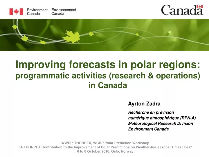
Improving forecasts in polar regions: programmatic activities (research & operations) in Canada. Ayrton Zadra Recherche en pr é vision numérique atmosph é rique ( RPN-A) Meteorological Research Division Environment Canada. WWRP, THORPEX, WCRP Polar Prediction Workshop

E N D
Improving forecasts in polar regions: programmatic activities (research & operations) in Canada Ayrton Zadra Recherche en prévision numérique atmosphérique (RPN-A) Meteorological Research Division Environment Canada WWRP, THORPEX, WCRP Polar Prediction Workshop “A THORPEX Contribution to the Improvement of Polar Predictions on Weather-to-Seasonal Timescales” 6 to 8 October 2010, Oslo, Norway
Contents • Research • THORPEX-IPY • Sea-ice analysis • Operations • NWP • Coupled models • Ongoing and planned projects
THORPEX Arctic Weather and Environmental Prediction Initiative (TAWEPI) Primary objective: develop & validate Polar- GEM, an experimental regional NWP model over the Arctic Data assimilation sub-projects (4) validation/assimilation of polar orbiting satellite data; (5) stratospheric analyses; (6) singular vector sensitivity studies • Modelling sub-projects • polar clouds • (2) sea-ice • (3) snow over sea-ice Member of IPY-THORPEX cluster www.ipy-thorpex.no http://collaboration.cmc.ec.gc.ca/science/rpn/tawepi/en/index.html
sublimation suspension saltation wind Sea ice Project: Snow over sea-iceInvestigators: Y.-C. Chung, S. Bélair, J. Mailhot • Goals • better represent the interactions between snow pack and sea ice • to examine the effect of blowing snow on the simulation of snow and sea ice • Methodology • coupling of 3 schemes/models: • RPN/MSC thermodynamic sea-ice model • SNTHERM multi-layer snow model (Jordan,1991) • PIEKTUK blowing snow model (Dery, 2001) • verification against SHEBA data • Conclusions • Coupled scheme improved simulation of: • timing of snow depletion • ice thickness / growth • formation of ice slabs at bottom of ice pack • sublimation due to blowing snow, which improves snow depth, duration of snow cover, and underlying sea ice properties 1-D, blowing snow model, PIEKTUK (Déry, 2001) snow 1-D, multi-layer snow model SNTHERM (Jordan, 1991) ocean Multi-layer, thermodynamic sea ice model from Meteorological Service of Canada (MSC) operational forecasting system run 1-D, offline model
Project: Polar cloudsInvestigators: F. Chosson, P. Vaillancourt, J. Milbrandt Objective Improve representation of clouds & precipitation and surface radiative energy budget in GEM, specially over the Arctic. Methodology Study the sensibility of Polar-GEM forecasts to the choice of microphysics scheme: • single-moment Sundqist (1989) • multi-moment Milbrandt & Yau (2005) Conclusions • cloud fraction, condensate and precipitation are highly sensitive to microphysics scheme • schemes are very sensitive to choice of time step • sub-grid cloud fraction is needed cloud fraction total condensate height (km) height (km) % g/m^2 Fig: Vertical profiles of cloud fraction and total condensate, averaged over space (Arctic) and time (48h), from three simulations of Polar-GEM using the Sundqist (black), single-moment M&Y (blue) and double-moment M&Y (red) schemes.
Project: Sea-ice modellingInvestigators: N. Steiner, G. Flato, Y. Lu Objectives • Implement & expand latest version of Los Alamos CICE model (used in several GCMs and US Navy's ice-ocean forecast model) • Apply & test model in various settings (operational sea-ice, ocean & atmosphere forecasting – coupled to Polar-GEM/GEM-LAM, coupled climate studies) • Develop a Canadian community sea-ice model to be used in climate mode (GCM, RCM) and forecast mode (weather, sea-ice) Initial tests • Global CICE4.0 was installed on Canadian Centre for Climate modelling and analysis (CCCma) as standalone sea-ice model • Initially tested with climatological daily forcing from a 20 year GCM run (atmosphere) and monthly Polar Science Center
Project: Assimilation of polar orbiting satellite dataInvestigators: O. Pancrati, L. Garand, S. Heilliette • Validation of cloud height/cover retrieval • - for data quality control • - to infer model deficiencies • Specific problems found in Arctic & Antarctic • regions linked to cloud parameter • determination. Validation with independent data • needed (MODIS, Calipso, MISR datasets) • Background • AIRS radiances • (Atmosp. IR Sounder) • - 87 channels • assimilated since Jun 2008 • - radiances not sensitive to lower • clouds assimilated • CO2-slicing technique (retrieval of cloud parameters) was reexamined and applied to both real AIRS radiances and simulated ones 6-h and 12-h forecasts), then compared to model output of cloud parameters • allows separating systematic biases associated with the retrieval technique from those of forecast errors. • cloud parameter fields are compared to equivalent products available from • MODIS and AIRS standard processing -- good overall agreement is found
Project: Stratospheric analysesInvestigators: M. Reszka, J. DeGrandpré, A. Robichaud, C. Charette, M. Roch, S. Polavarapu • Dynamics and chemistry analyses for March 1, 2007 – Feb 28, 2009 have been generated and provided to SPARC IPY database • Dynamics fields were produced using Canadian Meteorological Centre's 3D-Var global assimilation scheme and GEM forecast model • Chemistry fields were produced using an online stratospheric chemistry package (Belgian Institute for Space Aeronomy) • Data set is being used to study several processes, including • - fine structure of polar temperatures during 2007/2008 stratospheric sudden warming • - trace gas distribution as compared with spectrometer measurements • - deep stratospheric intrusions as revealed by the ozone field O3 OBS GEM-BACH analysis Comparison of trace-gas measurements from a Fourier transform spectrometer with GEM-BACH IPY analyses at Eureka, Nunavut – Mar 01 to Oct 30, 2007: Total (and partial) columns derived from spectrometer data (blue) and analyses (red) are in very good agreement for most gases measured (e.g. O3, N2O, HCl, HNO3). Figure provided by R. Batchelor (U. of Toronto)
Project: Singular vector sensitivity studiesInvestigators: A. Mahidjiba, M. Buehner, A. Zadra • The sensitivity of Arctic forecast errors to initial analysis error is quantified using singular vectors. • SV analysis was performed daily during the IPY period. • The combination of SVs that best reproduces the observed forecast error is used to evaluate Arctic – midlatitude interactions. Singular vector analysis of 48h forecast sensitivity for the summer of 2007. Target region is outlined with a dashed black line. Warmer colours denote stronger response. 80N 60N 40N 0° 90°E 180°E 90°W 0°
Project: Improved sea-ice analyses(Lead: Mark Buehner, MRD/EC) • collaboration between Environment Canada • (EC) and Canadian Ice Service (CIS) • 3DVar FGAT analysis (sea-ice fraction only, • for now) • assimilates AMSR-E, SSMI, CIS ice charts • and image analyses (RadarSat, EnviSat) • 3 domains: Global, N. America and Gulf of St- • Lawrence N. America (~5km) Global (~10km) GSL (~5km)
Operations: The Canadian Regional Deterministic Prediction System (RDPS) • March 2009: core grid of the regional model (15-km resolution) was • extended over the Arctic regions + new radiative transfer scheme • June 2009: implementation of 0600 UTC and 1800 UTC runs • June 2009: extension into the stratosphere (model top went from • 10 hPa to 0.1 hPa) northward extension of the core of the Canadian regional model
Operations: The Canadian Regional Deterministic Prediction System (RDPS) and Regional Ensemble Prediction System (REPS) • Fall 2010: New RDPS will become operational, using • limited-area model (red line in figure) • 3D-Var assimilation system independent from the global system • Project lead: L. Fillion • 2011: A 20-member regional ensemble prediction system will become operational: • 33km resolution • same grid (red line) • Project lead: M. Charron
Operations: The Canadian High Resolution Deterministic Prediction System (HRDPS) high resolution (2.5 km) limited-area models: EXPERIMENTAL (USER ACCOUNT) OPERATIONAL (CMC OPERATIONS) Source: J. Milbrandt
Operations: The Canadian High Resolution Deterministic Prediction System (HRDPS) – The Arctic Model Material provided by forecasters from the National Laboratory for Hydrometeorology and Arctic Meteorology – Environment Canada Mission: • provide improved understanding and prediction high-impact weather • focus on hydro-meteorological and northern latitude weather processes and phenomena Fig: Domain covered by the CMC 2.5km Arctic LAM. Relevant processes: “all boundary layer processes (turbulence, cloud microphysics, etc.) that feed into low-level winds and/or visibility” Relevant forecasts *: - winter: wind / blizzards - summer: low cloud / fog *Source: R. Goodson (HAL/EC)
Operations: Coupled Atmosphere-Ice-Ocean Forecast System for the Gulf of St. Lawrence • A fully-interactive coupled atmosphere-ice-ocean forecasting system for the Gulf of St. Lawrence (GSL) is now running operationally at the Canadian Meteorological Centre (CMC) • Produces daily 48hr forecasts (weather, ice, ocean) • Results during the past year have demonstrated that the coupled system produces improved weather forecasts in and around the GSL during all seasons • Shows that atmosphere-ice-ocean interactions are indeed important even for short-term Canadian weather forecasts • Great potential for improved ice-ocean components and global systems • Forecasts used by: • Canadian Coast Guard (Marine safety and routine operations) • Canadian Ice Service (Ice products) • Fisheries and Oceans Canada (Search and Rescue, Oil Spill) Slide kindly provided by G. Smith (MRD/EC)
Operations: The Gulf of St. Lawrence (GSL) Coupled System (forecast season, 2008) • A dynamic representation of sea surface conditions improves the meteorological forecast locally • Operational regional forecasting system (GEM-Ops) has tendency to overestimate cold events in winter. • Due to overly high ice concentration and thickness • Dynamic ice cover in coupled model allows vast stretches of ice-free water to open up, buffering atmospheric temperatures • Use of coupled model results in significantly improved forecasts all around the GSL • Further discussion of this system and physical ice-ocean processes involved provided tomorrow by Greg Smith -5°C -15°C -25°C Slide kindly provided by G. Smith (MRD/EC)
Operations: The Canadian Global Deterministic Prediction System (GDPS) Polar StratosphereThe major sudden stratospheric warming of January 2009 • Horizontal resolution: 33km • 4DVar data assimilation system • June 2009: extension into the stratosphere (top went from 10 hPa to 0.1 hPa) Sources: M. Charron, S.-W. Son, P. Martineau
Operations: The Canadian Extended Range Prediction System (ERPS)(Lead: H. Lin) Skill of CMC monthly forecast system: operational vs experimental Main changes w.r.t. operational system: • single model ensemble with perturbed physics • more accurate initial conditions • better representation of SST anomalies • improved sea-ice & snow analysis • higher resolution Note: increased skill in polar regions. Figure 4: Correlation skill of time mean surface temperature: operational 40-member ensemble forecast system (left); experimental EPS-based 20-member MFS (right).
Operations: The Canadian Extended Range Prediction System (ERPS)(Lead: H. Lin) GEM forecast persistence • The Canadian monthly forecast system shows skill* in predicting the NAO index (top figure) • Results indicate that the predictability of the NAO index increases in the presence of a strong MJO (bottom figure) • * here the skill measured as the correlation coefficient between observed and forecast NAO index
Plans: The Polar Communications & Weather (PCW) MissionSource: L. Garand • Objectives • - Reliable communications in the high latitudes (North of 70º) • Provide high temporal/spatial resolution meteorological data above 50º N in support of NWP, environmental monitoring, emergency response and climate monitoring • Launching: 2017 • Endorsed by WMO as major contribution to Earth Observing System (EOS) PCW: Constellation on Molniya orbit – 2 satellites to provide continuous GEO-like imagery (55-90 N, 0.5-1 km VIS, 2 km IR, 12-h period, 63.4 deg. Inclination; apogee: ~39,500 km; perigee: ~600 km)
Plans: Monthly, global, regional and high-resolution systems • new monthly forecast system expected to become operational in 2011 • resolution of global model to go from 33km to 25km in 2012 • horizontal resolution of regional model is expected to go from 15km to 10km in 2011 • resolution of regional EPS to go from 33km to 25km in 2011/2012 • existing high-resolution (2.5km) Arctic grids may be moved to other locations Plans: Sea-ice analysis • - new system expected to become operational for CIS applications in near • future • will be used to replace “direct insertion” in current Gulf of St-Lawrence • (GSL) system • soon to be proposed for NWP applications (regional and global • systems)
Plans: The Canadian Global Deterministic Prediction System (GDPS) • Development of a global forecasting Yin-Yang model: • orthogonal coordinates (easy representation of operators such as Gradient, Laplacian …) • no polar singularity • same grid structure for Yin and Yang components • easy to nest (as a LAM) • easy to parallelize (domain decomposition method) = 2-way coupling of 2 LAMs Yin-Yang gridby Abdessamad Qaddouri (see Qaddouri et al. 2008 Appl. Num. Math.)
Coupled systems: Future directions • Several new coupled systems under development as part of CONCEPTS • Canadian Operational Network of Coupled Environmental Prediction Systems • Tri-departmental collaboration • To develop coupled atmosphere-ice-ocean forecasting systems: • Global: Monthly-seasonal • Regional: short-to-medium for Canadian east coast and Arctic • Collaboration with Mercator • French operational oceanographic group CONCEPTS Slide kindly provided by G. Smith (MRD/EC)
Future Canadian Regional System Gulf of St. Lawrence coupled system to be replaced by N. American coupled system: Northwest Atlantic Arctic Great lakes System to include: Atmosphere-ice-ocean coupled model Wave model Land surface and blowing snow Analysis systems: Atm: 4DVAR/EnKF Ocean: SEEK (Mercator) Ice: 3DVAR Precipitation(snow): CaPa GEM: 10km NEMO: 1/12° NW Atl NEMO: 1/12° Arctic NEMO: 2km Great lakes Slide kindly provided by G. Smith (MRD/EC)
References and Links Chung, Y.-C., S. Belair and J. Mailhot (2010): Simulation of Snow on Arctic Sea Ice Using A Coupled Snow/Ice Model. Journal of Hydrometeorology, 11, 199-210 Chung, Y.-C., S. Belair and J. Mailhot (2010): Blowing snow on Arctic sea ice: results from an improved sea ice/snow/blowing snow coupled system. Submitted toJournal of Hydrometeorology Deacu, D., A. Zadra and J. Hanesiak (2009): Simulating wind channeling over Frobisher Bay and its interaction with downslope winds during the 7-8 November 2006 wind event. Atmosphere-Ocean 48(2), 101-121 Garand, L., O. Pancrati and S. Heilliette (2010): Validation of forecast cloud parameters from multispectral AIRS parameters. Submitted to Atmorphere-Ocean Caya, A., M. Buehner and T. Carrieres (2010): Analysis and forecasting of sea ice conditions with three dimensional variational data assimilation and a coupled ice-ocean model. Journal of Atmospheric and Oceanic Technology, 27, 357-369 Fillion, L., M. Tanguay, E. Lapalme, B. Denis, M. Desgagne, V. Lee, N. Ek, Z. Liu, M. Lajoie, J.-F. Caron, C. Page (2010): The Canadian Regional Data Assimilation and Forecasting System. Accepted in Weather and Forecasting Meteorological Service of Canada: http://www.msc-smc.ec.gc.ca/ Canadian Meteorology Centre: http://www.msc-smc.ec.gc.ca/cmc/index_e.html Canadian Weather Office: http://www.weatheroffice.gc.ca/canada_e.html Canadian Ice Service: http://www.ec.gc.ca/glaces-ice/default.asp?lang=En&n=D32C361E-1 TAWEPI: http://collaboration.cmc.ec.gc.ca/science/rpn/tawepi/en/index.html PCW mission: http://www.asc-csa.gc.ca/eng/satellites/pcw/default.asp SPARC-IPY: http://www.atmosp.physics.utoronto.ca/SPARC-IPY/
THANK YOU Acknowledgments S. Belair, M. Buehner, A. Caya, M. Charron, F. Chosson, Y.-C. Chung, L. Fillion, G. Flato, L. Garand, R. Goodson, S. Heilliette, V. Lee, H. Lin, Y. Lu, A. Mahidjiba, J. Mailhot, J. Milbrandt, O. Pancrati, S. Polavarapu, A. Qaddouri, M. Reszka, G. Smith, N. Steiner, P. Vaillancourt
Canada and the World Marine Weather Forecast Areas • Planned activities include: • observational monitoring (e.g. buoys, drifters, plane campaigns) • integrated Arctic environmental prediction http://weather.gmdss.org/metareas.html