Download
1 / 13
130 likes | 214 Views
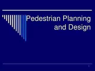
Planning for a Pedestrian-Friendly Neighborhood Using 3D GIS-Based Visualizations. Cana McCoy August 16, 2006. Background & Goals Preliminary Research Methods Results & Conclusions. Background & Goals. Revitalizing Pomeroy Village streetscape planning process

E N D
Planning for a Pedestrian-Friendly Neighborhood Using 3D GIS-Based Visualizations Cana McCoy August 16, 2006
Background & Goals • Preliminary Research • Methods • Results & Conclusions
Background & Goals • Revitalizing Pomeroy Village streetscape planning process • Providing Amherst with reusable 3D GIS data and useful results from public survey and traffic analysis • Evaluating the costs and utility of a particular method for creating 3D visualizations • Aiding the continued integration of GIS into planning
Around 10 scholarly articles, from sources such as Journal of Urban Planning and Development Journal of the American Planning Association Landscape and Urban Planning Computers, Environment and Urban System Transportation Research Record Trade magazine articles and conference proceedings for most recent information GeoWorld Earth Observation Magazine 2005 ESRI User Conference Amherst planning studies from Town and student researchers Preliminary Research
Methods • Pomeroy Village Public Survey • Traffic Measurement & Analysis
Methods • Creation of 3D GIS Data & Visualizations • Resource Accounting • Public Meeting
Exit Questionnaire for Public Meeting • Did you find these visuals helpful? □ Yes □ Somewhat □ No • Did the visuals have: □ Too much detail □ Just the right amount of detail □ Not enough detail • Were you able to identify the locations shown in the computer-generated pictures? □ I could easily identify them □ Eventually, I could identify them all □ There were some where I couldn’t □ Not at all • Did the visuals give you a good sense of how a possible future streetscape might look? □ Yes □ Somewhat, or only for certain aspects □ No • In general, do you find the use of 3-D images like these in a public meeting to be a useful approach? □ Yes □ No • Did you fill out the Pomeroy Village public survey? □ Yes □ No • If yes, did you change your mind on any of the questions posed in the survey after this meeting? □ Yes □ No
Results & Conclusions • Previous reports tells us that the village center has been planned for some time, but implementation is slow. • The public survey yielded both lessons and results. • Traffic analysis indicated that intersection performance will need to be carefully examined as part of any changes.
Results & Conclusions • Creation of 3D scenes was limited by both time, and software/hardware capabilities, but was ultimately successful. • Time and resources required to achieve useful results were reasonable, and products can be reused extensively. • The visualizations were a useful and clear tool which aided the public in understanding and discussing plans.
Thankyou! Town of Amherst • Planning Department • IT Department • Department of Public Works • Design Review Board UMass – LARP and CEE My Committee: Dr. Rick Taupier Niels la Cour Dr. Michael Knodler