Download
1 / 22
270 likes | 487 Views
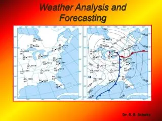
Unit 4 Weather analysis and forecasting. Value of weather forecasting. Short-term: Safety: road travel, air travel, evacuations in severe cases, detection of emergencies Economic: farming Convenience: What to do this weekend? Long-term

E N D
Value of weather forecasting • Short-term: • Safety: road travel, air travel, evacuations in severe cases, detection of emergencies • Economic: farming • Convenience: What to do this weekend? • Long-term • Economic: farmers - what to plant, insulation, water reservoir planning • Where humanitarian aid is needed • Future cost of grain • Burn bans, forest fire potential • Very long term: Climate (average weather)
Why remote sensing for weather? • We do have conventional surface stations • Remote sensing • Greater coverage (not point, also 3-D) • Other parameters, eg turbulence • Coverage over the ocean (few weather ships) • Sensors not in danger
The U.S. Historical Climatology Network (USHCN) is a high-quality, moderate-sized data set of monthly averaged maximum, minimum, and mean temperature and total monthly precipitation. http://cdiac.ornl.gov/by_new/bysubjec.html#climate
Ground based remote sensing systems • Most important: Radar • Used since end of WWII (1940s) • Raindrops, cloud droplets, ice particles, snowflakes • Radar mechanism: transmitter, antenna, receiver, display/recording • Returned signal (energy) provides information on location and type of material in atmosphere and direction of movement (Doppler) • Bremerton region radar http://www.king5.com/weather/radar?iq_id=34015342
Airborne weather-detection systems • Onboard radar for aircraft safety (avoid thunderstorms) • Research (atmospheric profiles) • Hurricane research and routine observations (http://www.aoml.noaa.gov/hrd/aircraft.html) • Dropsonds: vertical profiles of pressure, temperature, humidity, wind (descending instrument is making in-sity measurements)
Weather satellites • Operational: Over the USA, GOES satellites, other satellites over other parts of Earth • GOES (geostationary operational Environmental Satellites) http://www.goes.noaa.gov/ • Geostationary • 4km resolution at best • Great for identifying and tracking hurricanes and our mid-latitude storms
GOES DATA • Detects • Cloud cover • Cloud temperatures (relates to rain probability, cooler corresponds to greater likelihood of rain) • Used to monitor • Storms • Hurricanes • Mid-latitude storms
Data was collected for Erin in September 2001. Dropsondes were used to collect data in an effort to improve predictions of hurricane intensity and to improve tracking forecasts.
Hurricane tracking and forecasting (http://www.jstrack.org/jstrack/index.html)
Hurricane Hunters http://www.hurricanehunters.com/
Also AVHRR • AVHRR (Advanced High Resolution Radiometer) • A NOAA instrument with a higher spatial and spectral resolution than GOES • also used by meteorologists for weather forecasting • Currently, NOAA-14, NOAA-16 and NOAA-17 satellites carrying AVHRRs are in orbit. • 1km resolution (6 bands) • Again … great for hurricanes and other weather systems!
Polar-orbiting satellite tracks of AVHRR satellites (14.1 orbits a day)
AVHRR/3 Band Characteristics Typical Uses • 0.58 - 0.68 (um) Daytime cloud and surface mapping • 0.725 - 1.00 (um) Land-water boundaries • 1.58 - 1.64 (um) Snow and ice detection • 3.55 - 3.93 (um) Night cloud mapping, sea surface temperature • 10.30 - 11.30 (um) Night cloud mapping, sea surface temperature • 11.50 - 12.50 (um) Sea surface temperature Data from these channels are folded into models which along with other data are used to track and forecast hurricane activity
Mid-latitude storms • http://virga.sfsu.edu/crws/specials/sathts_snd_loop_0610-0701/SFSUMapsAWildWestcoastWinter.mp4
Storm Paths • Storms track along the boundary between warm and cold air • Our location?
Important for us on the West Coast • Travel direction for our storm systems? • GOES data combined with many other sources including the Voluntary Observing Ships • Voluntary Observing Ship locations http://www.sailwx.info/shiptrack/shiplocations.phtml • Seems like many but oceans are large • Ships provide details at points, satellites an overview (also different measurables)
In closing • Weather forecasting is important for many purposes – list? • Forecasting relys on data from surface stations, airplanes, satellites • Weather satellites are viewed as very important – crucial to weather forecasting • GOES and AVHRR are two sources for the web of information that is used by weather forecasters