Download
1 / 40
400 likes | 543 Views
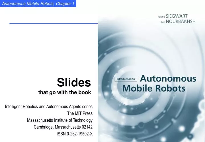
Slides that go with the book. Intelligent Robotics and Autonomous Agents series The MIT Press Massachusetts Institute of Technology Cambridge, Massachusetts 02142 ISBN 0-262-19502-X. 1. Autonomous Mobile Robots. The three key questions in Mobile Robotics Where am I ? Where am I going ?

E N D
Slidesthat go with the book Intelligent Robotics and Autonomous Agents series The MIT Press Massachusetts Institute of Technology Cambridge, Massachusetts 02142 ISBN 0-262-19502-X
1 Autonomous Mobile Robots • The three key questions in Mobile Robotics • Where am I ? • Where am I going ? • How do I get there ? • To answer these questions the robot has to • have a model of the environment (given or autonomously built) • perceive and analyze the environment • find its position within the environment • plan and execute the movement • This course will deal with Locomotion and Navigation (Perception, Localization, Planning and motion generation)
1 Content of the Course • Introduction • Locomotion • Mobile Robot Kinematics • Perception • Mobile Robot Localization • Planning and Navigation • Other Aspects of Autonomous Mobile Systems • Applications
1 General Control Scheme for Mobile Robot Systems Knowledge, Mission Data Base Commands Cognition Localization "Position" Path Planning Map Building Global Map Environment Model Path Local Map Information Path Extraction Execution Perception Motion Control Raw data Actuator Commands Sensing Acting Real World Environment
1 Applications of Mobile Robots Indoor Outdoor Structured EnvironmentsUnstructured Environments
1 Automatic Guided Vehicles • Newest generation of Automatic Guided Vehicle of VOLVO used to transport motor blocks from on assembly station to an other. It is guided by an electrical wire installed in the floor but it is also able to leave the wire to avoid obstacles. There are over 4000 AGV only at VOLVO’s plants.
1 Helpmate • HELPMATE is a mobile robot used in hospitals for transportation tasks. It has various on board sensors for autonomous navigation in the corridors. The main sensor for localization is a camera looking to the ceiling. It can detect the lamps on the ceiling as reference (landmark). http://www.ntplx.net/~helpmate/
1 BR700 Cleaning Robot • BR 700 cleaning robot developed and sold by Kärcher Inc., Germany. Its navigation system is based on a very sophisticated sonar system and a gyro. http://www.kaercher.de
1 ROV Tiburon Underwater Robot • Picture of robot ROV Tiburon for underwater archaeology (teleoperated)- used by MBARI for deep-sea research, this UAV provides autonomous hovering capabilities for the human operator.
1 The Pioneer • Picture of Pioneer, the teleoperated robot that is supposed to explore the Sarcophagus at Chernobyl
1 The Khepera Robot • KHEPERA is a small mobile robot for research and education. It sizes only about 60 mm in diameter. Additional modules with cameras, grippers and much more are available. More then 700 units have already been sold (end of 1998). http://diwww.epfl.ch/lami/robots/K-family/ K-Team.html
1 Forester Robot • Pulstech developed the first ‘industrial like’ walking robot. It is designed moving wood out of the forest. The leg coordination is automated, but navigation is still done by the human operator on the robot.http://www.plustech.fi/
1 Robots for Tube Inspection • HÄCHER robots for sewage tube inspection and reparation. These systems are still fully teleoperated. http://www.haechler.ch • EPFL / SEDIREP: Ventilation inspection robot
1 Sojourner, First Robot on Mars • The mobile robot Sojourner was used during the Pathfinder mission to explore the mars in summer 1997. It was nearly fully teleoperated from earth. However, some on board sensors allowed for obstacle detection.http://ranier.oact.hq.nasa.gov/telerobotics_page/telerobotics.shtm
1 NOMAD, Carnegie Mellon / NASAhttp://img.arc.nasa.gov/Nomad/
1 The Honda Walking Robot http://www.honda.co.jp/tech/other/robot.html Image of Honda Robot
1 General Control Scheme for Mobile Robot Systems Knowledge, Mission Data Base Commands Cognition Localization "Position" Path Planning Map Building Global Map Environment Model Path Local Map Information Path Extraction Execution Perception Motion Control Raw data Actuator Commands Sensing Acting Real World Environment
1 "Position" Localization Cognition Global Map Environment Model Path Local Map RealWorld Perception Motion Control Environment Control Architectures / Strategies • Control Loop • dynamically changing • no compact model available • many sources of uncertainty • Two Approaches • Classical AI • complete modeling • function based • horizontal decomposition • New AI, AL • sparse or no modeling • behavior based • vertical decomposition • bottom up
1 Two Approaches • Classical AI(model based navigation) • complete modeling • function based • horizontal decomposition • New AI, AL(behavior based navigation) • sparse or no modeling • behavior based • vertical decomposition • bottom up • Possible Solution • Combine Approaches
1 Localization Cognition Position Position Local Map Local Map Position Feedback Perception to Action Obstacle Avoidance Path Environment Model Local Map Real WorldEnvironment Motion Control Perception Mixed Approach Depicted into the General Control Scheme
1 Environment Representation and Modeling:The Key for Autonomous Navigation • Environment Representation • Continuos Metric -> x,y,q • Discrete Metric -> metric grid • Discrete Topological -> topological grid • Environment Modeling • Raw sensor data, e.g. laser range data, grayscale images • large volume of data, low distinctiveness • makes use of all acquired information • Low level features, e.g. line other geometric features • medium volume of data, average distinctiveness • filters out the useful information, still ambiguities • High level features, e.g. doors, a car, the Eiffel tower • low volume of data, high distinctiveness • filters out the useful information, few/no ambiguities, not enough information
1 Environment Representation and Modeling: How we do it! • Odometry • not applicable • Modified Environments • expensive, inflexible • Feature-based Navigation • still a challenge for artificial systems Corridor crossing Elevator door Entrance How to find a treasure Courtesy K. Arras Landing at night Eiffel Tower
1 Environment Representation: The Map Categories • Topological Maps • Recognizable Locations Courtesy K. Arras • Metric Topological Maps • Fully Metric Maps (continuos or discrete)
1 Environment Models: Continuous <-> Discrete ; Raw data <-> Features • Continuos • position in x,y,q • Discrete • metric grid • topological grid • Raw Data • as perceived by sensor • A feature(or natural landmark) is an environmental structure which is static, always perceptible with the current sensor system and locally unique. Examples • geometric elements (lines, walls, column ..) • a railway station • a river • the Eiffel Tower • a human being • fixed stars • skyscraper
1 Human Navigation: Topological with imprecise metric information Courtesy K. Arras
1 Methods for Navigation: Approaches with Limitations • Incrementally (dead reckoning) Odometric or initial sensors (gyro) • not applicable • Modifying the environments (artificial landmarks / beacons) Inductive or optical tracks (AGV) Reflectors or bar codes • expensive, inflexible Courtesy K. Arras
1 Methods for Localization: The Quantitative Metric Approach 1. A priori Map: Graph, metric 2. Feature Extraction (e.g. line segments) 3. Matching: Find correspondence of features 4. Position Estimation: e.g. Kalman filter, Markov • representation of uncertainties • optimal weighting acc. to a priori statistics Courtesy K. Arras
1 Gaining Information through motion: (Multi-hypotheses tracking) Believe state Courtesy S. Thrun, W. Burgard
1 Grid-Based Metric Approach • Grid Map of the Smithsonian’s National Museum of American History in Washington DC. (Courtesy of Wolfram Burger et al.) Grid: ~ 400 x 320 = 128’000 points Courtesy S. Thrun, W. Burgard
1 Methods for Localization: The Quantitative Topological Approach 1. A priori Map: Graph locally unique points edges 2. Method for determining the local uniqueness e.g. striking changes on raw data level or highly distinctive features 3. Library of driving behaviors e.g. wall or midline following, blind step, enter door, application specific behaviors Example: Video-based navigation with natural landmarks Courtesy of [Lanser et al. 1996]
1 Map Building: How to Establish a Map 1.By Hand 2. Automatically: Map Building The robot learns its environment Motivation: - by hand: hard and costly - dynamically changing environment - different look due to different perception 3.Basic Requirements of a Map: • a way to incorporate newly sensedinformation into the existing world model • information and procedures for estimating the robot’s position • information to do path planning and other navigation task (e.g. obstacle avoidance) • Measure of Quality of a map • topological correctness • metrical correctness • But: Most environments are a mixture of predictable and unpredictable features hybrid approach model-based vs. behaviour-based predictability Courtesy K. Arras
1 Map Building: The Problems 1.Map Maintaining: Keeping track of changes in the environment e.g. disappearing cupboard - e.g. measure of belief of each environment feature 2.Representation and Reduction of Uncertainty position of robot -> position of wall position of wall -> position of robot • probability densities for feature positions • additional exploration strategies Courtesy K. Arras
1 Map Building: Exploration and Graph Construction 1.Exploration - provides correct topology - must recognize already visited location - backtracking for unexplored openings 2.Graph Construction Where to put the nodes? • Topology-based: at distinctive locations • Metric-based: where features disappear or get visible Courtesy K. Arras
1 Knowledge, Mission Data Base Commands Cognition Localization "Position" Path Planning Map Building Global Map Environment Model Path Local Map Information Path Extraction Execution Perception Motion Control Raw data Actuator Commands Sensing Acting Real World Environment Control of Mobile Robots • Most functions for save navigation are ’local’ not involving localization nor cognition • Localization and global path planningèslowerupdate rate, only when needed • This approach is pretty similar to what human beings do. global local
1 Tour-Guide Robot (Nourbakhsh, CMU)
1 Autonomous Indoor Navigation (Thrun, CMU)
1 Tour-Guide Robot (EPFL @ expo.02)
1 Autonomous Indoor Navigation (Pygmalion EPFL) • very robust on-the-fly localization • one of the first systems with probabilistic sensor fusion • 47 steps,78 meter length, realistic office environment, • conducted 16 times > 1km overall distance • partially difficult surfaces (laser), partially few vertical edges (vision)
1 Autonomous Robot for Planetary Exploration (ASL – EPFL)
1 Humanoid Robots (Sony)