Download
1 / 10
100 likes | 268 Views
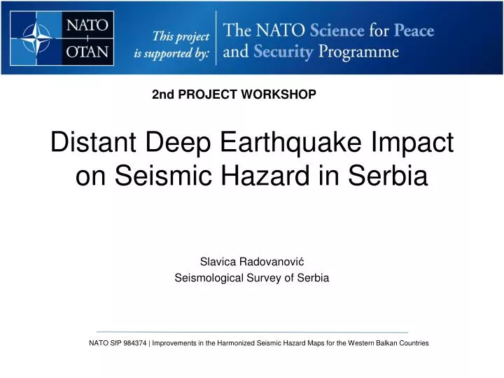
NATO SfP 984374 | Improvements in the Harmonized Seismic Hazard Maps for the Western Balkan Countries. Distant Deep Earthquake Impact on Seismic Hazard in Serbia. 2nd PROJECT WORKSHOP. Slavica Radovanovi ć Seismological Surve y of Serbia.

E N D
NATO SfP 984374 | Improvements in the Harmonized Seismic Hazard Maps for the Western Balkan Countries Distant Deep Earthquake Impact on Seismic Hazard in Serbia 2nd PROJECT WORKSHOP Slavica Radovanović Seismological Survey of Serbia
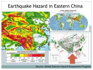
Seismic waves generated from the Vrancea seismoactive zone are of great interest not only for Romania, but also for the neighboring countries due to their social and economical impact on these territories. Since 1900, the maximal seismic intensity registered so far is degree X on the MSK scale in 1940, while the area that experienced the degree VI and VII (severe ground motion and building damage) includes Romania, the Republic of Moldova, a large part of Bulgaria and south-western Ukraine and east part of Serbia. The strong intermediate-depth earthquakes1940, Mw=7.7; 1977, Mw=7.4; 1986, Mw=7.1; 1990, May 30, Mw=6.9; 1990, May 31, Mw=6.4; and 2004, Mw=6.0. are largely felt in Serbia and caused extensive damage in east parts of the country. NATO SfP 984374 | Improvements in the Harmonized Seismic Hazard Maps for the Western Balkan Countries Vrancea earthquakes
NATO SfP 984374 | Improvements in the Harmonized Seismic Hazard Maps for the Western Balkan Countries DATA The data were obtained from the catalogue of macroseismic data. The “Macro-catalogue of Serbia” for the period 306–2006 (6818 pages with 30,480 earthquakes) was compiled by different scientists in different time intervals; in 1940, the author was Jelenko Mihajlović. As demonstrated by the analysis performed during the compilation of the Balkan catalogue (Shebalin et al., 1972), Mihajlović modified the used macroseismic scale over time, i.e., he inconsistently applied the Rossi–Forel and then the Mercalli scales. Therefore damage field reports for Serbian territory given in the Macro catalogue until 1950, including the 1940 Vrancea event, have been reinterpreted using the MSK and European Macroseismic scales After 1964, the MSK scale is used in Serbia.
NATO SfP 984374 | Improvements in the Harmonized Seismic Hazard Maps for the Western Balkan Countries Sample page from the Macro-catalogue of Serbia for the 1940 Vrancea earthquake.
NATO SfP 984374 | Improvements in the Harmonized Seismic Hazard Maps for the Western Balkan Countries DATA Earthquake 1940, Mw=7.7
NATO SfP 984374 | Improvements in the Harmonized Seismic Hazard Maps for the Western Balkan Countries Local soil map based on EC-8
NATO SfP 984374 | Improvements in the Harmonized Seismic Hazard Maps for the Western Balkan Countries Hazard map TNRC=475y Soil modification
NATO SfP 984374 | Improvements in the Harmonized Seismic Hazard Maps for the Western Balkan Countries 1977th Vrancea eq- Nis time history of acceleration
NATO SfP 984374 | Improvements in the Harmonized Seismic Hazard Maps for the Western Balkan Countries CONCLUSION The effect of intermediate-depth Vrancea earthquakes on all buildings and structures, which have a long oscillation period and are located on soft and unconsolidated soil, is evident in the spatial distribution of the macroseismic effects of the 1940 Vrancea earthquake. The question remains whether the probabilistic approach, which is to be adopted, is able to account for the significant effect of distant earthquakes (such as the ones in Vrancea) in the area of East and Central Serbia.