1 / 44

Mapping as a way to…. find out facts about an area bring new issues to the table

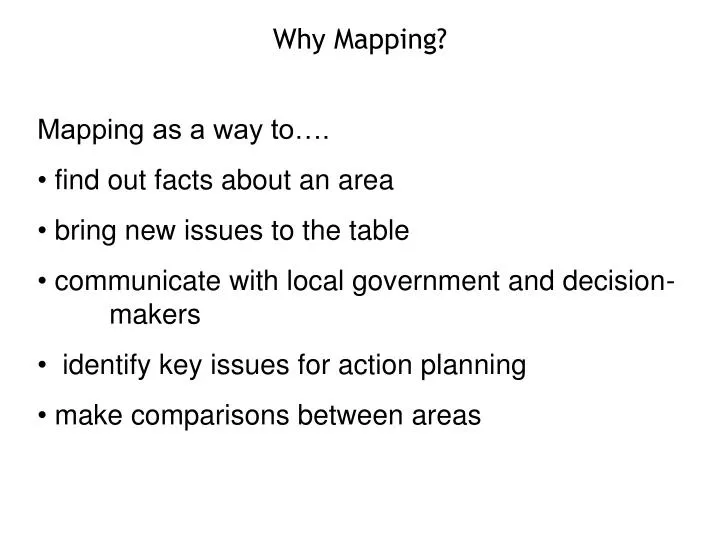
Why Mapping?. Mapping as a way to…. find out facts about an area bring new issues to the table communicate with local government and decision- makers identify key issues for action planning make comparisons between areas. Aerial Photographs. http://maps.google.co.uk.

zaina
Download Presentation

Mapping as a way to…. find out facts about an area bring new issues to the table

An Image/Link below is provided (as is) to download presentation Download Policy: Content on the Website is provided to you AS IS for your information and personal use and may not be sold / licensed / shared on other websites without getting consent from its author. Content is provided to you AS IS for your information and personal use only. Download presentation by click this link. While downloading, if for some reason you are not able to download a presentation, the publisher may have deleted the file from their server. During download, if you can't get a presentation, the file might be deleted by the publisher.

E N D

Presentation Transcript


  1. Why Mapping? • Mapping as a way to…. • find out facts about an area • bring new issues to the table • communicate with local government and decision- makers • identify key issues for action planning • make comparisons between areas

  2. Aerial Photographs http://maps.google.co.uk

  3. Street Maps http://maps.google.co.uk

  4. www.multimap.com

  5. Pollution Info

  6. http://environment-agency.gov.uk/maps

  7. Arla Foods, Inc. Palmers Green X Whittington Hospital, Archway

  8. Air Pollution http://www.londonair.org.uk/

  9. Noise Pollution http://www.londonnoisemap.com/

  10. Transportation Info http://www.transportdirect.info

  11. Social and Economic Information www.londonprofiler.org

  12. http://www.upmystreet.com/

  13. Local Sustainability Info www.londongreenmap.org

  14. http://www.areaprofiles.audit-commission.gov.uk

More Related