Download
1 / 28
280 likes | 446 Views
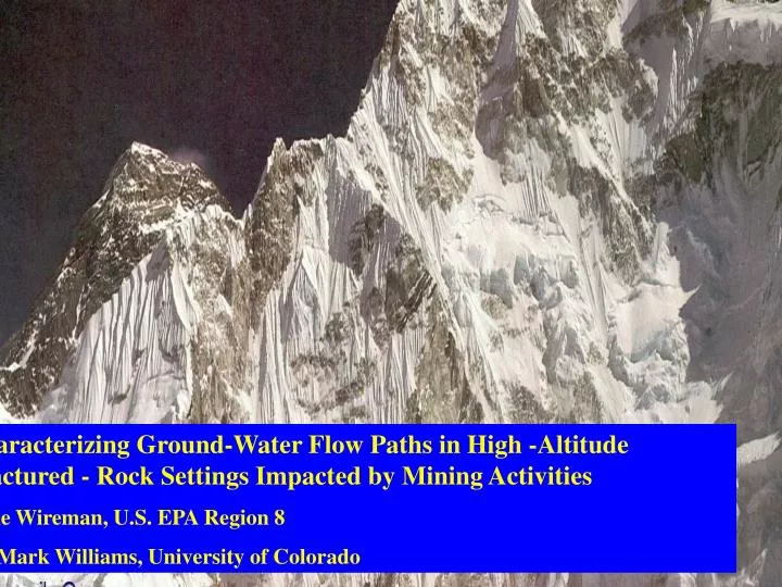
Mine Design, Operations & Closure Conference -2004. Characterizing Ground-Water Flow Paths in High -Altitude Fractured - Rock Settings Impacted by Mining Activities Mike Wireman, U.S. EPA Region 8 Dr. Mark Williams, University of Colorado. Mary Murphy Gold Mine Applied Research Site

E N D
Mine Design, Operations & Closure Conference -2004 Characterizing Ground-Water Flow Paths in High -Altitude Fractured - Rock Settings Impacted by Mining Activities Mike Wireman, U.S. EPA Region 8 Dr. Mark Williams, University of Colorado
Mary Murphy Gold Mine Applied Research Site Research Objectives: * To Develop Tools for Characterization of Site Hydrology and Geochemistry * To Better Understand Role of Ground Water Transport of Metals to Chalk Creek. Remedial Objectives: * To Determine Metals Loading Sources and Pathways * To Reduce Metal Loadings to Chalk Creek Partners: * USGS, USFS, University of Colorado & CDMG
Mary Murphy Gold Mine—Applied Research Site • Mining History • Placer Mined in 1860’s-1870: Vein Deposits Located • 1883-1893: Period of Greatest Mining Activity • Mary Murphy Mine: 1870—1951 • * 75% Gold, Silver, Lead, Zinc, Copper • * 5 Main Veins • * 14 Main Levels • * 2200 Vertical Feet • * Golf Adit—Drain / Haul Adit • * Connected to Iron Chest Mine • Remedial Work: • * 1991—3 Piles Consolidated 69,000 cu. yds., • Golf Tunnel Unplugged, Lined Settling Pond • * 1992—Golf Adit Water Rerouted • * 1998—1400 Level Opened / Stabilized • * 1999—700 Level Partially Opened • * 2003—Lady Murphy Adit Opened
Mary Murphy Mine Site Environmental Characterization History > Flow Measurements > Steam Tracing 14 Times –1990—2003 > GW Tracing > Metal Loading > Geochemical 5 Times- 1990—1994 Modeling > Sediment Sampling > Hydrometrics / Sept. ’93 & June ’99 Isotopic Research > Water Chemistry > Surficial 17 Times- 1990—2003 Geophysical Work > Toxicity Testing / Fish Data 11 Times- 1991—2003
Focus Of This Talk > Metals Loading > Stream & Ground-Water Tracing > Hydrometrics / Isotopic Results
Geology and Mine Features Mary Murphy Mine & Vicinity
Elements of Conceptual Model • Strong GW / SW Interaction • > Gaining Streams • > Strong Upward Gradient in Valley Bottom • Fracture Dominated Flow Paths • Multiple GW Flow Systems • Many Seeps / Springs • Significant Seasonal Variation in Flow and Water Quality • ( GW & SW) • Several Water Types • Chemistry of GW & SW is Strongly Impacted by Geology and • Mineralogy of Ore Body, and Mine Features.
Mary Murphy Gold Mine—Chafee County, CO DISSOLVED ZINC CONCENTRATIONS Location Date Conc. (ug/l) Chalk Creek CC-9 9/90 < 100 CC-9 7/00 118 CC-9 7/02 24 CC-9 5/03 Upstream of Pomeroy 35.2 CC-7D 9/90 110 CC-7D 7/02 44 CC-7D 5/03 Upstream of Golf 53.2 CC-7 9/90 18,000 CC-7 7/00 27,710 CC-7 7/02 24,300 CC-7 Golf Adit 3,620 CC-6 9/90 420 CC-6 2/02 417 CC-6 5/03 Upstream of Iron Chest 534 CC-0 9/90 < 100 CC-0 7/02 At Arkansas 08
Mary Murphy Gold Mine—Chafee County, CO DISSOLVED ZINC CONCENTRATIONS Location Date Conc. (ug/l) GW Wells MM-15 9/93 45 MM-15 Bedrock 7/02 08 MM-11 9/93 188 MM-11 7/00 210 MM-11 7/02 179 MM-11 Allurial 5/03 560 MM-3 9/93 17,131 MM-3 7/00 15,830 MM-3 2/02 21,500 MM-3 Bedrock 5/03 5,570 MM-6 9/93 2605 MM-6 7/02 13,700 MM-6 Allurial 122,000
Scope of Ground-Water Tracing Mary Murphy Mine—Applied Research Site
Results of Ground Water Tracing Mary Murphy Mine
Variation of Discharge Components Versus Time in 1400 Level. Mary Murphy Gold Mine
Delta O-18 in Selected Tributary Inflows, 1400 Level Mary Murphy Gold Mine
Pre-event Water and Event Water in Total Discharge From 1400 Portal Mary Murphy Gold Mine
HELIUM DATAMary Murphy Mine site • ESTIMATED AGES OF GROUND WATER • Using tritium data from different date • t = 12.43/ln2 . ln ( 1 + [3Het] / [3Ht] ) Clark & Fritz p188 • BEDROCK WELLS • MM 3 - 2-4 YRS • MM 18 - 2-3 YRS • MM 15 - ABOUT 8 YEARS OLD • ALLUVIAL WELLS • MM11 - 3-4 YRS • Source – A. Manning -USGS