Download
1 / 23
230 likes | 330 Views
San Diego’s Regional Planning Agency. Smart Growth Concept Map Application. Presented at the San Diego Regional GIS Council meeting on October 12, 2011. Topics. Introduction of the Smart Growth Concept Map Update of Smart Growth Concept Map Old Process vs. New Process

E N D
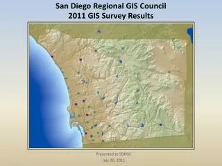
San Diego’s Regional Planning Agency Smart Growth Concept Map Application Presented at the San Diego Regional GIS Council meeting on October 12, 2011
Topics • Introduction of the Smart Growth Concept Map • Update of Smart Growth Concept Map • Old Process vs. New Process • Smart Growth Map Review Applications • Internet and Intranet Apps • Conclusion and Summary
Smart Growth Concept Map • Shows areas that compete for Smart Growth Funding • Needs to be updated based on input from local jurisdictions and data from the SR12 Forecast and the 2050 RTP.
Old Review Process • SANDAG prints out hardcopies of maps • SANDAG sends maps to local jurisdictions • Local jurisdictions review and markup maps to identify changes • Local jurisdictions send maps back to SANDAG • SANDAG updates their GIS database based on feedback
New Review Process • SANDAG develops and publishes Web-based map • SANDAG sends link and login instructions for Web-based map to local jurisdictions • Local jurisdictions review Web-based map and electronically submit comments to identify changes to the map • SANDAG reviews comments as they come in from local jurisdictions • SANDAG updates the GIS database based on feedback
Smart Growth Concept Map Application Purpose • Review and Comment Smart Growth Opportunity Areas • Location • Boundaries • Type
Smart Growth Concept Map Application • Internet App • Security Features • Open by invitation to a select group of planners from 19 local jurisdictions
Smart Growth Concept Map Application Layers • Smart Growth Opportunity Areas • Symbology based on area type • Basemap • Freeways and Major Roads • Transit Facilities • Land-use by parcel
Smart Growth Concept Map Application Features • Identify Smart Growth Opportunity Areas • Site code • Place type • Jobs/Dwellings per Acre • Minimum Jobs/DU’s per Acre • Identify Parcels • Land-use codes • Forecasted dwelling units
Smart Growth Concept Map Review: Request Change in Place Type
Smart Growth Concept Map Review: Request Change in Place Type
Smart Growth Concept Map Review: Request Change in Place Type
Smart Growth Concept Map Review: Split Smart Growth Site Area
Smart Growth Concept Map Review: Split Smart Growth Site Area
Technologies used for Smart Growth Concept Map Application • Client-Side • ArcGIS API for JavaScript Version 2.3 • Server-Side • ArcGIS Server 10.0 • Microsoft ASP.NET 3.5 • Database • Microsoft SQL Server 2008 • ArcSDE 9.3
Results • Received over 50 comments through the application • Some comments came in from other means • Shapefiles • Graphics • Comment period was one month • Revised Smart Growth Map ready a month later
Conclusions • Better record keeping • All comments are stored in a central database • Easier for Collaboration with Jurisdictions • No need for printing a map for every jurisdiction • Accessible through the Web • Easier for SANDAG Review • Comments are immediately viewable in ArcMap • SANDAG Planners could easily use Intranet app • Update process not complete • Review entire process to determine lessons learned
More Info • www.sandag.org • GIS Staff • Steve Hossack – shos@sandag.org • Rachael Rider – rri@sandag.org • Project Manager • Carolina Gregor – cgr@sandag.org