Download
1 / 77
850 likes | 1.41k Views
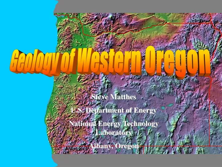
Geology of Western Oregon. Steve Matthes U.S. Department of Energy National Energy Technology Laboratory Albany, Oregon. 1. Introduction to Oregon Geology. Cartoon by Sidney Harris. Oregon’s Geographic Regions Correspond to Oregon’s Geology. USGS Geological Map of Oregon

E N D
Geology of Western Oregon Steve Matthes U.S. Department of Energy National Energy Technology Laboratory Albany, Oregon
Oregon’s Geographic Regions Correspond to Oregon’s Geology USGS Geological Map of Oregon Various colors represent surface rock of varying types and ages.
Metasequoia – Oregon’s State Fossil Thunderegg – Oregon’s State Rock Sun Stone – Oregon’s State Gemstone
Oregon’s Oldest Surface Rocks (more than 50MYA) Paleozoic sedimentary rock (frequently metamorphosed) (300MYA) Old Cenozoic marine basalt and andesite (50 MYA) Mezozoic granitic rocks (150 MYA) Permian and Triassic sedimentary and volcanic rocks (250 – 200 MYA) Mezozoic sedimentary and volcanic rocks Eocene and Oligocene marine sediments (50MYA) Mezozoic sedimentary and volcanic rocks Permian and Triassic sedimentary and volcanic rocks (250 – 200 MYA) Mezozoic granitic rocks (150 MYA)
Paleozoic sedimentary rock (frequently metamorphosed) (300MYA) Eocene Oligocene Pennsylvanian Triassic Mississippian Permian and Triassic sedimentary and volcanic rocks (250 – 200 MYA) Eocene Mezozoic sedimentary and volcanic rocks Eocene and Oligocene marine sediments (50MYA) Mezozoic sedimentary and volcanic rocks Permian and Triassic sedimentary and volcanic rocks (250 – 200 MYA) Cretaceous Jurassic Jurassic
Most surface rocks in Oregon are younger than 25 million years Oldest Oregon Rocks 360 MYA rocks from the Mississippian epoch of the Paleozoic era.
High Cascades andesite and basalt (less than 10 MYA) Columbia River Basalts (20 MYA) Oregon’s Youngest Surface Rocks (less than 50MYA) Miocene marine sediment (5 MYA) Recent basalt and andesite (less than 1 MYA) Recent alluvial deposits including deposits from Missoula Floods (15,000 YA or younger) Western Cascades andesite and basalt (25 MYA) Older Cenozoic non-marine sedimentary rock- ash-flow tuffs, banded rhyolite (20-5 MYA) Recent alluvial lake deposits and pumice (1 MYA or younger) Younger Cenozoic ( less than 5 MYA)
Miocene marine sediment (5 MYA) Recent alluvial deposits including deposits from Missoula Floods (15,000 YA or younger) Older Cenozoic non-marine sedimentary rock- ash-flow tuffs, banded rhyolite (20-5 MYA) Recent alluvial lake deposits and pumice (1 MYA or younger) Younger Cenozoic ( less than 5 MYA)
High Cascades andesite and basalt (less than 10 MYA) Columbia River Basalts (20 MYA) Miocene marine sediment (5 MYA) Paleozoic sedimentary rock (frequently metamorphosed) (300MYA) Old Cenozoic marine basalt and andesite (50 MYA) Recent basalt and andesite (less than 1 MYA) Mezozoic granitic rocks (150 MYA) Recent alluvial deposits including deposits from Missoula Floods (15,000 YA or younger) Permian and Triassic sedimentary and volcanic rocks (250 – 200 MYA) Western Cascades andesite and basalt (25 MYA) Mezozoic sedimentary and volcanic rocks Eocene and Oligocene marine sediments (50MYA) Older Cenozoic non-marine sedimentary rock- ash-flow tuffs, banded rhyolite (20-5 MYA) Mezozoic sedimentary and volcanic rocks Recent alluvial lake deposits and pumice (1 MYA or younger) Permian and Triassic sedimentary and volcanic rocks (250 – 200 MYA) Mezozoic granitic rocks (150 MYA) Younger Cenozoic ( less than 5 MYA)
Corvallis, Oregon Siletz River volcanics – Ancient undersea volcanoes uplifted by collision of tectonic plates Corvallis Fault
How do geologists know what the earth’s geologic history looks like? • Wells from oil and gas exploration- rocks from drill core (geologic column) • Water wells • Type of rock (igneous, sedimentary) • Fossils • Chemical composition of rocks • Dating Methods (radioactive decay, dendrochronology, ice cores, varves, coral clocks) • Plate tectonics
Tertiary Ft. Union Fm ............……….........100 feet Cretaceous Greenhorn Fm ............….........4910 feet Cretaceous Mowry Fm..............…..…...... 5370 feet Cretaceous Inyan Kara Fm........….............5790 feet Jurassic Rierdon Fm..................……........6690 feet Triassic Spearfish Fm................……........7325 feet Permian Opeche Fm...................……........7740 feet Pennsylvanian Amsden Fm........................7990 feet Pennsylvanian Tyler Fm.............…...........8245 feet Mississippian Otter Fm..............……........8440 feet Mississippian Kibbey Lm..............…........8780 feet Mississippian Charles Fm.............….........8945 feet Mississippian Mission Canyon Fm............9775 feet Mississippian Lodgepole Fm....................10255 feet Devonian Bakken Fm....................….......11085 feet Devonian Birdbear Fm..................….......11340 feet Devonian Duperow Fm.................…........11422 feet Devonian Souris River Fm.............….......11832 feet Devonian Dawson Bay Fm........................12089 feet Devonian Prairie Fm.....................……....12180 feet Devonian Winnipegosis Grp.....................12310 feet Silurian Interlake Fm..................……......12539 feet Ordovician Stonewall Fm...........…..........13250 feet Ordovician Red River Dolomite...............13630 feet Ordovician Winnipeg Grp..............….......14210 feet Ordovician Black Island Fm...........….......14355 feet Cambrian Deadwood Fm..........................14445 feet Precambrian..............................………....14945 feet Complete Geologic Column in North Dakota- discovered by an oil exploration well drilled 15,000 feet deep!
Parent Daughter Half-life Uranium-235 Lead-207 0.704 billion years Uranium-238 Lead-206 4.47 Potassium-40 Argon-40 1.25 Rubidium-87 Strontium-87 48.8 Samarium- 147 Neodymium 143 106 Thorium-232 Lead-208 14.0 Rhenium- 187 Osmium- 187 43.0 Lutetium- 176 Hafnium- 176 35.9 Radioactive Dating Only 0.01% of the potassium in a rock is K-40!
Periodic Table of the Elements Select an element ( ) = Internet link Potassium 40 (K) has 19 protons and 21 neutrons. It is radioactive and decays to Argon 40 (Ar) which has 18 protons and 22 neutrons.
Potassium Argon (K-Ar) Dating • 1250 Million year half-life (works well for mica, amphibole, K-feldspar, volcanic rocks older than 30 million years) • Works best in granitic rocks where the various mineral crystals are large enough for processing. • Based on assumption that Ar will not be present in the crystal structure when the rock forms (good assumption- Ar is Very rare in the crust)
Plate Tectonics The earth’s crust consists of a patchwork of solid plates “floating” on the mantle. These plates are constantly in motion, colliding and rearranging. The drawings at left show how the plates have moved over the last 225 million years.
Age of Ocean Crust Old crust New crust
Quiz 1. 250 million years ago , the continents were all connected together in a “super” continent called______________. 1. Answer: Pangea
New Crust forms here Plates may Slide by each other. Transform Plates may Separate. Divergent Plates may Collide with each other. Convergent {e.g. San Andreas Fault) (e.g. Juan de Fuca ridge)
Oceanic plate New crust is created at the ocean ridge. The seafloor spreading pushes the ocean plate into the continental plate Volcanoes form near the collision between two plates
Subduction uplift uplift Upwelling This is where volcanoes form
What causes the two plates to collide? Ocean Ridge Magma Seafloor Spreading When hot rock gets close to the surface of the ocean crust it may liquefy because of reduced pressure. The liquefied rock solidifies on exposure to the seawater. Solidified rock expands forcing the oceanic crust apart at the ridge. The process repeats resulting in seafloor spreading.
Plates are constantly in motion in relation to each other. Average plate speed is 5 cm per year. Southern California coast is on the Pacific Plate and is moving to the NW.
Quiz 5. 100 million years from now, parts of California will be an island off of _______________. 5. Answer: Alaska
200 million years ago (ya) Wallowas Pacific Ocean Blue Subduction zone Continental shelf Old continent Klamath
100 million ya (Tropical) Subduction zone Volcanoes caused by collision of Pacific Plate with North American Plate
Quiz 2. The ____________ zone is where the oceanic plate is forced under the continental plate. 2. Answer: Subduction
50 million ya (Tropical) Undersea volcanoes erupt – formation of Siletz River Volcanics (54 million ya)
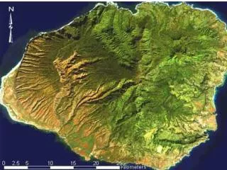
Pillow lava on Mauna Loa, Hawaii Pillow lava at Axial Seamount “Pillow Basalt” forms when lava is cooled quickly underwater. “Pillow basalt” is evidence that an area once was underwater. “Pillow Basalt” on Mary’s Peak 2000 feet above sea level!