Download
1 / 2
20 likes | 63 Views
From monitoring to surveying job sites, drones prove to be indispensable for the success of construction projects. Here, you will know the benefits of drone mapping for the sector.

E N D
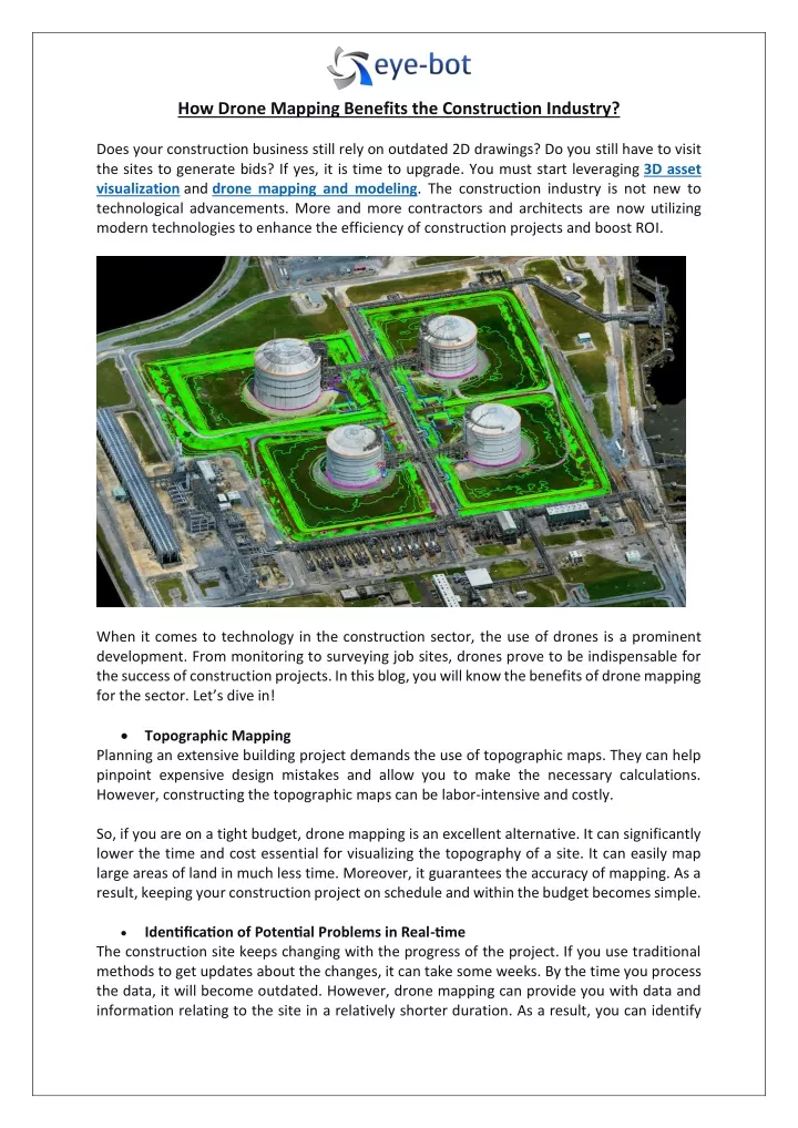
How Drone Mapping Benefits the Construction Industry? Does your construction business still rely on outdated 2D drawings? Do you still have to visit the sites to generate bids? If yes, it is time to upgrade. You must start leveraging 3D asset visualization and drone mapping and modeling. The construction industry is not new to technological advancements. More and more contractors and architects are now utilizing modern technologies to enhance the efficiency of construction projects and boost ROI. When it comes to technology in the construction sector, the use of drones is a prominent development. From monitoring to surveying job sites, drones prove to be indispensable for the success of construction projects. In this blog, you will know the benefits of drone mapping for the sector. Let’s dive in! Topographic Mapping Planning an extensive building project demands the use of topographic maps. They can help pinpoint expensive design mistakes and allow you to make the necessary calculations. However, constructing the topographic maps can be labor-intensive and costly. So, if you are on a tight budget, drone mapping is an excellent alternative. It can significantly lower the time and cost essential for visualizing the topography of a site. It can easily map large areas of land in much less time. Moreover, it guarantees the accuracy of mapping. As a result, keeping your construction project on schedule and within the budget becomes simple. Identification of Potential Problems in Real-time The construction site keeps changing with the progress of the project. If you use traditional methods to get updates about the changes, it can take some weeks. By the time you process the data, it will become outdated. However, drone mapping can provide you with data and information relating to the site in a relatively shorter duration. As a result, you can identify
potential hazards or problems and make well-informed decisions. It proves to be beneficial both for the project and the team. Improves Bids The bidding competition for construction projects is always stiff. When placing a bid, you would never want to underestimate or overshoot. However, determining the right bid can be challenging. That is where aerial solutions like drone mapping comes to help. The drone can capture detailed and high-resolution images of the site. By generating 3D model maps, the drones can help you make precise analysis and calculations. All these can enable the contractors to refine their quotations and submit proposals on time. It can provide you with an edge in the bidding process and increase the chances of convincing the investors. Promotes On-Site Safety Mapping the site manually would require the workers to work on hazardous areas and unstable surfaces. As a result, it can risk the lives of people and may lead to several injuries. Drone mapping can create a safe environment and help complete tasks at speed. With drones, the safety of construction sites (https://www.safetyandhealthmagazine.com/articles/23628-construction-safety-drones- save-lives) Conclusion: The demand for drone mapping is on the rise owing to the convenience it offers. The drones like Elios 2 Confined Space can enable you to capture every corner of the confined assets. So, are you looking for professional drone mapping services? If yes, Eye-bot can be your perfect partner. From architectural laser scanning to 3D laser scanning services, they offer everything in one place. can increase by 55%.
