Download
1 / 64
850 likes | 1.77k Views
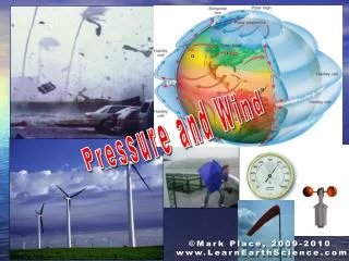
Air Pressure and Wind. Chapter 6. Pressure. Hear this term often in weather forecasts but what does it mean in the atmosphere? From earlier, it’s the weight of the air above How about weather? High pressure? Usually nice weather Low pressure? Associated with stormy weather. Wind.

E N D
Air Pressure and Wind Chapter 6
Pressure • Hear this term often in weather forecasts but what does it mean in the atmosphere? • From earlier, it’s the weight of the air above • How about weather? • High pressure? • Usually nice weather • Low pressure? • Associated with stormy weather
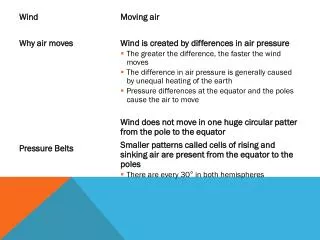
Wind • Another weather element we deal with on a regular basis • Anyone know why the wind blows? • Turns out that wind and pressure are related • In fact, wind blows due to horizontal differences in pressure • If there is high pressure over one part of the country and low pressure over another part: • The atmosphere is out of balance and the wind blows in an attempt to restore balance
Air Pressure and Wind • A couple of chapters ago we talked about temperature • Before that, pressure and density • In the atmosphere, these variables are all related such that a change in one will cause changes in the others • Ex. If temperature changes, there will be a corresponding change in pressure and/or density
Air Pressure and Wind • The “Ideal Gas Law” or “Equation of State” illustrates this: • Pressure is approximately equal to density x a constant x temperature • We can ignore the constant and just go with…..
Air Pressure and Wind • If the pressure doesn’t change: • An increase in T results in a decrease in density • Warm air is less dense and therefore rises • A decrease in T results in an increase in density • Cold air is dense and sinks • Just like we’ve been saying all along
Air Pressure and Wind • If the temperature doesn’t change: • An increase in pressure results in an increase in density • A decrease in pressure results in a decrease in density • At the same temperature, air at a higher pressure is more dense than air at a lower pressure
Atmospheric Pressure • How does all of this stuff relate to the atmosphere? • We’ve said from the beginning that pressure is basically the weight the air above us. • Like at the right • Pressure at the surface is due to the weight of all air molecules in the colum
Atmospheric Pressure • Simplified model • Assumes air can’t leave the column • Columns of air have the same # of molecules and are at the same temperature • The pressure at the surface is the same • What would happen if the temperatures of the air changed? • Cool #1, Warm #2
Atmospheric Pressure • City 1, temp decreased so density increased • City 2, temp increased causing density to decrease • Just like the gas law said • Pressure stayed the same • Bottom line: It takes a shorter column of cold air to exert the same amount of pressure as a taller column of warm air
Atmospheric Pressure • Now let’s go up to a certain height in the atmosphere • At this level, in which column is the pressure greatest? • So, relatively speaking, the pressure is high at this level in column 1 and low in column 2 L H
Atmospheric Pressure • Points: • Pressure changes more rapidly w/ height in cold air masses • Warm air aloft is associated w/ high pressure aloft • Cold air aloft is associated w/ low pressure aloft • Differences in temperature cause differences in pressure L H
Atmospheric Pressure • Finally, notice that the heights of pressure surfaces (500 mb in this example) are lower in the cold air column 500 mb 500 mb
Atmospheric Pressure • The difference in pressure establishes a force we call the “pressure gradient force” (directed from H to L) • Now, if we remove the side barriers of the columns, air will rush from high to low pressure in order to equalize things …. • WIND!!
Atmospheric Pressure • Pressures at the surface will also change due to molecules moving • Pressure will rise at City 1 and fall at City 2 • To make a long story short: • Differences in temp from place to place can cause differences in pressure resulting in the movement of air.
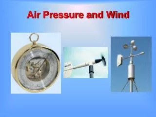
Measuring Air Pressure • Even though pressure is exerted on us at all times, it’s hard to detect small changes • Can you tell difference between high and low? • We can detect big changes in pressure though • Like popping of ears in the mountains or in planes • Air pressure equalizing inside/outside ears
Measuring Air Pressure • Mercury Barometer • Just a large, hollow glass tube immersed in mercury • As air pressure changes, mercury is forced up or down the tube…pretty simple right • On average, the height of the mercury would be 29.92 inches (avg. sea level pressure) • Or 1013.25 millibars
Measuring Air Pressure • Aneroid Barometer • Has a hollow metal “cell” which expands or contracts as pressure changes • Same type as in the 3-dial weather instruments people hang on walls
Altimeters • Just an aneroid barometer • Calibrated to equate pressure to height • Must be corrected constantly by pilots!
Altimeters • Or this might happen w/ poor visibility
Atmospheric Pressure • Seen something like this on TV right? • Lines are called “isobars” • These are lines of equal pressure (in millibars) • Question: • If elevation varies across the US (and it does), and we know pressure changes quickly w/ height, then why are these types of maps nice and neat? • Shouldn’t they be really screwy looking?
Atmospheric Pressure • This kind of map depicts “sea-level pressure”, not surface pressure • We wouldn’t always be able to tell where high and low pressure systems were otherwise • How do we figure out what sea-level pressure is at each location where measurements are taken?
Sea-level Pressure • To get a sea-level pressure chart: • 1) Measure surface pressure • 2) Correct for instrument error • Temperature, gravity, materials of barometer, etc. • 3) Correct for altitude • 4) Draw isobars (usually at 4 mb increments) • Connect the dots essentially • 1) and 2) are easy. What about 3) and 4)?
Altitude Correction • Near the earth’s surface, pressure changes at 10mb per 100m • So, if a station is 300m altitude, 30mb needs to be added to the surface pressure to get sea-level pressure • Once the altitude correction is done everywhere, we can draw the isobars
Isobars 995 999 1005 1010 998 1002 1007 1011 1014 1006 1010 1015 1009 1013 1020 996 1000 1004 1008 1012 1016
Surface Chart • End result is a “sea-level pressure chart” or “surface chart” • “Closed” highs and lows show where centers of pressure systems are
Pressure and Wind • Northern Hemisphere: surface winds blow clockwise and outward from high pressure (anticyclones) • counter clockwise and inward around low pressure systems (cyclones) • Note: • Winds cross isobars slightly • Tightly packed - stronger winds • Reversed flow in Southern Hemisphere
Isobaric Map (Upper Air Chart) • Shows the height of a pressure surface - constant pressure chart • In meters (60m intervals) • This one is 500mb • From Monday - pressure surfaces are higher up in warm air • So, the 500mb heights are higher toward the south
Isobaric Map (Upper Air Chart) • Where heights are low - cold air • High heights - warm air • Elongated areas of low heights/pressure are called troughs • cold air • Elongated areas of high heights/pressure are called ridges • warm air
Isobaric Map (Upper Air Chart) • Other uses?? • Wind - shows us direction and speed • Like surface map except winds tend to blow parallel to height lines • Closer lines - stronger wind speeds • Steering - upper level winds determine where surface systems go and whether or not they strengthen (more later)
Surface and Upper Air Charts • Both surface and upper air charts are extremely valuable to meteorologists • Surface charts identify where pressure systems are located and their intensities • Upper air charts indicate where these systems will move and how they will strengthen/weaken in time
Wind • Now with all this background, we can determine why the wind blows • More specifically, what the direction and speed will be • Anything that moves does so due to the forces acting upon it • Throwing a ball - pushing away by the hand, friction from the air, gravity, etc. • Same thing for the wind
Wind • Actually 4 forces acting to influence wind speed and direction • 1) Pressure gradient force • 2) Coriolis force • 3) Friction • 4) Centripetal force
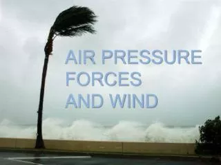
Pressure Gradient Force • Due to the difference in pressure over a distance • Greater pressure gradients lead to a greater PGF • like at the right • Hurricanes are a good example • Very low pressures at the center • Pressure increases rapidly as you move away from the center • Strong PGF
Pressure Gradient Force • ALWAYS directed from high to low pressure • Direction is at right angles to the isobars • This does not mean that wind blows directly from high to low though…….other forces…..
Pressure Gradient Force • Wait just a second. Since pressure changes much faster w/height than horizontally, isn’t the PGF incredibly strong in the vertical? • I’ve already said that vertical air motions are very small (usually) compared to horizontal winds…..what’s up with that?
Pressure Gradient Force • Gravity almost exactly balances the upward directed PGF - “Hydrostatic balance”
Coriolis Force (Effect) • Tricky subject • An “apparent” force due to the rotation and curvature of the earth • Causes wind to deflect to the right in the Northern Hemisphere • Left in SH • Force is at a right angle to the wind • Things drain differently in SH??? Umm..no
Coriolis Force • Maximum at poles, zero at the equator • Faster speeds - stronger Coriolis force • It’s why aircraft fly in “circular” paths
Coriolis Force • Summary: • Causes objects to deflect to the right of a straight path in the NH (left in SH) • Amount of deflection depends on • 1) Rotation of the earth • 2) Latitude • 3) Speed of object (wind, airplane, etc.)
PGF - Coriolis Balance • Above the friction layer near the surface, the PGF and CF roughly balance each other • That’s why air aloft flows parallel to isobars • Wind which flows at a constant speed parallel to evenly spaced isobars is called • Geostrophic Wind
Geostrophic Wind • Always low pressure to the left and high pressure to the right (Northern Hemisphere) • Speed depends on the “packing” or “tightness” of isobars • loosely packed = weak wind : tightly packed = strong wind
Geostrophic Wind • Only a theoretical wind but still, a good approximation of winds above the surface • Why only theoretical? • Isobars are rarely evenly spaced OR straight
Gradient Wind • In this case, the wind is called a gradient wind • Basically the same as geostrophic wind except that it blows parallel to curved isobars • Note: both geostrophic and gradient winds refer to air flow well above the surface
Wind Review • 4 forces (talked about 2 so far) • 1) Pressure gradient force • Directed from High to Low pressure • Stronger PGF = stronger wind • 2) Coriolis force • Deflects wind to right in NH • Faster wind = stronger CF • Zero at equator, max at poles • These two forces are roughly in balance above the surface • Causes upper level winds to generally flow west to east in mid-latitudes (parallel to isobars or height contours)
Friction • Friction affects air flow near the surface (lowest 1 km or so) • Slows down the wind (drag) • If wind slows, what happens to the Coriolis Force?? • Weaker • So, the PGF is now greater than the CF and flow is across isobars • ~ 30º angle