Download
1 / 40
400 likes | 771 Views
GLBET GIS/DSS CORE GROUP. Status Report - Accomplishments & Next Steps. CHARGE & APPROACH: GLBET GIS/DDS CORE GROUP DRAFTED CHARGE AND APPROACH * APPROVED BY GLBET EXECUTIVE COMMITEE. CHARGE TO THE CORE GROUP. Shall examine the role that geospatial data, technologies, and analysis

E N D
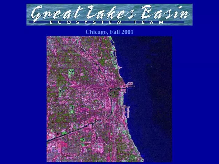
GLBET GIS/DSS CORE GROUP Status Report - Accomplishments & Next Steps
CHARGE & APPROACH: GLBET GIS/DDS CORE GROUP DRAFTED CHARGE AND APPROACH * APPROVED BY GLBET EXECUTIVE COMMITEE
CHARGE TO THE CORE GROUP Shall examine the role that geospatial data, technologies, and analysis play in the implementation of an ecosystem approach to management in the Great Lakes Basin
APPROACH • Develop a Strategic Plan
APPROACH • Develop a Strategic Plan • Conduct a Pilot Project to identify obstacles and opportunities
APPROACH • Develop a Strategic Plan • Conduct a Pilot Project to identify obstacles and opportunities • Develop Recommendations for the implementation of geospatial technologies to support Great Lakes Basin resource management issues
APPROACH • Develop a Strategic Plan • Conduct a Pilot Project to identify obstacles and opportunities • Develop Recommendations for the implementation of geospatial technologies to support Great Lakes Basin resource management issues • Report out regularly to the Executive Committee and Team
PROCESS IMPLEMENTED • GIS Capabilities Subgroup, and GIS Needs Subgroup formed to inventory and determine existing geospatial capabilities and needs of the Programs, Field Stations, and the Team • Initiated a Pilot Project to identify obstacles and opportunities • Developed Strategic Plan and Draft Recommendations for the implementation of geospatial technologies to support Great Lakes Basin resource management issues
PROCESS IMPLEMENTED • GIS Capabilities Subgroup, and GIS Needs Subgroup formed to inventory and determine existing geospatial capabilities and needs of the Programs, Field Stations, and the Team • Initiated a Pilot Project to identify obstacles and opportunities • Developed Strategic Plan and Draft Recommendations for the implementation of geospatial technologies to support Great Lakes Basin resource management issues
PROCESS IMPLEMENTED • GIS Capabilities Subgroup, and GIS Needs Subgroup formed to inventory and determine existing geospatial capabilities and needs of the Programs, Field Stations, and the Team • Initiated a Pilot Project to identify obstacles and opportunities • Developed Draft Strategic Plan and Preliminary Recommendations for the implementation of geospatial technologies to support Great Lakes Basin resource management issues
ACCOMPLISHMENTS • Determined existing geospatial capabilities of Programs and Field Stations, reported in Strategic Plan • Initiated a Pilot Project to identify obstacles and opportunities – GLBET GIS Decision Support System Lake Michigan Islands Demonstration • Developed Draft Recommendations for the implementation of geospatial technologies to support Great Lakes Basin resource management issues
ACCOMPLISHMENTS • Determined existing geospatial capabilities of Programs and Field Stations, reported in Strategic Plan • Initiated a Pilot Project to identify obstacles and opportunities – GLBET GIS Decision Support System Lake Michigan Islands Demonstration • Developed Draft Recommendations for the implementation of geospatial technologies to support Great Lakes Basin resource management issues
ACCOMPLISHMENTS • Determined existing geospatial capabilities of Programs and Field Stations, reported in Strategic Plan • Initiated a Pilot Project to identify obstacles and opportunities – GLBET GIS Decision Support System Lake Michigan Islands Demonstration • Developed Draft Recommendations for the implementation of geospatial technologies to support Great Lakes Basin resource management issues
Funding Support: GLBET TEAM KITTY • $7.5 K Awarded GIS/DSS Core Group • $4K for Michigan State University – Center for Remote Sensing • $3.5 K for USGS Upper Midwest Science Center
Funding Support: GLBET TEAM KITTY • $7.5 K Awarded GIS/DSS Core Group • $4K for Michigan State University – Center for Remote Sensing: Data mining, metadata, and formatting data for DSS • $3.5 K for USGS Upper Midwest Science Center
Funding Support: GLBET TEAM KITTY • $7.5 K Awarded GIS/DSS Core Group • $4K for Michigan State University: • $3.5 K for USGS Upper Midwest Science Center: Setting up and framing DSS Demo modules, some staff time, and travel support
Funding Support: REGION 5 FLEX FUNDS • $30K Awarded GLBET GIS/DSS Core Group to support Team GIS/DSS Initiative • Expand DSS Lake Michigan Basin Wide • GIS Specialist staff time and travel • Data mining, building metadata, data acquisition, data formatting/preparation • Training and implementation of DSS use – Jump Start to Great Lakes GIS/DSS
Funding Support: REGION 5 FLEX FUNDS • $30K Awarded GLBET GIS/DSS Core Group to support Team GIS/DSS Initiative • Expand Lake Michigan DSS Demo Basin Wide • GIS Specialist staff time and travel • Data mining, building metadata, data acquisition, data formatting/preparation • Training and implementation of DSS use – Jump Start to Great Lakes GIS/DSS
Funding Support: REGION 5 FLEX FUNDS • $30K Awarded GLBET GIS/DSS Core Group to support Team GIS/DSS Initiative • Expand Lake Michigan DSS Demo Basin Wide • GIS Specialist staff time and travel • Data mining, building metadata, data acquisition, data formatting/preparation • Training and implementation of DSS use – Jump Start to Great Lakes GIS/DSS
Funding Support: REGION 5 FLEX FUNDS • $30K Awarded GLBET GIS/DSS Core Group to support Team GIS/DSS Initiative • Expand Lake Michigan DSS Demo Basin Wide • GIS Specialist staff time and travel • Data mining, building metadata, data acquisition, data formatting/preparation • Training and implementation of DSS use – Jump Start to Great Lakes GIS/DSS
Funding Support: REGION 5 FLEX FUNDS • $30K Awarded GLBET GIS/DSS Core Group to support Team GIS/DSS Initiative • Expand Lake Michigan DSS Demo Basin Wide • GIS Specialist staff time and travel • Data mining, building metadata, data acquisition, data formatting/preparation • Training and implementation of DSS use – Jump Start to Great Lakes GIS/DSS
Funding Support: REGION 3 FLEX FUNDS – Partnership Match • $30K Awarded GLBET GIS/DSS Core Group to support Team GIS/DSS Initiative • $30K Match by the Great Lakes Commission • $2K for facilitating drafting the GLBET Great Lakes Islands Strategy Document • $10K to GLC for GLBET Intranet Clearinghouse Working Web Site; GIS data acquisition and work; binational partnership coordination and outreach to support Team GIS/DSS and priority conservation efforts • $4K to USGS Great Lakes Science Center for additional data mining, building metadata, data acquisition, data formatting/preparation • $14K to USGS Upper Midwest Science Center for DSS Product, including hardware and software; completed and formatted data layers; scripting query and other DSS capabilities, updating and altering per Team input and needs; training and implementation of GLBET GIS/DSS
Funding Support: REGION 3 FLEX FUNDS – Partnership Match • $30K Awarded GLBET GIS/DSS Core Group to support Team GIS/DSS Initiative • $30K Match by the Great Lakes Commission • $2K for facilitating drafting the GLBET Great Lakes Islands Strategy Document • $10K to GLC for GLBET Intranet Clearinghouse Working Web Site; GIS data acquisition and work; binational partnership coordination and outreach to support Team GIS/DSS and priority conservation efforts • $4K to USGS Great Lakes Science Center for additional data mining, building metadata, data acquisition, data formatting/preparation • $14K to USGS Upper Midwest Science Center for DSS Product, including hardware and software; completed and formatted data layers; scripting query and other DSS capabilities, updating and altering per Team input and needs; training and implementation of GLBET GIS/DSS
Funding Support: REGION 3 FLEX FUNDS – Partnership Match • $30K Awarded GLBET GIS/DSS Core Group to support Team GIS/DSS Initiative • $30K Match by the Great Lakes Commission • $2K for facilitating drafting the GLBET Great Lakes Islands Strategy Document • $10K to GLC for GLBET Intranet Clearinghouse Working Web Site; GIS data acquisition and work; binational partnership coordination and outreach to support Team GIS/DSS and priority conservation efforts • $4K to USGS Great Lakes Science Center for additional data mining, building metadata, data acquisition, data formatting/preparation • $14K to USGS Upper Midwest Science Center for DSS Product, including hardware and software; completed and formatted data layers; scripting query and other DSS capabilities, updating and altering per Team input and needs; training and implementation of GLBET GIS/DSS
Funding Support: REGION 3 FLEX FUNDS – Partnership Match • $30K Awarded GLBET GIS/DSS Core Group to support Team GIS/DSS Initiative • $30K Match by the Great Lakes Commission • $2K for facilitating drafting the GLBET Great Lakes Islands Strategy Document • $10K to GLC for GLBET Intranet Clearinghouse Working Web Site; GIS data acquisition and work; binational partnership coordination and outreach to support Team GIS/DSS and priority conservation efforts • $4K to USGS Great Lakes Science Center for additional data mining, building metadata, data acquisition, data formatting/preparation • $14K to USGS Upper Midwest Science Center for DSS Product, including hardware and software; completed and formatted data layers; scripting query and other DSS capabilities, updating and altering per Team input and needs; training and implementation of GLBET GIS/DSS
Funding Support: REGION 3 FLEX FUNDS – Partnership Match • $30K Awarded GLBET GIS/DSS Core Group to support Team GIS/DSS Initiative • $30K Match by the Great Lakes Commission • $2K for facilitating drafting the GLBET Great Lakes Islands Strategy Document • $10K to GLC for GLBET Intranet Clearinghouse Working Web Site; GIS data acquisition and work; binational partnership coordination and outreach to support Team GIS/DSS and priority conservation efforts • $4K to USGS Great Lakes Science Center for additional data mining, building metadata, data acquisition, data formatting/preparation • $14K to USGS Upper Midwest Science Center for DSS Product, including hardware and software; completed and formatted data layers; scripting query and other DSS capabilities, updating and altering per Team input and needs; training and implementation of GLBET GIS/DSS
Funding Support: REGION 3 FLEX FUNDS – Partnership Match • $30K Awarded GLBET GIS/DSS Core Group to support Team GIS/DSS Initiative • $30K Match by the Great Lakes Commission • $2K for facilitating drafting the GLBET Great Lakes Islands Strategy Document • $10K to GLC for GLBET Intranet Clearinghouse Working Web Site; GIS data acquisition and work; binational partnership coordination and outreach to support Team GIS/DSS and priority conservation efforts • $4K to USGS Great Lakes Science Center for additional data mining, building metadata, data acquisition, data formatting/preparation • $14K to USGS Upper Midwest Science Center for DSS Product, including hardware and software; completed and formatted data layers; scripting query and other DSS capabilities, updating and altering per Team input and needs; training and implementation of GLBET GIS/DSS
GLBET GIS/DSS CORE GROUP SUCCESSES • Drafted Team GIS/DSS Implementation Strategy Plan • Completed excellent preliminary recommendations for making GLBET GIS a reality • Have built the working framework for GLBET GIS/DSS • GLBET intranet clearinghouse/working site
GLBET GIS/DSS CORE GROUP SUCCESSES • Completed survey and analyses of Team, Island Committee, Great Lakes Refuge Island, Regional, and Field Station GIS capabilities and needs • Team support through Team Kitty, and Regional Flex Funding Proposals – three great successes • GLBET intranet clearinghouse/working site
GLBET GIS/DSS CORE GROUP SUCCESSES • Team support through Team Kitty, and Regional Flex Funding Proposals – three great successes • Survived loss of Core Group participants – pregnancies, transfers, and two reassignments (one good, one … not so good) • Have already built partnership interest and support – MWNRDG, USGS, Great Lakes Planning Meeting, GLC, GLPF . . .
GLBET GIS/DSS CORE GROUP SUCCESSES USGS Great Lake Science Center Mapping Sensitive Habitats on Great Lakes Islands with Multispectral Satelite Imagery $48.5 K - Eastern Region Partnership Integrated Science Funds
GLBET GIS/DSS CORE NEXT STEPS • Demonstrate DSS and work with GLBET Islands Committee, get their feedback • Continue to fine tune and revise DSS, expand basin wide • Plug GLBET GIS/DSS at next weeks MWNRDG Meeting • Participate in TNC Great Lakes Islands Workshop in November, and our Island Workshop this winter/spring
GLBET GIS/DSS CORE NEXT STEPS • Plan and facilitate GIS/DSS training for Team, Program, and Field staff: LGLFRO, GLSC, UMWSC, GLNPO, R.O.’s • Based on feedback; revise and complete Strategic Report and Recommendations • Inform, and engage Program Project Leaders, and Regional Directorships: presentations planned • Constant, repetitive informing of status; and requests for input, feedback, and support from Team, Executive Committee, and other Team Committees • Complete Core Group’s Charge prior to next GLBET Meeting
IN CLOSING A famous general once said that there are three things essential for victory.
Audacity . . . . . . AUDACITY… AUDACITY!
General Bo (Don’t call me George) Patton Schembechler