Download
1 / 20
200 likes | 437 Views
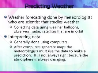
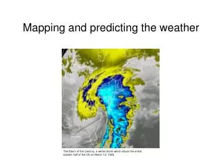
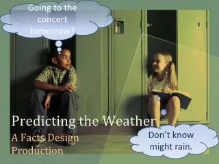
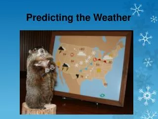
PREDICTING WEATHER (Meteorology). All Weather Takes Place In The Atmosphere: Look There. The atmosphere is a bubble of gas that surrounds our planet. It is made up mostly of Nitrogen (78%) then Oxygen (21%). To learn more about our atmosphere….

E N D
All Weather Takes Place In The Atmosphere: Look There The atmosphere is a bubble of gas that surrounds our planet. It is made up mostly of Nitrogen (78%) then Oxygen (21%) To learn more about our atmosphere…. http://www.windows.ucar.edu/tour/link=/earth/Atmosphere/overview.html
Examine The Temperature Temperature Temperature is probably the most important element of the weather since it controls or influences other elements, Temperature is the measure of heat in the air in a given place. The earth is heated from the sun's energy. This heat not only affects how hot or cold the air is, but is a major factor in the water cycle and in the formation of winds. Thermometers measure temperature Try This: http://eo.ucar.edu/webweather/basic1.html
Examine The Humidity Humidity is moisture in the air. The rate of evaporation goes down as the humidity in the air increases - there is not enough room in the air to take more water vapor through the process of evaporation. Hygrometers measure Humidity
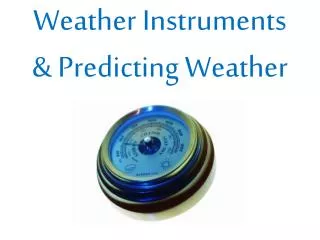
Examine The Barometric Pressure The weight of the air pressing down on the Earth causes air pressure. Earth's gravity, of course, causes the downward force that we know as "weight." The “weight” or amount of Barometric Pressure changes each day. Low pressure is associated with bad weather because less pressure causes the air to rise. The rising air cools and rains down condensing water!!! Barometers measure Barometric Pressure
Examine The Wind Wind is caused by the sun and convection (the movement of heat). The sun heats some of the air in our atmosphere and, as always, hot air rises. When the hot air “mass” rises, air rushes in to take its place. The moving air is called WIND Air always moves from high pressure area to low pressure areas L LOWPRESSURE L H HIGH PRESSURE
Examine The Wind Wind is measured in two ways: SPEEDand DIRECTION Weather Vanes Measure Wind Direction Anemometers Measure Wind Speed
Look for Fronts Fronts are: The boundary between air masses (air clumps). Whenever a mass (clump) of warm, moist air meets up with a mass (clump) of cool dry air, a front is formed. THERE ARE THREE MAJOR KINDS OF FRONTS: FRONT SYMBOLS
Examine the Clouds: Cloud Types
Prefixes and Suffixes Used to Describe Clouds:Clouds are defined by both the way they look and how high they are in the atmosphere. NAMED FOR HEIGHT Cirro (meaning "wisp of hair") =high-altitude clouds (above 20,000 feet). Alto (meaning "high") = mid-altitude clouds (between 6,000 and 20,000 feet). ????There is no prefix for low-altitude clouds. When clouds are by the ground we call them fog. Clouds
Clouds NAMED FOR THE WAY THEY LOOK Nimbus (meaning "rain") or nimbus means the cloud can produce precipitation Cumulo (meaning "heap") refers to piled-up clouds. Strato (meaning "layer") refers to flat, wide, layered clouds.
CUMULONIMBUSSTORM CLOUD storm clouds: Clouds that precede or produce stormy weather such as cumulus and cumulonimbus clouds. Cumulus clouds precede storms. Cumulonimbus clouds, or thunderstorms, produce stormy weather. EX #1 EX #2 EX #3
LOW-???? CLOUDS Nimbostratus clouds: (storm-flat) are uniform grayish clouds that often cover the entire sky. They resemble fog that does not reach the ground. they may drizzle. Cumulonimbus: (puffy-storm) produce severe storms Stratus- Low and flat Cumulus- Low and puffy
MID-ALTO CLOUDS Altocumulus clouds are middle level clouds that are made of water droplets and appear as gray, puffy masses, sometimes rolled out in parallel waves or bands. The appearance of these clouds on a warm, humid summer morning often means thunderstorms may occur by late afternoon. Altostratus clouds are gray or blue-gray middle level clouds composed of ice crystals and water droplets. These clouds usually cover the entire sky. In the thinner areas of the cloud, the sun may be dimly visible as a round disk. Altostratus clouds often form ahead of storms that will produce continuous precipitation
HIGH-CIRRUS CLOUDS The most common form of high-level clouds are thin and often wispy cirrus clouds. Typically found at heights greater than 20,000 feet (6,000 meters), cirrus clouds are composed of ice crystals that originate from the freezing of supercooled water droplets. Cirrus generally occur in fair weather and point in the direction of air movement at their elevation. Cirrus clouds are a third general type of cloud. The word cirrus comes from the Latin word for a tuft or curl of hair. Cirrus clouds are very wispy and feathery looking. They form only at high altitudes, about 7 km above the earth's surface. Cirrus clouds are composed of ice crystals and are so thin that sunlight can pass right through them. EX: CIRRUS / CIRRUS STRATUS
VERTICAL CLOUDS Cumulus: These clouds form in high piles or heaps and fall into two types Fair Weather Cumulus Cumulonimbus (Storm)
TECHNOLOGY There are many other tools used to study weather! Weather Buoy Weather Plane
TECHNOLOGY Weather Satellite and Satellite Photo Weather Balloon
TECHNOLOGY Radar Image Weather Map