Download
1 / 37
380 likes | 835 Views
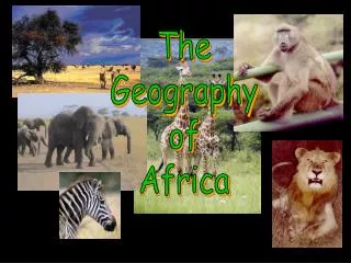
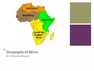
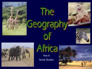
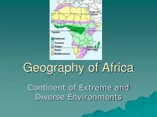
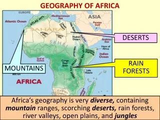
Geography of Africa. #3 Deserts Tree Map. Kalahari Desert. Covers parts of Botswana, South Africa and Namibia The inhabitants are nomadic bushmen who still hunt in the region Sometimes gets seasonal rains .

E N D
Kalahari Desert • Covers parts of Botswana, South Africa and Namibia • The inhabitants are nomadic bushmen who still hunt in the region • Sometimes gets seasonal rains
The desert's name is derived from the Tswana word Kgalagadi, meaning "the great thirst."
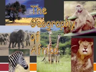
Animals of the Kalahari • Antelope such as eland, gemsbok, springbok, hartebeast, steenbok, kudu, and duiker are common, as are giraffe & warthog
Sahara Desert • Largest tropical desert in the world, about the size of the US • Has many mountains as well as sand and rocky areas • Covers most of North Africa from Atlantic Ocean to the Red Sea
Animals • Camels, horned viper, spotted hyena
Facts • the Drakensberg range is a major tourist destination in South Africa • White settlers clashed with local native inhabitants during the 1800’s • Drakensberg mountain range, originally referred to as the "Dragon Mountains" by early settlers.
Facts continued • The mountains are located in South Africa • mountains are home to the world's second-highest waterfall, the Tugela Falls (Thukela Falls), with a total drop of 947 metres. That’s over 9 football fields long!
warthog They call me Mr. Pig
Atlas Mountains • The Atlas mountains contain many fertile valleys, • Many millions of people live in the Atlas Mountains, almost all of them counting themselves as Berbers, • The Atlas are rich in natural resources. There are deposits of iron ore, lead ore, copper,
Location • The Atlas mountains are in Northern Africa and run through Morocco, Tunisia and Algeria
animals • Mountain Reedbuck, • Serval cat, and • Jackal.
Serval cat • jackal
Ethiopian highlands • Home to 80 percent of Africa's tallest mountains • The region, which slopes away from either side of the Great Rift Valley, is composed of a series of mountains and valleys; • It covers 2/3 of Ethiopia • Ras Dashen (15,158 ft/4,620 m), Ethiopia’s highest peak, is there.
Lake Victoria • the second largest freshwater body in the world. • Named for Queen Victoria • Source of the White Nile River
Location • The following countries border the lake • Uganda,Tanzania & Kenya
Lake Tanganyika facts • ON the Western Great Rift Valley, • It is the second largest of African lakes • It is the deepest lake in Africa • Location-Burundi, Democratic Republic of the Congo (DRC), Tanzania and Zambia,
Find Each Of these rivers and label them on your map • Nile River- Blue Nile & White Nile • Zambezi River • Congo River • Niger River
Following the rivers • Make a 4 column chart • Write the name of the rivers in the first column • Put the countries each river flows through in Column 2 • Put the body of water each empties into in column 3 • Put facts about each river in column 4
Rivers (The Nile) • The Nile River is over 4200 miles long • It has two tributaries- The Blue Nile (Which begins in the Ethiopian highlands) and the White Nile (starts in Lake Victoria) • They join together near the city of Khartoum • It is considered an “exotic” river because much of it runs through desert
Zambezi River • The Zambezi River is over 1600 miles long • It empties into the Indian ocean • It is renown for its many rapids • Victoria Falls is on the Zambezi River
Congo River • Also called the Zaire River • It is 2700 miles long • Much of it travels along the equator in the rainforest before it empties into the Atlantic • Much of it can not be traveled on by boat because of rapids
Niger River • The River is 2600 miles long • It empties into the Atlantic Ocean in West Africa • The river is important to farmers who live in very dry regions of West Africa