Download
1 / 16
170 likes | 605 Views
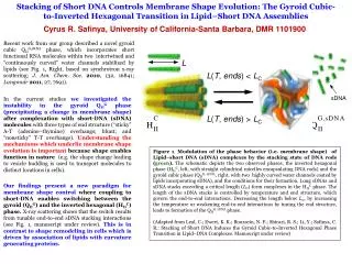
Hydrologic Modeling for the Santa Barbara Channel – Long Term Ecological Research Project. February 17, 2002 R. Ed Beighley Marine Science Institute University of California, Santa Barbara. http://sbc.lternet.edu/. SBC-LTER Objective….

E N D
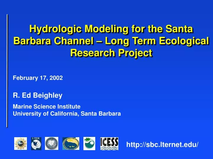
Hydrologic Modeling for the Santa Barbara Channel – Long Term Ecological Research Project February 17, 2002 R. Ed Beighley Marine Science Institute University of California, Santa Barbara http://sbc.lternet.edu/
SBC-LTER Objective… • The primary research objective of the SBC LTER is to investigate the relative importance of land vs. ocean processes in structuring giant kelp forest ecosystems for different conditions of land use and climate.
Gaviota Arroyo Hondo Arroyo Burro Mission Refugio El Capitan Santa Monica Franklin Carpinteria Rincon SBC – LTER Study Region... Santa Barbara Channel
Hydrologic Modeling… • Compile/Develop Spatial Data • Topography (DEM) • Drainage Network (Stream and Drains) • Land Use (Digital Images and Parcels) • Soils (SSURGO) • Estimate Rainfall Coverages • Rain Gauge Network • Orographic Enhancement • Setup HEC-HMS Model • Sub-divide watersheds • Determine spatially averaged parameters
Spatial Data... Mission Creek Watershed at Montecito St. SBC-LTER ID: MC00
Spatial Data... Santa Barbara City Parcel Boundaries and Zoning Information Low Density Residential “IMPERVIOUS AREA” Medium Density Residential
Gaviota Arroyo Hondo Arroyo Burro Mission Refugio El Capitan Santa Monica Franklin Carpinteria Rincon SBC – LTER Rain Gauge Network...
Gauge EL 1000 m Gauge EL 30 m Orographic Enhancement… Water Year 2001
Orographic Enhancement… • Precipitation distributed to each pixel, Pi, by: where a, b and c are storm specific regression coefficients; Ei and Ai are elevation and aspect, respectively; ei is the regression residual at gauge k; wi is the inverse-distance-squared weight for gauge k; and m is the number of gauges used in the weighting procedure (Taschner et al, 2001).
Hydrologic Model… • HEC-HMS Model • Spatially averaged parameters • Event based • Surface Response • Impervious surfaces • Infiltration excess • Subsurface Response • Rapid shallow soil flow (interflow) • Slower groundwater discharge (baseflow) • Flow Routing • Overland • Channel
HEC-HMS Model... Junctions: Flow Connections • Sub-Basin Properties: • Drainage Area • Flow Length • Roughness • Slope • Channel Properties: • Cross-Sect. Shape • Length • Roughness • Slope SBC-LTER Sample Site, MC00, Mission Cr. @ Montecito St. Outlet HEC-HMS Model Schematic
Surface Response… • Impervious Surfaces • All rainfall runoffs off • Infiltration Excess • No runoff until initial losses satisfied: • Interception, ground cover, etc. • Initial soil moisture deficit (ex., 30%) • Maximum soil storage (ex., 35 cm) • When above satisfied, runoff occurs when: • rainfall rate > infiltration rate
Subsurface Response… • Exponential recession model • where Qt is the recession flow starting at time T; QT is the threshold flow; k is an exponential decay constant • QT is a flow specified as a ratio-to-peak surface flow (ex., 20%) • Rate of recession, k, changes depending upon subsurface source: interflow or deep groundwater
Subsurface Response… Threshold Flow, QT
Flow Routing… • Kinematic-Wave Model • Overland and channel flow • Based on momentum and continuity • Assumptions: • 1-dimensional flow • No acceleration effects • No backwater effects • Overland plane is a shallow wide rectangular channel • and m are functions of channel geometry, slope and roughness
HEC-HMS Model Results... Mission Creek at Mission St. USGS Gauge No. 11119745 March 4-7, 2001 HEC-HMS Simulation USGS Gauge Data