Download
1 / 14
140 likes | 252 Views
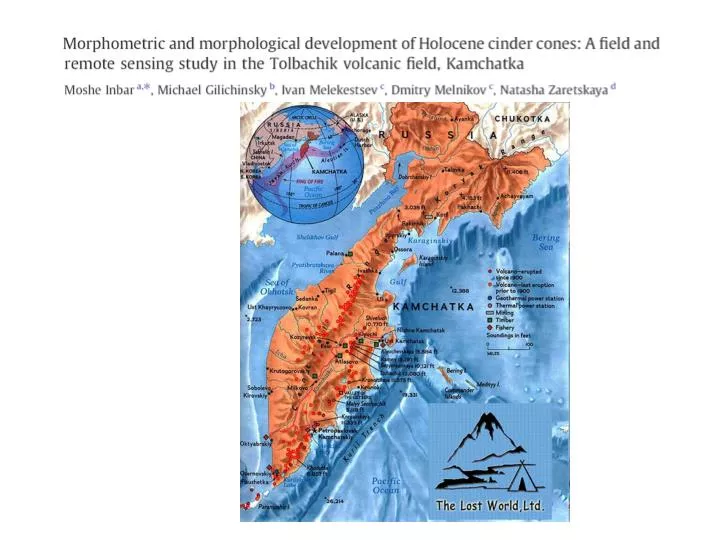
New Cones: N1, N2, N3, and Yuzhniy Erupted 1975-1976 Average slope:31.9 (ASTER), 31.7 (Map) Old cones: Kamenistaya, Krasniy, Camp, Stariy, and Alaid Erupted 1500-1700 years ago Average Slope:26.3 (ASTER), 27.1 (Map). Conclusions. Topographic map height values match closely with DEM models

E N D
New Cones: N1, N2, N3, and Yuzhniy Erupted 1975-1976 Average slope:31.9 (ASTER), 31.7 (Map) Old cones: Kamenistaya, Krasniy, Camp, Stariy, and Alaid Erupted 1500-1700 years ago Average Slope:26.3 (ASTER), 27.1 (Map)
Conclusions • Topographic map height values match closely with DEM models • Vertical RMSE values (Root Mean Square Error) were higher (3x) than the horizontal values especially for the older cones. • Humid climate: precipitation ranging from 2500 mm/year (east coast) to 500-800mm/year (central) winters are cool and snowy, summers are wet and cloudy • Climate conditions and vegetation cover determine high rates of erosion and rapid morphological changes, although variability is based on composition of the cones. • H/W ratios are consistent with published data for several areas of the world with differing climates although the erosional processes in the Kamachatka region are more intensive than published values. • Peaks of erosion occurred in the first stage 1 to 2 years after eruption as eruptive ashes are stripped from surface, as well as after forest fires • ASTER DEM data and topographic map data clearly supports the association of younger cones having a higher h/w ratio and slope values while the older cones have a lower h/w ratio and slope values.