Download
1 / 18
260 likes | 975 Views
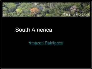
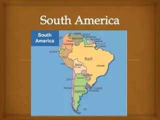
South America. SOME LANDFORMS. Andes Mountains Amazon Patagonia Pampas Atacama Desert. AMAZON BASIN. The Amazon Basin ( Amazonia ) is covered by the largest tropical rain forest in the world The Amazon River runs through the rain forest

E N D
SOME LANDFORMS • Andes Mountains • Amazon • Patagonia • Pampas • Atacama Desert
AMAZON BASIN • The Amazon Basin (Amazonia) is covered by the largest tropical rain forest in the world • The Amazon River runs through the rain forest • The overall basin covers about one-third of the South American landmass
The river network (tributaries…) irrigates almost half of the continent Largest river in the world (in terms of water dumped into ocean) AMAZON RIVER
ANDES • Mountain system that extends from the tip of South America all the way to Panama • Large ice sheets are common in S. Chile • Highest point: Aconcagua (in Argentina) at 22,384 ft. (6,960m)
Some of the largest volcanoes are found in the Andes Above: Osorno Volcano (Chile) Andes
ATACAMA DESERT • A somewhat small desert (or plateau) running high into the Andes of Chile • Climate: cold • Rainfall is rare • ~ 100 miles wide and 625 miles long
PAMPAS • Large plain in the southern part of the continent (in central Argentina) • Extends almost 1,000 miles (1,600 km), and covers 294,000 sq. miles (761,460 sq km). • Famed for its many cattle ranches • Gauchos!
PATAGONIA • Located between the Andes and the Atlantic Ocean • Patagonia stretches south from the Rio Negro River (southern Argentina) to Tierra del Fuego and the Strait of Magellan • ~1,000 miles in length • Mostly rugged, barren land
SOURCES • http://www.worldatlas.com/webimage/countrys/sa.htm • http://rst.gsfc.nasa.gov/Sect6/amazon_map01.jpg • http://www.casarioblanco.com/rainforest-2.jpg • http://image.guim.co.uk/sys-images/Guardian/Pix/pictures/2007/11/17/whale460x276.jpg • http://www.galapagos-inc.com/images/image006.jpg • http://www.amazonbasins.com/images/snake_Snowballs.jpg • http://www.adventureprone.com/travel/photos/DSCF0437.JPG • http://www.galapagos-inc.com/amazon_pic/1.jpg • http://www.questconnect.org/images/Northern_Andes.jpg • whatonearth.olehnielsen.dk/volcanoes.asp • http://img2.travelblog.org/Photos/4165/15276/f/66359-Andes-Mtns-from-Air-0.jpg • http://www.ventureforth.co.za/wp-content/themes/ventureforth/img/andes_lg.jpg • http://www.green-chiclet.com/pictures/andes.jpg • www.my-quito.com/images/pichincha.jpg • http://www.vivatravelguides.com/typo3temp/pics/110e5d4eb2.jpg
More sources • http://epod.usra.edu/archive/images/chile1.gif • http://www.visitchile.com/imagenes/hi/04.jpg • http://www.wightlightgallery.co.uk/Webtest/images/Pampas.jpg • http://www.blueplanetbiomes.org/images/pampas_gauchos.jpg • http://cache.eb.com/eb/image?id=65213&rendTypeId=4 • http://climb.mountainzone.com/2002/story/outthere/photos/patagonia_ste_poinc_fitz.jpg • http://www.canadahouse.com/Cerro-Torre-Los-Glaciares-National-Park-Patagonia-Argentina.jpg • http://www.condorjourneys-adventures.com/images/argentina_fitzroy1.jpg • http://www.backroads.com/images/trips/WCPI-patagonia-walking.jpg