Download
1 / 48
510 likes | 770 Views
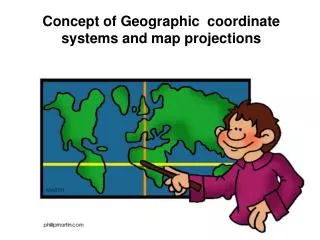
Projections and Coordinate Systems. Projections Coordinate systems Datums. Projections. The earth is a spheroid The best model of the earth is a globe. not easy to carry not good for making planimetric measurement (distance, area, angle). Maps are flat easy to carry

E N D
Projections and Coordinate Systems • Projections • Coordinate systems • Datums
The earth is a spheroid The best model of the earth is a globe • not easy to carry • not good for making planimetric measurement(distance, area, angle)
Maps are flat easy to carry good for measurement scaleable
A map projection is a method for mapping spatial patterns on a curved surface (the Earth’s surface) to a flat surface.
an imaginary light is “projected” onto a “developable surface” • a variety of different projection models exist
secant cone tangent cone cone as developable surface
tangent cylinders cylinder as developable surface
Exactly what are map projections? Sets of mathematical equations that convert coordinates from one system to another inputoutput unprojected projected angles (lat/long) Cartesian coordinates
How do projections work on a programmatic level? • each set of "coordinates" is transformed using a specific projection equation from one system to another • angular measurements can be converted to Cartesian coordinates • one set of Cartesian coordinates can be converted to a different measurement framework
How does ArcGIS handle map projections in data frames? • Project data frames to see or measure features under different projection parameters • Applying a projection on a data frame projects data “on the fly.” • ArcGIS’s data frame projection equations can handle any input projection. • However, sometimes on-the-fly projected data do not properly overlap.
How does ArcGIS handle map projections for data? • Projecting data creates a new data set on the file system • Data can be projected so that incompatibly projected data sets can be made to match. • ArcGIS’s projection engine can go in and out of a large number of different projections, coordinate systems, and datums.
Cassini projection of the world
Coordinates • Features on spherical surfaces are not easy to measure • Features on planes are easy to measure and calculate • distance • angle • area • Coordinate systems provide a measurement framework
Coordinates • Lat/long system measures angles on spherical surfaces • 60º east of PM • 55º north of equator
Lat/long values are NOT Cartesian (X, Y) coordinates constant angular deviations do not have constant distance deviations 1° of longitude at the equator 1° of longitude near the poles
Coordinate systems Example of coordinate/projection systems • Universal Transverse Mercator (UTM)
Coordinate systems Universal Transverse Mercator (UTM) • Based on the Transverse Mercator projection • 60 zones (each 6° wide) • false eastings • Y-0 set at south pole or equator
Coordinate systems Every place on earth falls in a particular zone
Datums A system that allows us to place a coordinate system on the earth’s surface Initial point Secondary point Model of the earth Known geoidal separation at the initial point
Datums Examples of used datums • NAD83 North American Datum • World Geodetic System of 1984 (WGS84)
المسند الجيوديسي geodetic datum هو المرجع الذي اشتقت منه أنواع القياسات. ففي علمي المساحةوالجيوديسيا (قياسات الأرض)، فإنالمسند الجيوديسي هو مجموعة من النقاط المرجعية على سطح الأرض توضع في مقابلها قياسات الموضع، وفي (الغالب) أيضًا نموذج متصل لشكل الأرض (مجسم القطع الناقص المرجعي) لتحديد نظام الإحداثيات الجغرافية. وتستخدم مراجع الإسناد الأفقية لوصف نقطة على سطح الأرض، وفقًا للعرض الجغرافيوالطول الجغرافي أو أي نظام إحداثي آخر. في حين أن مراجع الإسناد العمودي تقيس الارتفاعات أو الأعماق. وفي الهندسة التطبيقيةووالرسم التخطيطي، يكون مرجع الإسناد هو نقطة مرجعية أو سطح أو محور، لهدف يتم إجراء القياسات في مقابله.
نقاط الإسناد المرجعيه • نقاط الإسناد المرجعية هي نقاط معروفة وثابتة على سطح الأرض تستخدم لوصف موقع نقاط غير معروفة على الأرض. ونظرًا لأن نقاط الإسناد المرجعية قد يكون لها أنصاف أقطار ونقاط مركزية مختلفة، فإن نقطة معينة على سطح الأرض يكون لها إحداثيات مختلفة وذلك وفقًا لنقطة الإسناد المستخدمة في إجراء القياس. ولهذا توجد المئات من نقاط الإسناد المرجعية المحلية حول الأرض، والتي يتم تحديدها وفقًا لنقطة مرجعية محلية ملائمة. وتهدف نقاط الإسناد المعاصرة، والتي تعتمد بشكل متزايد على القياسات الدقيقة لشكل الأرض، إلى تغطية مناطق أكبر. وتعد أكثر نقاط الإسناد المرجعية شيوعًا في الاستخدام في أمريكا الشمالية هي NAD27، وNAD83،وWGS84.
Matching Datums Revenge of the Shift I’m using WGS84 I use GPS for all my mapping. I’m using NAD83(1986) 4.3 ft
WGS 84 • WGS 84 هو النظام الجيوديسي العالمي لعام 1984. إنه الإطار المرجعي الذي تستخدمه وزارة الدفاع الأمريكية (DoD) والذي حددته الوكالة الوطنية للاستخبارات الأرضية الفضائية (NGA) (وكالة رسم الخرائط الدفاعية سابقًا، ثم الوكالة الوطنية للصور ورسم الخرائط). وتستخدم وزارة الدفاع الأمريكية نظام WGS 84 في جميع أغراض رسم الخرائط، والمخططات، والمساحة، والملاحة، بما في ذلك مدارات النظام العالمي لتحديد المواقع GPS "البثي" و"الدقيق". • ولا يستخدم اليوم أي نظام مرجعي عالمي سوى نظام الإسناد WGS84، والمطابق تقريبًا لنظام الإسناد NAD83 في أمريكا الشمالية. كما أن نظام WGS84 هو نظام الإسناد القياسي الافتراضي للإحداثيات المخزنة في وحدات GPS الترفيهية والتجارية
UTM 36 UTM 34 Lake Victoria is not in central Africa Projecting spatial data sets Used for going between projections Source data sources may not be compatible
both arenow UTM 34 Lake Victoria really is in east Africa Projecting spatial data sets • Data sets are now compatible • Used for going between projections