Download
1 / 21
210 likes | 373 Views
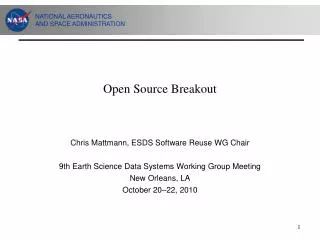
An Open-Source Data Hub for Improving the Effectiveness of Integrated Modeling Applications. Brandon Nevers (KAI) Xuesong Zhou, Jeff Taylor (Univ. of Utah) Prepared for Transportation Data Palooza. Problem Statement and Need.

E N D
An Open-Source Data Hub for Improving the Effectiveness of Integrated Modeling Applications Brandon Nevers (KAI) Xuesong Zhou, Jeff Taylor (Univ. of Utah) Prepared for Transportation Data Palooza
Problem Statement and Need • Transportation decision making is complex; requires consideration of multiple levels of analysis or domains • Improved suite of tools is critical to support USDOT initiatives: • Connected Vehicles • Integrated Corridor Management • Active Transportation Demand Management • Many integrated modeling practices are still ad-hoc
Integrated Modeling Practices Current PracticeAd Hoc
Our Vision With AMS Data HubSystematic Current PracticeAd Hoc
FHWA Research Project • Project title: Effective Integration of Analysis and Modeling Simulation (AMS) Tools • April 2011 to January 2013 • Objectives: • Define a concept of operations • Allow for the effective integration of AMS tools across various domains and scale, • Perform multi-resolution simulation for multiple scenarios
Development Goal 2: Support Cross Resolution Modeling Mesoscopic simulation Regional planning model Microscopic simulation Height (Z-axis) represents zone-specific population Color range represents predicted accessibility
Development Goal 3: Facilitate Data Exchanges between Modeling/Simulation Software Packages Traffic assignment: Signal Optimization: Synchro Microsimulation: Vissim Google Maps Output
AMS Data Hub Software Prototype: NEXTA • Open Source: Available at Google Code: https://code.google.com/p/nexta/ • Windows based applications but with connections to on-line storage (Google Fusion Tables) • Start with GIS with multiple transportation layers • Network, demand, vehicle trajectory, Link MOE, …. • Focus on data processing and visualization
Connection 1: • Regional planning models • TransCAD • CUBE • VISUM • GIS shape files • Multiple demand formats • CSV, Matrix • Automatic identification of signal locations • Subarea cut utility • Export network to Google Maps
Network Data Importing • Import GIS node/link/zone shape files • Utilize Open-source Geospatial Data Abstraction Library (GDAL) library • Script for mapping planning data set to NEXTA data hub VISUM Open-Source Q-GIS
Connection 2: • Import DYNASMART/Dynust data set • Network • Signal Control • Vehicle trajectory • Trajectory-based statistics generation • Select link, path, subarea analysis • 95% percentile travel time • Planning index
Connection 3: • Import Aimsun vehicle trajectory file • Export synchro data format • Export VISSIM network data format (*.anm) • Extensions: • TRANSIMS • Open-source CORSIM
Connection to Synchro and QEM • Import Synchro data directly to NEXTA • Match nodes using two layers • Fetch signal data from Synchro layer for Dynamic Traffic Assignment • Future year study through QEM
DTALite Large-scale Dynamic Traffic Assignment & Simulator Integrated MOVES Lite and DTALitePackages for Emission Analysis Emission Result Aggregation Microscopic Vehicle Trajectory Reconstruction Emission Estimates Project level Network level MOVES Lite Simplified Emission Estimation Method
Connection 6: • Inrix Sensor data • 15-min speed count • GPS data sets • Tomtom dataset from New York • NGSIM data set • Incident data (crash locations) • Google Transit Feed • Extension: • Dynamic OD demand calibration tools
Network Coding/Debugging/Calibration • Reduce editing and debugging efforts • Visualization and validation Purple band: observed volume vs. Darkblue band: simulated volume
Test Applications • Two test networks selected: • NW 185th Avenue in Portland, Oregon • I-10 in Tucson, Arizona • Primary objective: demonstrate linkages among AMS tools and field data • Model and field data already available to team • Familiar networks • Interested modeling agencies • Portland Metro • Pima Association of Governments
Estimated Time Saving from AMS Data Hub 80% Savings
Challenges • Network coding Different applications require different levels of details • Signal data representation Capacity Turning movement and effective green time Dual ring signal timing Software/hardware in the loop • Software vendor buy-in Existing multi-resolution integration using their own proprietary format • Community support
Next Steps • Obtain critical feedback from software development and model user communities • Continue model development and testing • Refine and expand connections with signal timing data • Linkage with Activity-Based Model • Expand number of AMS tool interfaces • Provide connection with real-time detector data • Conduct additional applications