Download
1 / 30
300 likes | 327 Views
Explore GIS data models, accessing geographic data online, converting existing data, and creating your own. Learn about vector and raster data, GIS formats, and online resources for geographic data.

E N D
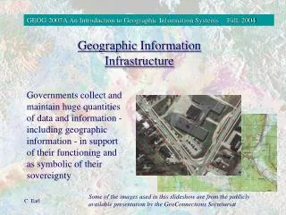
July 23-27, 2012 What Is Geographic Data and Where Can I Find It? Miriam Schmidts Geri Miller
Agenda • What is Geographic Data? • Where can I find it? • Online sources • Converting existing data • Creating it yourself
Geographic data Is this geographic data? yes yes yes
Geographic data • Information describing the location and attributes of things, including their shapes and representation. • Geographic data is the composite of spatial data and attribute data.
GIS data models Real world Vector Raster
Raster data - a cell based view Imagery Elevation Vegetation
How GIS data stores location • Pairs of X,Y coordinates • Longitude and Latitude • Projected X,Y coordinates Y X<0 Y>0 X>0 Y>0 (0,0) X X<0 Y<0 X>0 Y<0
How GIS data is stored Vector formats • Geodatabase feature classes • Shapefiles • Name.shp • Name.shx • Name.dbf • Coverages / E00 • KML/KMZ Raster / Image formats • Tiff • MrSID • Many more….
Layer and map packages • Map package • Full contents of map document • Map properties • Data frames • All layers and data • Layer package • Full contents of a single layer • Includes layer's data • May also apply to group layer
Summary: Accessing GIS data online • ArcGIS.Online: http://www.arcgis.com/home/ • Ready to use data and basemaps • Data and Maps for ArcGIS • Esri Data page: http://www.esri.com/data/find-data.html • Imagery, Streets, Shaded Relief, Topographic Data • Demographics, Consumer Spending, Business, and Marketplace Data • Free Data • 2010 Census TIGER/Line® Shapefiles
Data Documentation When was it made? • Item Description • Title, Thumbnail, Tags • Summary (Purpose) • Description (Abstract) • Credits • Use Limitations • Extent • Scale range • Metadata • More elements • Complies with standards How was it made? Can I use it? Who made it? What's this? What's this?
Summary: More online data sources Government agencies, for example: • http://www.data.gov/ • http://data.geocomm.com • http://cumulus.cr.usgs.gov/ • http://gis.fema.gov/DataFeeds.html • Colleges and Universities, for example: • http://gis.harvard.edu • States, counties, cities • Commercial vendors • Many….
Converting existing data • Converting spatial data formats • Shapefile Geodatabase • E00 Coverage Geodatabase • Any Any • Converting tabular data into spatial data
Converting tabular data Display X,Y Data Geocoding
Summary: Converting tabular data • Display X,Y data: converting X,Y coordinates into points • Need separate columns for the X and the Y coordinate • Can be longitude and latitude or projected coordinates • Need to define the coordinate system that the x,y • Geocoding: converting address information into points • Can geocode single addresses or a table of addresses • Use online geocoding service or build your own address locator
Creating geographic data • Vector • Digitized from paper maps or from imagery • Survey data, GPS, ranging • Converted from imagery or scanned maps • As output from geoprocessing • Raster • Aerial cameras/scanners • Classification from imagery • As output from geoprocessing
Summary: Digitizing vector data If necessary, create a shapefile or geodatabase feature class If necessary, add it to the map Start an edit session Choose feature template & construction tool Create new feature Add or edit attributes Save edits
Steps to evaluate UC sessions • My UC Homepage > “Evaluate Sessions” • Choose session from planner OR • Search for session www.esri.com/ucsurveysessions
Thank you for attending • Have fun at UC2012 • Open for Questions • Please fill out the evaluation: • www.esri.com/ucsessionsurveys • First Offering ID: 623 • Second Offering ID: 1949