Download
1 / 33
360 likes | 419 Views
Learn about the East African Rift System and Albertine Graben, developments in petroleum exploration in Uganda before and after 1983, exploration areas, seismic surveys, drilling activities, and more.

E N D
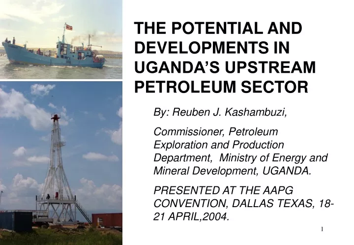
THE POTENTIAL AND DEVELOPMENTS IN UGANDA’S UPSTREAM PETROLEUM SECTOR By: Reuben J. Kashambuzi, Commissioner, Petroleum Exploration and Production Department, Ministry of Energy and Mineral Development, UGANDA. PRESENTED AT THE AAPG CONVENTION, DALLAS TEXAS, 18-21 APRIL,2004.
TOPICS TO COVER. • EAST AFRICAN RIFT SYSTEM AND ALBERTINE GRABEN. • SUMMARY OF DEVELOPMENTS IN PETROLEUM EXPLORATION IN UGANDA. • PETROLEUM POTENTIAL OF THE ALBERTINE GRABEN. • CONCLUDING REMARKS.
N 1. EAST AFRICAN RIFT SYSTEM AND ALBERTINE GRABEN ALBERTINE GRABEN • THE ALBERTINE GRABEN IS: • Northernmost part of the Western arm of the East African Rift system. • 23,000sq km (Uganda part) • 1600 km from the coast • It is Miocene in age
2. DEVELOPMENTS IN PETROLEUM EXPLORATION IN UGANDA A: BEFORE 1983: • Butiaba Waki – B1 well • Drilled in 1938 • T.D of 1232m • Revealed presence of: • Source rocks • Reservoir rocks • Possible seals • Live oil • Possible multiple pay zones. • Map showing oil seeps. • Oil seeps first documented by Wayland, 1925 30E 31E 32E
2. DEVELOPMENTS IN PETROLEUM EXPLORATION CONT’D… • Shallow drilling in 1956 for geological correlation. • 13 shallow wells in Semliki basin • 9 near Kibiro Oil seep • Depths of 150 –640m • Some wells with oil shows. • CLEARLY EVEN THEN, THERE WAS AMPLE EVIDENCE OF PETROLEUM POTENTIAL WHICH WAS NOT FOLLOWED-UP
2. DEVELOPMENTS IN PETROLEUM EXPLORATION CONT’D… • 1983/1984: • 9578 line km of aero -magnetic data acquired DEMOCRATIC REPUBLIC OF CONGO
2. DEVELOPMENTS IN PETROLEUM EXPLORATION CONT’D… • Interpretation of aeromagnetic data reveals: • 3 significant basins • Depth to basement of 3-4 km • Albertine Graben subdivided into three Exploration Areas (EAs), namely: • EA 1 • EA 2 • EA 3 • Significant depths for source rock maturation and oil generation • Oil seeps accounted for. N EA1 Mswa Kibiro EA2 EA3
2. DEVELOPMENTS IN PETROLEUM EXPLORATION 1984 TO DATE B: 1984 TO DATE • Gravity surveys have: • Revealed significant structuring. • Improved depths to basement. • Enabled further subdivision of Exploration Areas (EA’s)from 3 to 5. • Improved the capacity of Government to promote the potential of the Albertine Graben. • Two Exploration Areas (2 & 3) licensed. Negotiations concluded for EA 1. 5 1 2 3 4
2. DEVELOPMENTS IN PETROLEUM EXPLORATION CONT’D… EXPLORATION AREAS AND STATUS OF LICENSING • EA5 Rhino Camp Basin • Area Size 6,040 sq. Km • Estimated sediment thickness 3 Km from aeromagnetic data. • EA2 Lake Albert Basin • Area size 4,675 sq Km • Modeled sediment thickness 5.5 km • Licensed to Hardman Resources Ltd. and Energy Africa Ltd in 2001. • EA1 Pakwach Basin • Area Size 4,285 sq Km • Estimated sediment thickness 5 Km • EA4 Lake Edward-George basin • Area Size 5,910 sq Km • Sediment thickness 5.5 Km • EA3 Semliki Basin • Area size 4,630 sq Km • Estimated sediment thickness 6 Km • Licensed to Heritage Oil & Gas Ltd. and Energy Africa Ltd in 1997.
2. DEVELOPMENTS IN PETROLEUM EXPLORATION CONT’D… • MAP SHOWING SEISMIC GRID SUPERIMPOSED ON BOUGUER ANOMALY. • 1998: 170 line km. • 2001: 240 line km. • Very good quality data. • Drillable structures identified. • Confirmation of major structures mapped by gravity. Turaco-1
2. DEVELOPMENTS IN PETROLEUM EXPLORATION CONT’D… A section showing good quality 2-D seismic data in Semliki basin
DEVELOPMENTS IN PETROLEUM EXPLORATION CONT’D… DRILLING: • Turaco-1. • Spudded on 17th September 2002 • Total Depth=2487m • Gas and oil shows • Live oil • Suspended following mechanical problems. Slim hole rig at location of Turaco-1 well in Semliki Basin (EA3)
2. DEVELOPMENTS IN PETROLEUM EXPLORATION CONT’D… DRILLING: • Turaco-2 • Spudded on 05 October 2003 using larger rig. • Same Location as Turaco – 1. • Intended to reach targets that Turaco-1 did not. Larger Rig on Location at Turaco-2 well. Sidetrack of Turaco-1.
2. DEVELOPMENTS IN PETROLEUM EXPLORATION CONT’D… • Seismic Surveys on Lake Albert • Covers EA2 and EA3. • Jointly carried out by Hardman Petroleum Africa Ltd, Heritage Oil and Gas Ltd and Energy Africa (Uganda) Ltd. • Commenced 21st Sept. 2003; • 1,569 line km acquired. Seismic vessel, Victoria III, on Lake Albert.
2. DEVELOPMENTS IN PETROLEUM EXPLORATION CONT’D… Seismic grid map
2. DEVELOPMENTS IN PETROLEUM EXPLORATION CONT’D… Petroleum Exploration and licensing is governed by: (i) The Petroleum(Exploration and Production) Act, 1985 (ii) The Petroleum (Exploration and Production)(conduct of Exploration Operations) Regulations, 1993 (iii) The Production Sharing Agreements (iv) The National Environment statute (v)The wildlife statute (vi)Reference Manual, 2002 by National Environment Management Authority.
3. PETROLEUM POTENTIAL OF THE ALBERTINE GRABEN 3.1 Direct Hydrocarbon Indicators (DHI) 3.1.1 Oil Seeps An oil film floating on River Nile at Paraa (EA1) Oil Seepage at Kibiro, EA2 Kabyosi Oil Seepage (EA2)
PETROLEUM POTENTIAL OF THE ALBERTINE GRABEN CONT’D Hydrocarbon seeps on R. Kabyosi Oil Seeps Cont’d Hohwa Oil impregnated sandstone Hydrocarbon seeps on R. Warwire
PETROLEUM POTENTIAL OF THE ALBERTINE GRABEN CONT’D 3.1.2 Flat spots SP 191 181 171 161 151 141 131 121 111 0.50 FLAT SPOTS 0.58 186 0.66 0.74 0.82 Time (S) 0.90 0.98 1.06
PETROLEUM POTENTIAL OF THE ALBERTINE GRABEN CONT’D • Confirmed oil seeps. • Kabyosi and Warwire oil seeps in Kaiso – Tonya. • Residual oil sandstone (oil sand) in Kaiso-Tonya. • Kibiro oil seep and the Kaiso – Tonya seeps, supplied from the same source. • Difference is that Kibiro is continuously recharged from shallow reservoir (presence of hopanes and regular steranes in Kibiro seep,Peter Hall, Geolab Nor’ 2003).
PETROLEUM POTENTIAL OF THE ALBERTINE GRABEN CONT’D 3.2 SOURCE ROCKS • Inferred from oil seeps. • Presence in Waki B-1 well. • Mapped in Kaiso –Tonya. • Inferred from gas/oil shows, live oil in Turaco-1 Kaiso-Tonya Shale
PETROLEUM POTENTIAL OF THE ALBERTINE GRABEN CONT’D 3.3 Reservoir Rocks. • Mainly sandstones. • Thick (150 – 200m) e.g. Kisegi Formation. • Well sorted with porosities of the order of 30%. • Good permeabilities . • Possibilities of fractured basement as reservoir. • Possibilities of multiple pay zones. • Oil sand in Kaiso Tonya is 50m thick at outcrop. • Present in Turaco – 1 and 2 SUDAN D.R.C. Sebugoro Formation 100-120m of Sandstone, siltstone, diatomic, shale, fossiliferous and calcitic ironstone. Waki-B1-well Oil Sandstone exposure in Kaiso Tonya Kibuku Oil seepages UGANDA Kisegi Formation 150-200m of Sandstone
3. PETROLEUM POTENTIAL OF THE ALBERTINE GRABEN CONT’D 3.4 Traps RIFT FAULTS AND TRANSFER ZONES • Faults control trap formation • Relay ramps are significant avenues of sediment transportation and deposition. After McClay 1997
3.4 Traps contd.. KAISO-TONYA COMPARED TO GRONINGEN AND BERYL FIELDS Large scale relay ramp – Kaiso-Tonya Large scale relay ramp Groningen gas field, Netherlands (after Peacock et al 1994) Large scale relay ramp- Beryl oil field, South Viking Graben (after Peacock et al 1994)
3. PETROLEUM POTENTIAL OF THE ALBERTINE GRABEN CONT’D 3.4 Traps contd.. Gravity Anomalies • Gravity highs observed along E-E’ represent possible traps - inversion anticlines. • Lows represent possible ‘kitchens’.
PETROLEUM POTENTIAL OF THE ALBERTINE GRABEN CONT’D 3.4 Traps contd.. HOG-98 • Turaco –1 well drilled on a gravity high (uplifted basement) (bottom). • Compares well with Sudan where major oil fields coincide with gravity highs.
PETROLEUM POTENTIAL OF THE ALBERTINE GRABEN CONT’D 3.4 Traps … . Inversion anticlines are possible hydrocarbon traps. Contd q Rollover anticlines are typical traps in rifted environments. q Stratigraphic traps expected. q Seismic section showing an inversion anticline Seismic section showing an inversion anticline
PETROLEUM POTENTIAL OF THE ALBERTINE GRABEN CONT’D 3.5 Seals • Alternating shales and sandstones suggest good sealing mechanism. • Wide spread clays, some quite thick, may provide regional seals. Clays have been mapped across the Albertine Graben. • Observations in Turaco-1 still confidential. • A valid petroleum system exists.
4.0CONCLUDING REMARKS 4.1 SOME FACTS ABOUT UGANDA • Total Area : 214,039 sq km • Population (2002) : 24.7 million • Total Exports (2002) : US$477 million • Total Import (2001): US$ 1.0 billion • Petroleum Imports (2001): US$ 165.0 million(35% export earnings)
4.2 SOME KEY INCENTIVES TO INVESTORS • All the valid petroleum system do exist in the graben. • Exploration Areas are sizeable. • Market exists because the whole Region imports its petroleum products. • No Additional Profits Tax and no restriction on repatriation of profits. • There is stable taxation regime to avoid encumbrances resulting from tax fluctuations. • Uganda is a member of Multilateral International Guarantee Agency.
4.3 POTENTIAL MARKETS FOR UGANDA’S OIL AND GAS • OIL • LOCAL/REGIONAL CONSUMPTION • - Uganda consumed over 600,000 m3 of petroleum products during 2003 (equivalent to approximately US $ 165 million). This is increasing at a rate of 6%. • - East Africa (Kenya, Uganda, Tanzania) spend in excess of US$ 1 billion annually. • Regional demand including Rwanda,Burundi, Eastern DRC increasing • Region can consume petroleum products close to the equivalent of 100,000 barrels of oil per day (BOPD). • Medium to big refinery.
GAS POTENTIAL MARKETS FOR UGANDA’S OIL AND GAS CONT’D GAS -Market not as straight forward as that for oil • Generation of electricity considered an option • Gas considered very clean source of electricity • Conducive to stepping up generation capacity based on demand • Other uses of gas • Production of Carbon Black for production of tyres, plastics, paint paper etc • Production of methanol • Production of Ammonia urea for use as fertilizers • Reduction of Iron Oxide to metallic iron(feed stock for steel production) Muko Iron Ore.
Thank you Thank you You are All Welcome to Uganda Booth for more information & Discussion For further Information, Please Contact: The Commissioner Petroleum Exploration and Production Department P. O. Box 9, Entebbe, UGANDA Tel.: 256-41-320714 Fax.: 256-41-320347 Email: pepdebb@africaonline.co.ug