Download
1 / 24
240 likes | 256 Views
This study presents the modeling of atmospheric transport of mercury to the Great Lakes region, with a focus on the year 2005. The study analyzes emissions inventories, deposition patterns, and source attribution to understand the extent and effects of mercury pollution in the region. The results show reasonable agreement with measurements and provide insights for future research and policy implications.

E N D
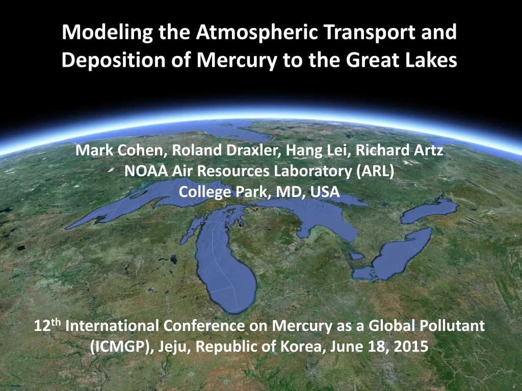
Modeling the Atmospheric Transport and Deposition of Mercury to the Great Lakes Mark Cohen, Roland Draxler, Hang Lei, Richard Artz NOAA Air Resources Laboratory (ARL) College Park, MD, USA 12th International Conference on Mercury as a Global Pollutant (ICMGP), Jeju, Republic of Korea, June 18, 2015
Acknowledgements and Thanks: • USEPA, Environment Canada • Arctic Monitoring and Assessment Program (AMAP) • National Atmospheric Deposition Program (NADP) • Winston Luke, Xinrong Ren, Paul Kelley, NOAA ARL • Eric Miller (Underhill Vermont) • Tom Holsen, Young-JiHan (New York State sites) • Mae Gustin, Seth Lyman, et al. (Nevada sites) • Dan Jaffe, Seth Lyman, et al. (Mt Bachelor site) • Laurier Poissant and Martin Pilote (St. Anicet) • Frank Froude (Burnt Island, Egbert, and Point Petre) • Rob Tordon (Kejimkujik) • Alexandra Steffen and Cathy Banic (Alert) • Brian Wiens (Bratt’s Lake) • HYSPLIT Modeling Team at NOAA ARL, Rick Jiang • Great Lakes Restoration Initiative Emissions Measurement Data for Model Evaluation Met Data, IT Funding
0.05 ppm level recommended by the Great Lakes Fish Advisory Workgroup (2007) Mercury in Great Lakes Fish Evers, D.C., et al. (2011). Great Lakes Mercury Connections: The Extent and Effects of Mercury Pollution in the Great Lakes Region. Biodiversity Research Institute. Gorham, Maine. Report BRI 2011-18. 44 pages.
NOAA’s HYSPLIT atmospheric transport and dispersion modeling system Stein,A.F., Draxler, R.R., Rolph, G.D, Stunder,B.J.B., Cohen, M.D., and Ngan, F. Bulletin of the American Meteorological Society, 2015, in press. http://journals.ametsoc.org/doi/abs/10.1175/BAMS-D-14-00110.1 1940 1950 1960 1970 1980 1990 2000 2010 2020 HYSPLIT can do more than just back-trajectories
When puffs grow to sizes large relative to the meteorological data grid, they split, horizontally and/or vertically To simulate the global transport of mercury, puffs are transferred to Eulerian grid after a specified time downwind (~3 weeks), and the mercury is simulated on that grid from then on… This is how we model the local & regional impacts. But for globalmodeling, puff splitting overwhelms computational resources Puffs of pollutant are emitted and dispersed downwind Atmospheric chemistry and deposition simulated for each puff 5
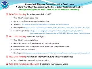
Today’s talk will just present Eulerian-only results, for 2005 These Eulerian-only simulations were much faster (a few weeks) than Lagrangian-only and hybrid Lagrangian-Eulerian simulations (3-6 months) It’s important to fail fast!
1/e Half-Lives for Fate Processes within HYSPLIT-Hg Starting with Uniform Mixing Ratio Throughout the Atmosphere Hg(p) Hg(II) 0.2 year = 2.4 months 0.048 year = 2.5 weeks Hg(0) Hg(0) oxidation rate 67% – no reduction Hg(0) oxidation base case – no reduction 0.84 year = 10 months
Emissions Inventories with Net Ocean and Terrestrial Hg(0) Fluxes This Work GEOS-Chem
2.5o x 2.5o grid Grid is too coarse to expect good agreement with measurements, but… Emissions (kg/yr) 5-10 10-50 Burnt Island 50-100 St. Anicet 100–300 Potsdam 300–500 Underhill Egbert 500–1000 Point Petre 1000–3000 Stockton Type of Emissions Source coal-fired power plants other fuel combustion waste incineration metallurgical manufacturing & other
Hg(0) at Egbert Ontario Which inventory components show the right seasonal variation?
modeled vs. measured Hg(0) concentrations during 2005, for measurement sites in the Great Lakes region and sites outside the region
Mt. Bachelor Gibbs Paradise Reno 2.5o x 2.5o grid
modeled vs. measured Hg(II) and Hg(p) concentrations during 2005 Model estimated total for all non-elemental mercury is higher than measurements: Are the measurements too low or is the model too high?
modeled vs. measured 2005 Hg wet deposition for Mercury Deposition Network (MDN) sites in different regions
Base-case results compared with recent CMAQ modeling: Grant, S. L., M. Kim, P. Lin, K. C. Crist, S. Ghosh and V. R. Kotamarthi (2014). A simulation study of atmospheric mercury and its deposition in the Great Lakes. Atmospheric Environment 94: 164-172. Base Case Source Attribution Results
Base Case 1: 60% oxid; ~50% L+R+O net Hg0 2: Plume HgII convert 50% 3: Plume HgII convert 67%
HYSPLIT-Hg Base Case gives reasonable results for 2005 • Several variations also considered, which can also give reasonable results for 2005 • Source Attribution results for the different cases are understandably somewhat different • However, policy implications of the different modeling results may not be that different • Next steps: • Modeling for more recent years, including detailed model evaluation at three NOAA/EPA monitoring sites (within AMNet): • Beltsville MD; Grand Bay MS; and Mauna Loa HI • + Nested grid + explicit sub-surface terrestrial & ocean layers
Thanks! This work was partially funded through the Great Lakes Restoration Initiative