Download
1 / 44
440 likes | 454 Views
Learn where and how to look for spatial data and how to publish your own data in accordance with INSPIRE guidelines. This course covers metadata, search strategies, and geoportal usage.

E N D
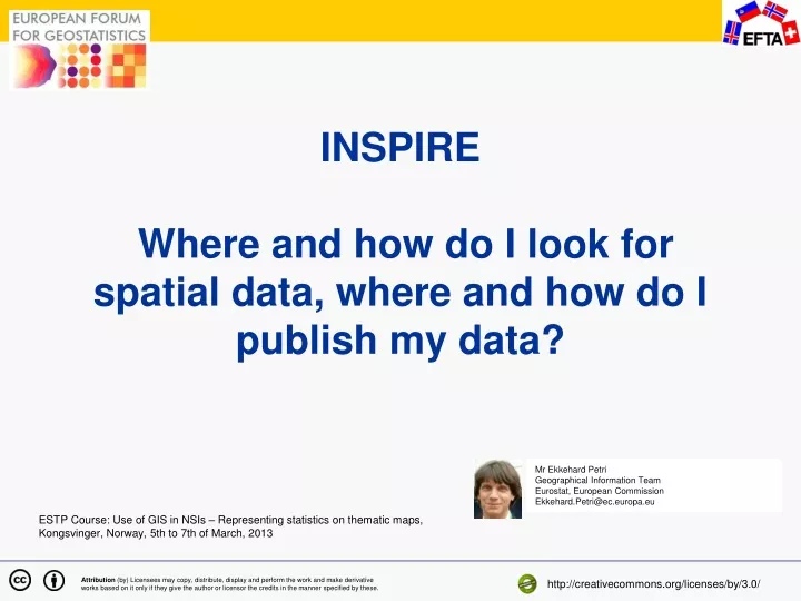
INSPIRE Where and how do I look for spatial data, where and how do I publish my data? Mr Ekkehard Petri Geographical Information Team Eurostat, European Commission Ekkehard.Petri@ec.europa.eu ESTP Course: Use of GIS in NSIs – Representing statistics on thematic maps, Kongsvinger,Norway, 5th to 7th of March, 2013 Attribution (by) Licensees may copy, distribute, display and perform the work and make derivative works based on it only if they give the author or licensor the credits in the manner specified by these. http://creativecommons.org/licenses/by/3.0/
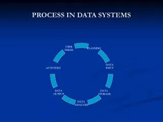
Content Block I Introduction and INSPIRE overview What is INSPIRE and what is it for? (~25 min) Information sources on INSPIRE (Demo ~5 min) Block II INSPIRE for data users INSPIRE metadata (~15 min) Search strategies for spatial data (10 min) Exercise on the INSPIRE geoportal (~15 min) Break Block III INSPIRE for data producers More on metadata Demo of tools to prepare metadata (~5 min) Creation of INSPIRE metadata (~Exercise 20 min)
What is INSPIRE? INfrastructure for SPatial InfoRmation in Europe A framework directive of the European Parliament and of the Council of 14 March 2007 (Directive 2007/2/EC) on the establishment of such a Spatial Data Infrastructure (SDI)
INSPIRE is about improving accessto and sharing of spatial information: Distributed infrastructure:INSPIRE is to be based on the infrastructures for spatial information established and operated by the Member States Organisational and technical harmonisation Data held by or on behalf of public authorities (including Statistical Offices) Data falling under the themes listed in theDirective For Community environmental policies and policies or activities which may have an impact on the environment. The environment doesn’t stop at borders
INSPIRE principles Data should be collected once and maintained at the level where this can be done most effectively It should be possible to combine seamless spatial information from different sources across Europe and share it between many users and application It should be easy to discover which geographic information is available and under which conditions it can be acquired and used Geographic data should become easy to understand and interpret
INSPIRE non- principles No requirement to create new spatial data No obligation to provide data for free No minimum level of quality No regulation of scales
INSPIRE history and future 2007 Adoption of INSPIRE directive 2008 First implementing regulation on Metadata 2009 – 2013 Further Implementing legal acts Since 2007 Transposition into national law Since 2011 INSPIRE geoportal Until 2020 Implementation phase in Member States
Essence of INSPIRE – spatial information Metadata Spatial data sets Spatial data services
Spatial information under INSPIRE Data: data from different sources is comparable Annex I, Annex II, Annex III (3 lists of spatial data themes) Network services (machine to machine communication) Discovery service: to be able to find the data in distributed catalogues View service: to evaluate the data visually Download service: to actually get the data Transformation service: coordinate transformation Invoke service Metadata Content: fixed list of elements Format: to treat it automatically (catalogues, search engines)
Content of INSPIRE – data themes • Annex I • Coordinate reference systems • Geographical grid systems • Geographical names • Administrative units • Addresses • Cadastral parcels • Transport networks • Hydrography • Protected sites • Annex III • Statistical units • Buildings • Soil • Land use • Human health and safety • Utilities and government service • Environmental monitoring facilities • Production and industrial facilities • Agricultural and aquaculture facilities • Population distribution - demography • Area management/restriction/ regulation zones & reporting units • Natural risk zones • Atmospheric conditions • Meteorological geographical features • Oceanographic geographical features • Sea regions • Bio-geographical regions • Habitats and biotopes • Species distribution • Energy resources • Mineral resources • Annex II • Elevation • Land cover • Orthoimagery • Geology
Spatial information under INSPIRE data sets INSPIRE@EC Geoportal
INSPIRE Metadata INSPIRE@EC Geoportal
Spatial information under INSPIRE - services INSPIRE View Service (Map Image) http://www.gisco.eurostat.cec:8399/arcgis/services/Statistical-Units/NUTS-1-ETRS-View/MapServer/WMSServer?request=GetMap&service=WMS INSPIRE@EC Geoportal
Further information on INSPIRE INSPIRE website INSPIRE forum
INSPIRE not only for geographers – data themes with direct relevance for statistics • Annex I • Coordinate reference systems • Geographical grid systems • Geographical names • Administrative units • Addresses • Cadastral parcels • Transport networks • Hydrography • Protected sites • Annex III • Statistical units • Buildings • Soil • Land use • Human health and safety • Utilities and government service • Environmental monitoring facilities • Production and industrial facilities • Agricultural and aquaculture facilities • Population distribution - demography • Area management/restriction/ regulation zones & reporting units • Natural risk zones • Atmospheric conditions • Meteorological geographical features • Oceanographic geographical features • Sea regions • Bio-geographical regions • Habitats and biotopes • Species distribution • Energy resources • Mineral resources • Annex II • Elevation • Land cover • Orthoimagery • Geology
How can a user find and use spatial data under INSPIRE? Geoportals as entry points Metadata as content description View services for content evaluation Download and transformation services for obtaining data in the right format => publish – find - bind
Why metadata and what is special about spatial metadata Metadata are data about data Metadata are essential for finding and understanding data We distinguish between structural metadata and descriptive metadata SDMX for statistics covers both INSPIRE metadata for spatial data are descriptive metadata Metadata serve different purposes (data discovery, assessing fitness for use, data access, data transfer, use) INSPIRE metadata are for discovery, some elements on access and fitness for use Metadata are relevant for data users (find) and for data producers (publish)
Metadata for spatial information Metadata are structured in hierarchical packages
Search for data – how does it work? INSPIRE queryables in the Metadata – e.g. title, abstract, resource type, keywords, topic category Search engines in Geoportals Thematic search and spatial search
Tour of the INSPIRE geoportal • http://inspire.jrc.ec.europa.eu/index.cfm • Exercise 1: Search for all resources from your country, refine it to datasets, then services, then refine it to hydrography. • Exercise 2: Go to one resource and read the metadata. Does it help you to understand the dataset? • Exercise 3: Try to find a dataset with a related view service. • Exercise 4: Try to add a view service to the map window on the left and change its transparency.
INSPIRE metadata INSPIRE metadata are regulated in „COMMISSION REGULATION (EC) No 1205/2008 of 3 December 2008 implementing Directive 2007/2/EC of the European Parliament and of the Council as regards metadata” Contains in total 21 metadata elements (19 for data sets and 17 for spatial data services) Further implementation details in INSPIRE Metadata Implementing Rules: Technical Guidelines based on EN ISO 19115 and EN ISO 19119 (Version 1.2)
Obligations in Member States regarding INPIRE Metadata 03-Dec-2010 Metadata available for spatial data sets and services corresponding to Annex I and II 09-Nov-2011 Discovery and view services operational 03-Dec-2013 Metadata available for spatial data sets and services corresponding to Annex III
INSPIRE metadata what is inside? http://eur-lex.europa.eu/LexUriServ/LexUriServ.do?uri=OJ:L:2008:326:0012:0030:EN:PDF
How to interpret the regulation - Technical Guidance documents
Problems with metadata Nobody likes to create metadata Structure well defined, content not Semantic interoperability not enforced Unclear titles Empty abstracts or other fields
Tools for metadata work Metadata editor http://inspire-geoportal.ec.europa.eu/editor/ Metadata validator http://inspire-geoportal.ec.europa.eu/validator/
Exercise Create Metadata using the Internet editor for the map you have created this morning
Recommendations on metadata Rather write too much than too little. Make the title speak for the full dataset. Begin the abstract with a short summary paragraph which is often shown in a geoportal. Include in the abstract some information on the main attributes, the data sources and references to legal acts. In the lineage field carefully document the way the data have been produced.
An outlook: data models, network services and transformations The INSPIRE data specifications prescribe a specific data structure. This should help users to immediately understand the data INSPIRE does not require the creation of new data -> Transformation of existing data into the INSPIRE format will be common practice.
Data transformation ATTRIBUTE MAPPING Identifier.namespace = EU.EC.EUROSTAT.<DATASETNAME>Identifier.localID = PRIMARYKEY from sourecdatasetIdentifier.version = unpopulated beginLifespanVersion = unpopulatedendLifespanVersion = unpopulatedauAdministrativeUnit nationalCode = CNTR_IDnationalLevel =1stLevelcountry = CNTR_ID upperlevelUnit = unpopulatedlowererlevelUnit = unpopulatednationalLevelName = countryname=NAME_ASCI
Further reading on INSPIRE Spatial data from Eurostat: http://epp.eurostat.ec.europa.eu/portal/page/portal/gisco_Geographical_information_maps/geodata/reference INSPIRE website: http://inspire.jrc.ec.europa.eu/index.cfm INSPIRE geoportal: http://http://inspire-geoportal.ec.europa.eu/