Download
1 / 23
230 likes | 554 Views
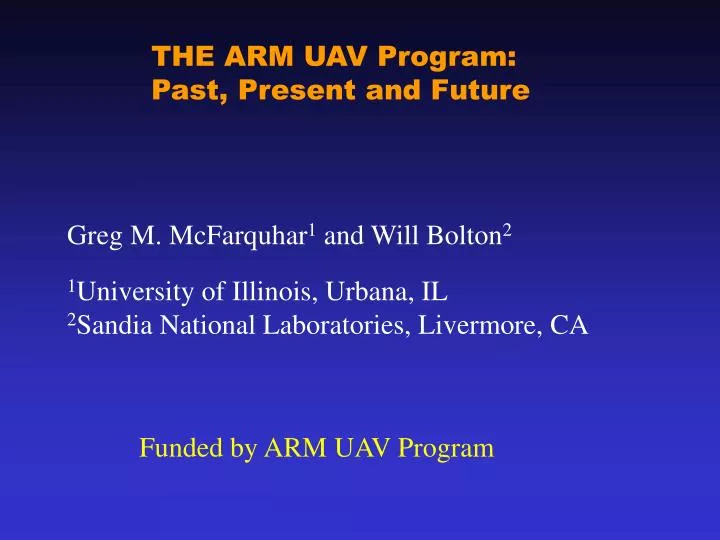
THE ARM UAV Program: Past, Present and Future. Greg M. McFarquhar 1 and Will Bolton 2 1 University of Illinois, Urbana, IL 2 Sandia National Laboratories, Livermore, CA. Funded by ARM UAV Program. Outline. Overview of ARM UAV Program Instruments for Cloud Research

E N D
THE ARM UAV Program: Past, Present and Future Greg M. McFarquhar1 and Will Bolton2 1University of Illinois, Urbana, IL 2Sandia National Laboratories, Livermore, CA Funded by ARM UAV Program
Outline • Overview of ARM UAV Program • Instruments for Cloud Research • New Science Issues UAVs can address
ARM UAV Program Objectives The ARM-UAV Program was established by DOE to • address the largest source of uncertainty in global warming: the interaction of clouds and solar/thermal energy • support the climate change community with valuable data sets • develop measurement techniques and instruments suitable for use with the new class of high altitude, long endurance UAVs • demonstrate these instruments and measurement techniques in field measurement campaigns
ARM-UAV has conducted ten major field campaigns GA-ASI “GNAT 750” (F93, S94) Field Campaigns to date: • Fall 1993, Edwards AFB, CA • Spring 1994, Northern OK • Fall 1995, Northern OK • Spring 1996, Northern OK • Fall 1996, Northern OK • Fall 1997, Northern OK • Spring 1999, PMRF Kauai, HI • Summer 1999, Monterey, CA • Winter 2000, Northern OK • Fall 2002, Northern OK Grob “Egrett” (F95, S96) GA-ASI “Altus I” (F96, F97) GA-ASI “Altus II” (Su99) Twin Otter (F93, S94, F95, S96, F96, F97, Sp99, Su99, W00)
Currently using Proteus, available from Scaled Composites, in piloted mode; flies to over 50 kft; 6900 kg payload; ~20 h duration
Current Suite of Instruments • Passive remote sensing (14 instruments) • Active remote sensing (2 instruments) • In-situ Microphysics (4 instruments) • Atmospheric State (5 instruments)
Proteus Payload -Passive Remote Sensing • Broadband Radiometers Package (BRP) • CM-22 pyranometers, 0.3 – 4um (zenith level, zenith fixed, nadir, nadir covered) • CG-4 pyrgeometers, 4 – 40 um (zenith level, nadir, nadir covered) • Spectral Radiance Package (SRP) • nadir mounted, NFOV • VIS 0.38-1 um, 2nm res, • A-Band 0.75-0.85 um, 0.07nm res • NIR 1.3-1.5 um, 2nm res • Solar Spectral Flux Radiometer (SSFR) • nadir & zenith, hemispheric FOV • 300–1700 nm • The Diffuse Field Camera (DFC) • VIS: 1300 x 1030 pixels x 12 bit, 645 nm center with 50 nm total bandpass • NIR: 320 X 256 pixels x 12 bit, 1610 nm center with 60 nm total bandpass • Scanning High-Resolution Interferometer Sounder (S-HIS) • scanning interferometer,high spectral resolution (0.5 cm-1) • Spectral Coveragebetween 3.3 and 18.0 µm
Stabilized Platform for High Altitude Remote Sensing • First flown in 2002 • Level to ±.02o • Improved data quality anddata range (±2 to ±5o) • Significantly reduces post processing time Location of Stabilized platform
Stabilized platform roll less than ±0.02o Aircraft roll ±3o
Proteus Payload - Active Remote Sensing • 95 GHz Compact Millimeter Wave Radar (CMR) • sensitivity of –42 dBZ at 1 km • Cloud Detection Lidar (CDL) • 1.053 µm at 5 kHz , 48 µJ/pulse CDL CMR
Proteus Payload -In-situ Instrumentation • MET Package • Buck Research CR-2 Cryogenic Hygrometer, -100oC, 20 s response • Near-ir laser absorption spectrometery, 1 ppmv, 50 Hz response • Micro Air Data Transducer (MADT) • static pressure, differential pressure, total air temp, • static air Temp, dh/dt, height, true air speed, indicated air speed • Best Aircraft Turbulence Probe • measured wind speed and direction at 50 Hz • Cloud, Aerosol, and Precipitation Spectrometer • cloud and aerosol spectrometer (CAS: 0.35 – 50 µm) • cloud imaging probe (CIP: 25 – 1550 µm) • liquid water content detector (LWC: 0.01 – 3 gm-3) • Cloud Integrating Nephelometer (CIN) • measures asymmetry parameter and extinction coefficient • Video Ice Particle Sampler (VIPS) • sizes between 10-200 μm • Nevzorov Probe (NEV), LWC, TWC • 0.003 – 3 gm-3, sensitivity: 0.003 gm-3 NEV pitot VIPS CR-2 TAT CIN CAPS
VIPS: Measuring Crystal Shape & Size Distributions Size distribution generated through automatic particle recognition from NIH software
Future Missions • Fall 04, North Slope Alaska (NSA) • vertical structure of mixed-phase clouds • Winter 06, Tropical western Pacific (TWP) • cirrus/radiative interactions associated with monsoon convection www.arm.gov
Have UAVs reached full potential? • No: UAV cost, reliability/maintenance, availability, and airspace access need to improve BUT: UAVs offer unique capabilities for important science applications Equipment and operational capabilities have been developed
Science Issues for UAVs • What can be done if we had routine long duration UAV flights that we cannot do now?
Aerosol/Cloud Vertical Profiles • Representing vertical distributions of aerosols, their mixing scenarios, size distributions & single-scattering properties crucial for different regions • Includes measurements in cloud layers! • Observations needed in many different regions • Different vertical profiles & meteorological forcing • Critical for radiative and thermodynamic forcing of aerosols • How representative are surface aerosol measurements of aerosol properties in cloud layers?
Complete Life Cycles/Parcel Studies • Satellites have at best hourly resolution and can’t resolve fine-scale phenomena • Trade wind cumuli have pretty short life cycles • Field observations don’t allow us to track complete life cycle (e.g., evolution of anvil associated with deep convection in Tropics) • Long duration platform might allow to track Saharan dust event, or brown cloud from Asia as it transits Pacific
Scaling Issues • Need to go from ground-based measurements to long space/time scales of satellites • Field experiments last only hours; satellites years long • More routine observations in several locations would be helpful • E.g., UAV spectral radiance measurements above ground-station would help scale between MODIS type retrievals and ground-based cloud retrievals
Summary • Unique set of instruments for airborne in-situ and remote sensing capabilities • Upcoming experiments offer unique opportunity for acquiring data on cloud-radiation interactions • Ongoing activities will attempt to further take advantage of UAV technology • Long duration platform for tracking whole life cycle • More routine climate tropospheric interactions not currently available
Proteus performance characteristics Altitude record (10/25/00): 62,786 feet (peak) 61,919 feet (sustained) 55,786 feet (w/1000 kg payload) Stall speed: 65 knots Top speed: 250 knots/M=0.6 Loiter (14,000 lb takeoff wt): 22 hours @ 500 nmi radius 12 hours @ 2000 nmi
Stable radiometer platform Boom extension, S-HIS Canard station, CIN Iridium satellite phone Canard station, CAPS Iridium satellite data link Payload pod ARM-UAV/Proteus payload arrangement