Download
1 / 17
180 likes | 397 Views
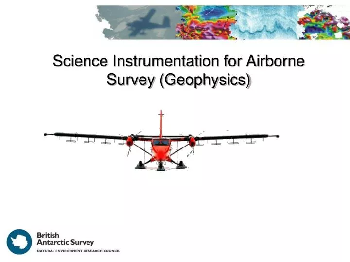
Science Instrumentation for Airborne Survey (Geophysics). Layers ‘easy’ to follow. Mag Pod. Mag Pod. Radar Antenna. Radar Antenna. Twin Otter Platform. Flux Gate. LiDAR / Hyperspectral. Power Conditioning. Gravimeter / INS. GPS Antenna. Equipment Control Racks. PGU. AHRS.

E N D
Mag Pod Mag Pod Radar Antenna Radar Antenna Twin Otter Platform
Flux Gate LiDAR / Hyperspectral Power Conditioning Gravimeter / INS GPS Antenna Equipment Control Racks PGU AHRS Twin Otter Platform Radar Tx
Future Equipment Plans (following CReSIS) Swath radar (cross-track imaging) Snow radar (near surface layering) OIB 20111112_01_120_184447
Magnetics Gravity LiDAR GPS/INS Radar (PASIN) Type Type Type Type Type Cesium CS3 Modified L&R Coherent 2 pulse Riegl LMS-Q240i Leica SR530 / Novatel Span Accuracy (processed) Resolution (accuracy) Carrier Frequency Accuracy (processed) Period 2, 4 or 16 minutes > 10cm 150 MHz 1 pT (1 nT) >2cm (at 650m) Bandwidth Accuracy Logging Frequency 10Hz 12 MHz 3.5 mGal for λ >10km Along Track Resolution 1 m Depth Resolution 8 m Standard Fit
Airborne Surveys Dronning Maud Land ICEGRAV/ Recovery Lakes Antarctic Peninsula Coats Land HRAM Ellsworth Whitmore Antarctic Gamburtsev Province Institute/ Möller Pine Island/ Thwaites Glaciers Transantarctic Mountains/ Wilkes Subglacial Basin Pre 1996-1997 2004 onwards
‘Good’ Layering (with turn) No ‘echo-free zone’ 3500 m Turn 10 km
3500 m 350 km
Das; Bell; Scambos; Wolovick; Creyts; Studinger; Frearson; Nicolas; JLenaerts; van den Broeke. Influence of persistent wind scour on the surface mass balance of Antarctica . Nature Geoscience 2013 Vol: 6(5):367-371. DOI: 10.1038/ngeo1766
2500 m 25 km 1500 m
DELORES ground based radar (3km section) Centre Frequency 1.5 MHz (40m aerials)