Download
1 / 37
370 likes | 555 Views
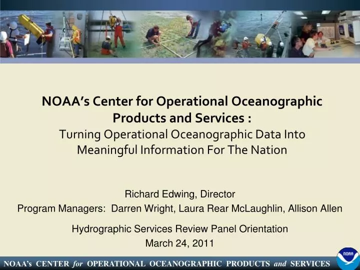
NOAA’s Center for Operational Oceanographic Products and Services : Turning Operational Oceanographic Data Into Meaningful Information For The Nation. Richard Edwing, Director Program Managers: Darren Wright, Laura Rear McLaughlin, Allison Allen

E N D
NOAA’s Center for Operational Oceanographic Products and Services : Turning Operational Oceanographic Data Into Meaningful Information For The Nation Richard Edwing, Director Program Managers: Darren Wright, Laura Rear McLaughlin, Allison Allen Hydrographic Services Review Panel Orientation March 24, 2011
About the Center for Operational Oceanographic Products and Services (CO-OPS) Mission • CO-OPS is the authoritative source for accurate, reliable, and timely tides, water levels, currents and other oceanographic information. • Our data, products and services support safe and efficient navigation, sound ecosystem stewardship, coastal hazards preparedness and response, and the understanding of climate change. Vision Everyone has ready access to tide, water level, current and other coastal oceanographic information needed for informed decision-making.
CO-OPS Employees and Offices Seattle, WA 10 FTE 4 Contractor Silver Spring, MD 86 FTE 42 Contractor Chesapeake, VA 26 FTE 13 Contractor CO-OPS Employees 122 FTE 59 Contractor
CO-OPS Organization Director Richard Edwing Maritime Services Mapping & Charting Services Programs COASTAL Deputy Director Ellen Clark Senior Scientist Engineering Division Oceanographic Division Information Systems Division Field Operations Division Engineering & Development Branch Atlantic Operations Branch Products & Services Branch Pacific Operations Branch Systems Support & Evaluation Branch Planning Monitoring & Analysis Branch
CO-OPS Program Structure A Matrix Organization Maritime Services Darren Wright, Program Manager Mapping and Charting Services Laura Rear McLaughlin, Program Manager Coastal Oceanographic Applications and Services of Tides and Lakes (COASTAL) Allison Allen, Program Manager Programs Divisions
CO-OPS Observing Systems • National Water Level Observation Network (NWLON): • Water level, wind speed / direction, barometric pressure, air and water temperature, conductivity • Short-term water level station deployments • National Current Observations • Short-term current meter deployments • 70 sites a year 210 NWLON Stations
Physical Oceanographic Real-Time SystemPORTS Measures and disseminates observations and predictions • Water levels • Currents • Salinity • Air gap • Meteorological parameters • Visibility • Waves
Integrating Technology to Meet User Needs System Integration • Microwave Water Level sensors • Visibility sensors • Wave data
National Coastal Modeling • Network of Operational Nowcast and Forecast Hydrodynamic Model Systems • Provides nowcasts predictions • Provides short-term (0 hr -48 hr) forecast predictions • Transitioning to high performance computers at NCEP Winds WL Temp. Salinity Currents Link to CBOFS
Operational PORTS (20) FY2011 PORTS (1) Operational Models (11) FY2011 Models (2) Great Lakes OFS New London St. John’s River OFS Northern Gulf of Mexico OFS
Maritime Safety and Efficiency Houston / Galveston, TX • 60% reduction in tugs and tows groundings • 50% reduction in ship groundings Tampa Bay, FL • 10% reduction in recreational distress calls • 50% reduction in ship groundings New York / New Jersey • Over 50% reduction in ship groundings Lower Columbia River, OR, WA • Estimated $6.4 million in annual economic benefits Statistics based on economic studies by Hauke Kite-Powell, Woods Hole Oceanographic Institution
Program Overview Maritime Services Darren Wright, Program Manager
Maritime Services • Providing a reference system for the Nation • Supporting safe and efficient navigation
Maritime Services Providing a reference system for the Nation • Vertical reference framework through tidal datums and International Great Lakes Datum (IGLD) • Part of National Spatial Reference System Datums are referenced to fixed points known as bench marks. • Tools / Products • Tidal datums / IGLD
Maritime Services • Supporting safe and efficient navigation • Avoided groundings • More draft • Tools / Products • Tide and tidal current prediction tables • Real-time data dissemination • Web and digital products • Nowcast / Forecast
Maritime Services • Tools / Products • Tide and tidal current tables • Real-time data dissemination • Web and digital products • Nowcast / Forecast
Maritime Services Tools / Products • Tide and tidal current tables • Real-time data dissemination • Web and digital products • Nowcast / Forecast PDA PORTS Application Automated Real-Time Narrative Summaries (ARNS) http://tidesandcurrents.noaa.gov/myports/
Maritime Services • Tools / Products • Tide and current predictions • Real-time data dissemination • Web and digital products • Nowcast / Forecast Nowcasts and forecasts are scientific predictions about the present and future states of water levels and other oceanographic variables in a coastal area
Program Overview Mapping and Charting Services Laura Rear McLaughlin, Program Manager
Mapping and Charting Services Support for • Nautical charting • Shoreline mapping • Marine boundaries • NOS VDatum tool • USACE projects Tools / Products • Tidal zoning • TCARI (Tidal Constituent And Residual Interpolation) • Tidal correctors • International/Federal/State/Private boundaries • Guidance documents (USACE policy)
Mapping and Charting Services Support for • Nautical charting • Shoreline mapping • Marine boundaries • NOS VDatum tool • USACE projects Tools / Products • Federal/State/Private boundaries • State to State boundaries • U.S. and International boundaries
Mapping and Charting Services Bathy/Topo Digital Elevation Model VDatum Support for • Nautical charting • Shoreline mapping • Marine boundaries • NOS VDatum tool • USACE projects • Dredging, coastal projects Topography CO-OPS collects water level data and determines tidal datums to support the VDatum program Tools / Products • VDatum Worklists • VDatum Complete list Bathymetry
Mapping and Charting Services Tidal Datums + Geodetic Datums = Spatial Reference Frame
Program Overview Coastal Oceanographic Applications and Services of Tides and Lakes (COASTAL) Allison Allen, Program Manager
COASTALCoastal Oceanographic Applications and Services of Tides and Lakes Tools / Products • Frequency and Duration of Inundation • Exceedance Probability • Marsh Analysis and Planning Tool Integrating Tides and Elevations (MAPTITE) • Operational HAB forecast bulletin • QuickLook • SLOSH input • Sea Levels Online • 1-min. real-time data • Guidance documents Ecosystem Management • Restoration • Shoreline stabilization • Monitoring and ecosystem science • Ecological forecasting (HAB forecasts) • Mitigation strategies Coastal Hazards • Storm surge • Tsunami Storm QuickLook Climate Change • Sea level definition • Long-term trends • Global sea level contribution HAB Bulletin Marsh Restoration
Helping Planners Restore Coastal Ecosystems • Marsh restoration managers need to predict salinity and inundation • Tools / Products • Frequency and Duration of Inundation • Exceedance Probability • MAPTITE • Guidance Documents
COASTALCoastal Oceanographic Applications and Services of Tides And Lakes Program • HAB Forecasts • HAB Bulletin • Condition report issued twice a week after confirmation of a HAB; and once weekly during the inactive HAB season Harmful algal blooms (HABs) threaten the health and safety of humans and marine organisms.
Supporting Storm Surge Warning and Emergency Management Storm QuickLook Tools • Storm Quicklook • SLOSH Model Input
Supporting National Tsunami Warning and Mitigation Efforts Photo: Crescent City, March 17, 2011
COASTALCoastal Oceanographic Applications and Services of Tides And Lakes Program • Climate Change • Long-term Sea Level • Sea Level Variability
Wetlands Restoration & Monitoring Coastal & Environmental Planning & Assessment Storm Surge Monitoring Marine Navigation & Safety Emergency & Hazardous Response Shoreline & Marine Boundaries Tsunami Warning Sea Level Change & Variability Marine Forecasting Questions
Authorization Legislative Mandates • US Coast and Geodetic Survey Act of 1947 • Hydrographic Services Improvement Act (1998) • Boundary Waters Treaty of 1909 • US Tsunami Warning and Education Act (2006) Legal Precedents • 1936 Borax, Ltd v. City of Los Angeles U.S. Supreme Court case • United States v California, 332 U.S. 19, 26 (1947) • National Tidal Datum Convention of 1980 • Dinkum Sands Court case
CO-OPS Hot Topics • PORTS, PORTS, PORTS • Current cost shared model is inefficient and unstable. • Identified as high priority by NOAA stakeholders. • Congress has provided authorization and appropriations language as well as funding for local maintenance costs. • Significant safety and economic benefits • Ecosystem-based Coastal and Marine Spatial Planning • Contribution to Climate
Continuous Operational Real-Time Monitoring System • 24-7 Quality Control-System Monitoring Operation • CORMS / AI • Rule-based system • Performs QC and notifies Watchstanders of suspect data
Photo taken at the trade center in downtown Mobile, looking south down the ship channel: 3/24/10 ~8:30am CDT Episode: 00:00 to 10:30 CDT 3/23 21:30 – 3/24 15:30 CDT