Download
1 / 11
110 likes | 233 Views
Climate Change, ARkStorms & the Sierra Nevada. Mike Dettinger, US Geological Survey, Scripps Institution of Oceanography Dale Cox, US Geological Survey, Sacramento. NOAA’s California-Nevada Applications Program. PROJECTED TEMPERATURE CHANGES. PROJECTED CHANGES IN ANNUAL TEMPERATURES,

E N D
Climate Change, ARkStorms & the Sierra Nevada Mike Dettinger, US Geological Survey, Scripps Institution of Oceanography Dale Cox, US Geological Survey, Sacramento NOAA’s California-Nevada Applications Program
PROJECTED TEMPERATURE CHANGES PROJECTED CHANGES IN ANNUAL TEMPERATURES, NORTHERN SIERRA NEVADA 12F +8F +4F 0F 20 of 23 in this range -4F Dettinger, SFEWS, 2005
PROJECTED PRECIPITATION CHANGES Among 12 projections with high-CO2 emissions, how many models yield increasing (decreasing) precipitation? Northern California still on the edge between more-or-less precipitation. Percentage Change from Historical Normals All Drier All Wetter
PROJECTED SNOW CHANGES Dettinger & Culbertson, SFEWS 2008 End snow szns NO change More change Rain vsSnow • More rain vs snow • Shorter snow-cover seasons • Earlier snowmelt & runoff Start snow szns Courtesy of David Pierce, SIO (9 CMIP5 RCP4.5 GCMs BCCA downscaled, VIC snow simulated)
PROJECTED STREAMFLOW CHANGES Distributions of 50-yr flood changes Northern Sierra Nevada Median of A2 emissions Median of B1 emissions Percentage of historical 50-yr flood 16 models, A2 emissions Center of sliding 50-yr window Cayan et al., SWCA, 2013 Das et al., ClimChg, 2012; JH, in rev
PROJECTIONS of MONSOONS/FIRE-WEATHER June-October, 2080-99 vs 1980-99 Moist Static Energy June-September, 2041-69 vs 1971-99 Precipitation Temperature • Reductions in summer precipitation? (Mearns et al. 2009) • Later monsoon arrivals & withdrawals (Cook & Seager, 2013) • More stable atmosphere, less thunderstorming(Cook & Seager, 2013)
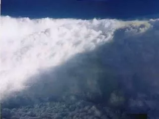
50-yr Floods PROJECTIONS of LARGEST WINTER STORMS (Atmospheric rivers, or pineapple expresses) Update to Dettinger, JAWRA, 2011
“ARkStorm” Consequences at Lake Tahoe • Short-Term (during & immediately following storm) • Flooding along streams & in meadows • Wind damage to structures • Deep wet snows/traffic interruptions, around Lake & to/from Lake • Infrastructure damages/utility interruptions • Trashed snow runs • Erosion, sediment & nutrient transports into Lake • Wind-blown tree falls • Dilution of upper layer of Lake?
“ARkStorm” Consequences at Lake Tahoe • Long-Term (month to years following storm) • Deep wet snows / continuing traffic interruptions to/from Lake (e.g., 1986) • Continuing utility interruptions • Trashed snow runs • Expensive repairs & economic recoveries • Forest/meadow damages • Continuing erosion/nutrient episodes • Major Lake clarity impact? • Repeated Lake clarity impacts? • Open-doors for invaders? Emergency-Response Desktop Exercises coming to Tahoe/Reno/CC region, Winter 2014!
FROM CLIMATE/HYDRO MODELS & • OTHER CONSIDERATIONS, • WE PROJECT: • Warming by +3 to +6ºC across Sierra, likely more so at higher altitudes • Much of Sierra in range for modest, wetter-or-drier trends • Monsoons may be delayed/reduced • Extreme weather/floods gets more extreme More rain, less snow Less snowpack Increased winter flood risks but longer low flows Less overall streamflow (think -5 to -15%) Changes in aquifer recharge Longer growing seasons More, more severe heat waves Fewer (but deeper?) cold snaps Increased wildfires Favors many invasive species
For much more info on these & other topics, see the new 2013 Southwest Climate Assessment Report: http://www.swcarr.arizona.edu Contact mddettin@usgs.gov w/questions or for info re: ARkStorm@Tahoe