Download
1 / 36
360 likes | 500 Views
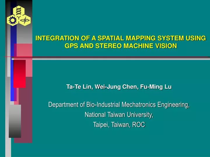
INTEGRATION OF A SPATIAL MAPPING SYSTEM USING GPS AND STEREO MACHINE VISION. Ta-Te Lin, Wei-Jung Chen, Fu-Ming Lu Department of Bio-Industrial Mechatronics Engineering, National Taiwan University, Taipei, Taiwan, ROC. INTRODUCTION. Precision Agriculture GPS and GIS

E N D
INTEGRATION OF A SPATIAL MAPPING SYSTEM USING GPS AND STEREO MACHINE VISION Ta-Te Lin, Wei-Jung Chen, Fu-Ming Lu Department of Bio-Industrial Mechatronics Engineering, National Taiwan University, Taipei, Taiwan, ROC
INTRODUCTION • Precision Agriculture • GPS and GIS • Spatial Mapping Methods • Stereo Machine Vision
INTRODUCTION SPATIAL MAPPING METHODS • Direct Measurement • Aerial Photography • Satellite and Airborne Scanning • Vehicular-based Position Detection • Field-walking • Etc.
OBJECTIVES • To develop concepts and integrate a spatial mapping system that allows for sensor fusion and establishment of basic GIS for farm management. • To implement the system with the capability to visualize, retrieve and store field data. • To test the performance of the system and its components.
MATERIALS & METHODS • System Description • GPS and Electronic Compass • Coordinate Transformation • Stereo Machine Vision • System Integration
Position GPS Host Computer User Interface Base Map Orientation Electronic Compass Positioning Database Map Layer 1 Map Layer 2 Image Database Stereo Machine Vision Image SYSTEM DESCRIPTION SCHEMATIC DIAGRAM OF THE SYSTEM
SYSTEM DESCRIPTION SYSTEM COMPONENTS • Trimble AgGPS 132 • TCM2-20 Electronic Compass • Dual Cameras • Matrox 4 Sight-II and Meteor II • Power Supply • MIL Image Processing Library • MapObjects (ESRI) Library
GPS AND ELECTRONIC COMPASS TRIMBLE AgGPS 132 • NMEA-0183 string • RS-232 interface • DGPS capability
GPS AND ELECTRONIC COMPASS TCM2-20 ELECTRONIC COMPASS • magneto-inductive magnetic sensor • RS-232 interface • Heading accuracy 0.5 • Tilt accuracy 0.2
GPS NMEA-0183 string WGS84 Spheroid Coordinates Coordinate Conversion WGS84 Cartesian Coordinates TWD67Cartesian Coordinates TWD67 Spheroid Coordinates Map Projection Transverse Mercator projections COORDINATE TRANSFORMATION
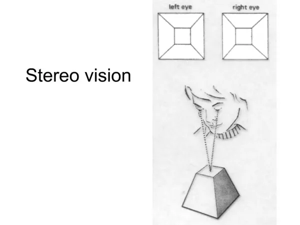
P(X,Z) Z Z X f Xl Xr Imaging plane B STEREO MACHINE VISION STEREO MACHINE VISION BASICS
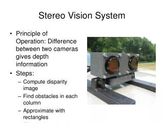
STEREO MACHINE VISION STEREO MACHINE VISION SYSTEM • Two JAI MCL-1500 Camera • 640x480 Resolution • NTSC Signal • Focal Length: 5.8~58mm
STEREO MACHINE VISION STEREO MACHINE VISION SYSTEM • Matrox 4 Sight-II • Celeron 566Mhz, 64MB RAM, 6GB HD, Windows NT 4.0 • Matrox Meteor II Image Processing Board
Data Acquisition Module Mapping Module Database Management Module GPS RS-232 I/O NMEA-0183 String Parsing Coordinate Transformation MapObjects User Interface Electronic Compass Positioning database Dual Cameras MIL Imaging Processing Library Image Processing Module Pattern Matching Range Estimation Image database SYSTEM INTEGRATION SOFTWARE FUNCTIONAL MODULES
SYSTEM INTEGRATION HARDWARE INTEGRATION
RESULTS • Performance of the GPS • Distance Measurement • Overall System Performance • Spatial Mapping and Retrieval
PERFORMANCE OF THE GPS Error in sampling point location using AgGPS 132 without differential correction
PERFORMANCE OF THE GPS Error in sampling point location using AgGPS 132 with differential correction
DISTANCE MEASUREMENT Error of distance estimation using the stereo machine vision system with f = 5.8 mm and B = 230 mm
DISTANCE MEASUREMENT Error of distance estimation using the stereo machine vision system with f = 58.0 mm and B = 230 mm
DISTANCE MEASUREMENT Error of distance estimation using the stereo machine vision system with f = 5.8 mm and B = 430 mm
DISTANCE MEASUREMENT Error of distance estimation using the stereo machine vision system with f = 58.0 mm and B = 430 mm
f=5.8, B=230mm f=58.0, B=230mm f=5.8, B=430mm f=58.0, B=430mm DISTANCE MEASUREMENT Comparisons of errors of distance estimation
OVERALL SYSTEM PERFORMANCE Error of distance estimation of the integrated spatial mapping system (f = 5.8 mm, B=230mm).
OVERALL SYSTEM PERFORMANCE Error of distance estimation of the integrated spatial mapping system (f = 5.8 mm, B=230mm).
OVERALL SYSTEM PERFORMANCE Comparison with the Aerial Mapping Method
SPATIAL MAPPING AND RETRIEVAL The user interface of the spatial mapping system
SPATIAL MAPPING AND RETRIEVAL The user interface of the spatial mapping system
SPATIAL MAPPING AND RETRIEVAL Retrieved image and indication of its scope on the map
SPATIAL MAPPING AND RETRIEVAL Relocating field objects and creating new map layer
SPATIAL MAPPING AND RETRIEVAL Relocating field objects and creating new map layer
SPATIAL MAPPING AND RETRIEVAL Base field map of TARI experimental paddy field
SPATIAL MAPPING AND RETRIEVAL Map layer showing scopes of saved image pairs
CONCLUSIONS • An integrated spatial mapping system combining GPS, electronic compass, and stereo machine vision is proposed and tested. • In the range of 100 m, the relative error of the whole spatial mapping system was 6.82.6%. • The integrated spatial mapping system provides a method to create digital maps incorporating image database. • The capability of retrieval and addition of range information from image database allows for dynamic and site-specific management of agricultural sectors.
FUTURE WORKS • System Accuracy • System Mobility • Database with Panoramic Images • 3-Dimensional Reconstruction
THANK YOU 謝 謝