Download
1 / 6
60 likes | 76 Views
Investigating geotechnical failures in coastal earthworks due to storm surges and floods for improved infrastructure resilience.

E N D
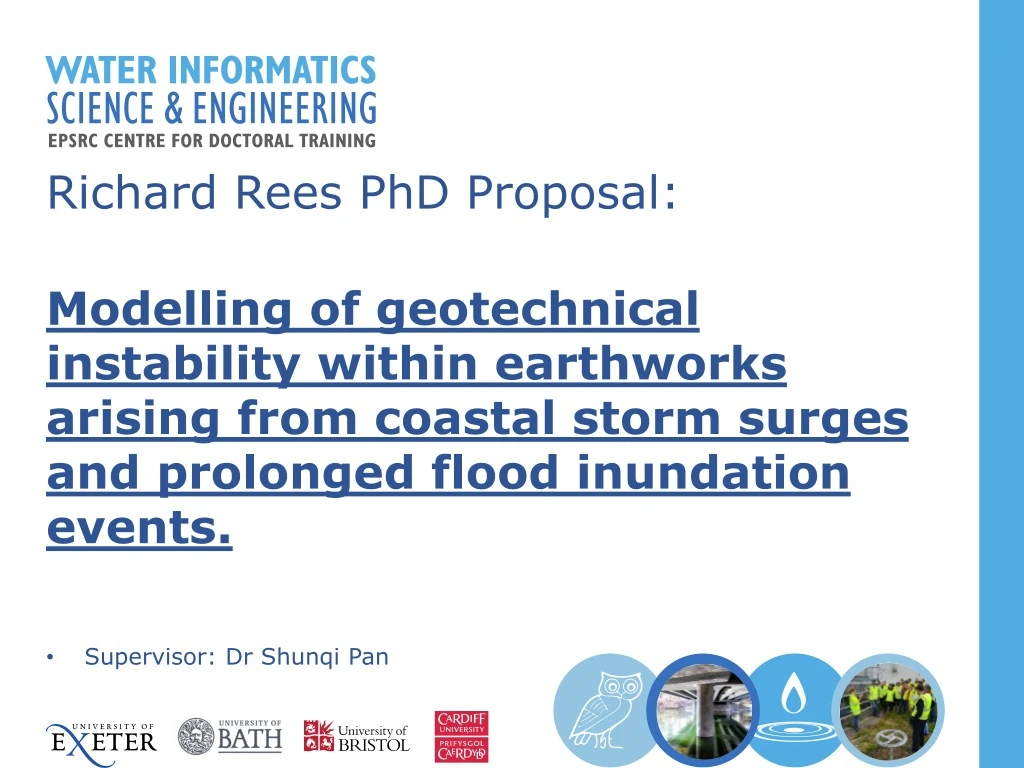
Richard Rees PhD Proposal: Modelling of geotechnical instability within earthworks arising from coastal storm surges and prolonged flood inundation events. Supervisor: Dr Shunqi Pan
Introduction Dawlish seawall breach - February, 2014 Recent Winters have generated successive powerful storm systems being strong winds and heavy rains. Coastal and inland regions have suffered significant damage to defensive and transport infrastructure. All have resulted in prolonged periods of disruption, expensive rebuilds, as well reduced economic output from the effected areas. The most widely publicised typically involves heavy engineered civil structures. What about geotechnical ‘earthwork’ based infrastructure? Shakespeare Cliff seawall (Dover) – Complete rebuild – March, 2016 Tadcaster Bridge reopening, Feb 2017
Somerset Levels (MLN, South of Bridgewater) – Flood water ~10m deep Geotechnical failures/damage Disruption to mainline railway services between Exeter and Bristol – Prolonged flooding of Somerset levels for over 6 weeks. Multiple breaching near Corston of River Douglas. Overtopping erosion of Great Western Canal leading to complete breach of structure. Corston, Lancashire. River levee breach – 31st December, 2015. Great Western Canal Breach – Halberton, Devon – November, 2012
PhD Proposal • Model Deepwater and near shore coastal storm conditions of target locality • Construct detailed geotechnical model of target locality structure and relevant surroundings. • Couple of the above to form hydro-geotechnical. • Potential use of geotechnical Remote Condition Monitoring (RCM) sensors of target locality earthwork.-Measurement of inclination, temperature, porewater pressure. Objectives • Create probabilistic flood risk and geotechnical instability maps in respect to initial storm event and from long term inundation and duration. • Allow more effective allocation of resources in preparation and recovery from inundation event. Overall, reducing repair and long term maintenance costs.
Dependencies • Network Rail • Appropriate study site (Ideally, N.Wales). • Borehole logs and geotechnical/soil mechanical properties of site. • Sensor acquisition, installation and operational costs. • Opportunity • Network Rail Welsh route in partnership with JBA regarding coastal asset management plan. PhD natural evolution of this. • Challenge • Coupling of historical oceanographic data to damaging geotechnical events. • Extrapolating these events to accommodate future sea-level and change in the nearshore conditions which will be experienced.