Download
1 / 16
160 likes | 195 Views
Explore the satellite training courses at The Caribbean Institute for Meteorology and Hydrology, offering various levels of meteorological education. Dive into techniques for weather forecasting, hazard identification, and aeronautical meteorology. Discover how satellite data integration enhances weather briefings and disaster risk management.

E N D
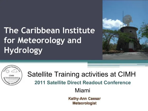
The Caribbean Institute for Meteorology and Hydrology Satellite Training activities at CIMH 2011 Satellite Direct Readout Conference Miami Kathy-Ann Caesar Meteorologist
The primary functions of CIMH Institute are to: • Provide facilities for the training of various categories of meteorological and hydrological personnel • Operate as a centre of research in meteorology and hydrology and associated sciences • Operate as contractors and consultants on various meteorological and hydrological projects • Maintain a service for the upkeep, repair, and calibration of meteorological instruments • Provide advice to participating governments on meteorological and hydrological matters • Collect, analyse, and publish meteorological and hydrological data • For 43 plus years has been the primary training and education facility for meteorological personnel in the Caribbean;. • CIMH has resigned itself to not only training but also in the involvement in collative projects that would benefit the local and regional community.
Satellite Training Courses • Training on the satellite technology, imagery interpretation and analysis now conducted at ALL levels of meteorological training at CIMH- • Entry level technicians’ course • Introduction to Basic Satellite Imagery • Mid-level technicians’ course • Interpretation for aeronautical briefing purposes; • Senior level technicians course • Interpretation, explanation and use of satellite products for forecasting purposes • Bachelors degree in Meteorology • Analysis, interpretation analysis and research • Continuing Professional Development – Online course for Operational Forecasters • Operational Satellite training Exercises
Aeronautical Meteorological Forecaster –WMO Competencies • Analyse and monitor continuously the weather situation • Simple scalar, synoptic analysis and satellite interpretation begin with in weeks of training; • Forecast aeronautical meteorological phenomena and parameters • Students use satellite products to assess regional and local features that can affect aeronautical operation • Warn of hazardous phenomena • Interpretation of synoptic analyses, NWP and remote sensing (satellite and radar) products • Ensure the quality of meteorological information and services • Regulations and documentation • Communicate meteorological information to internal and external users • Weather briefings, Public and Media presentations,
WMO 258 Satellite Meteorology Core competencies Assess current state of atmosphere & evolution Diagnosis (why?) Analysis (what?) Identify hemispheric, synoptic & mesoscale and local features Prognosis Identify relevant atmospheric processes Identify cloud types and amounts Identify atmospheric hazards Identify terrestrial surface conditions Integrate satellite data with other data sources Apply appropriate conceptual models Assess NWP guidance
Diagnostic Satellite Imagery from NOAA, and RAMSDISprovide valuable information Surface and upper level analysis both manual and machine generated TS Omar
Prognostic Use of satellite data in initializing the MM5 Mesoscale NWP Products
Special Events Forecasting and Disaster Risk Management Hurricane Tomas October 29th, 2010 The TAOS Real-time Impact Forecasting System (RTFS) Cricket World Cup 2007 2007 Cricket World Cup Final; ICC World Twenty20 Final ...Rain before play reduced the game to 38 overs per side at Kensington Oval the venue for the 2007 Cricket World Cup final between Australia and Sri Lanka, held on April 28,
Caribbean Weather Discussion Vlab - Regional Focus Group Satellite Discussions Visitview Focal Group Monthly Weather Discussion across Latin America and the Caribbean; Lead by Tony Mosel (UCAR/COMET); Bernadette Connell (CIRA) and Mike Davison (NCEP); Satellite data interpretations Special Weather events • Monthly weather briefings for Caribbean; • Weather briefings and system discussion • Teaching and Continuous Professional Development • Special events • Dust Week • Onset of tropical storms • Introduction of new products; e.g. TWP, RTFS TAOS model
Vlab – RFG – Special Events • Soufriere Volcanic Eruption • Afternoon February 11th 2010. • Large unexpected ‘cloud’ appeared over north eastern Caribbean Island • The Impressive plume shutdown flights across the Lesser Antilles • The discussion group got a RGB demonstration for Bernie Connell of CIRA • Blended Total Precipitable Water (TPW) imagery • Regional sessions on the TWP products assisted by Sheldon Kusselson of NOAA • Has been widely used in the regional forecast office
Real-Time Flood Forecasting for the CaribbeanFlood Forecasting Concept • The problem • Floods are a concern due to inadequate and untimely flood forecasts often lead to significant economic losses, and possibly, the loss of life • Our solution • Integrate quantitative precipitation forecasts into a distributed hydrological model • NWP WRF Mesoscale model and hydrological model • Updates utilizing outputs from Doppler weather radars • TRMM data
Progress to date… • Haiti recovery efforts http://63.175.159.26/~haiti WRF Outputs superimposed onto 2D surface map WRF Outputs superimposed onto watershed map of Haiti
Problems • Insufficient funds. • The Institute is funded by the supporting governments and with some of these facing harsh economic times the required funding is hardly ever received. • The Institute despite the difficulties intends to expand its training methods by including computer aided learning materials in a meaningful way. • Efforts are being made to increase more consulting activities; • Need to increase bandwidth • Significant progress has been made • Lack of adequate finances also impinges on the ability to hire adequate staff. • More activities require more staff
The Future • Integrate new satellite products into training and research; • Introduction of GEOnetCAST; • CoE VLab webpage; • Introduction of a Marine Meteorology program; • Continuing Professional Development program; • Aid Disaster Preparedness efforts;