Download
1 / 5
50 likes | 60 Views
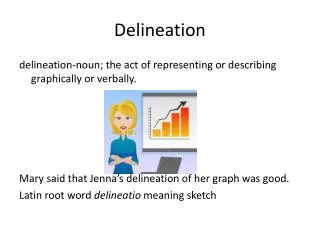
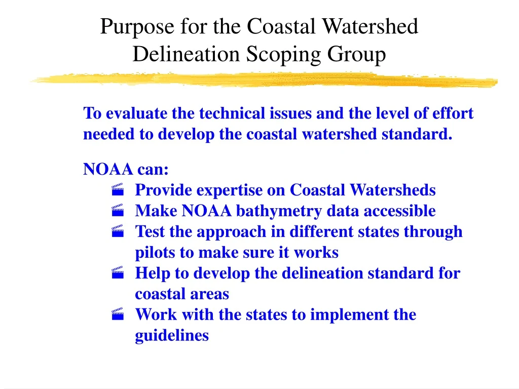
Purpose is to evaluate technical issues and level of effort needed to develop the coastal watershed standard. NOAA offers expertise, accessible bathymetry data, pilots to test the approach, development of the standard, and state collaboration.

E N D
Purpose for the Coastal Watershed Delineation Scoping Group To evaluate the technical issues and the level of effort needed to develop the coastal watershed standard. NOAA can: • Provide expertise on Coastal Watersheds • Make NOAA bathymetry data accessible • Test the approach in different states through pilots to make sure it works • Help to develop the delineation standard for coastal areas • Work with the states to implement the guidelines
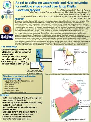
Proposed Timeline for Developing the Coastal Watershed Delineation Standard Next Steps Rec. Options for Additional NOAA Involvement Pilot Projects to Test Approach Supply Bathy data and new data ME, MA • Form Scoping Group • NCCOS • SPO • OCS • NMFS • others? Coastal Watershed Delineation Protocol and Criteria Draft protocol for North Carolina Completed Watershed Boundary Dataset NC Training Tech FL, TX Tech Transfer CA States NRCS Other Agencies Boundary Certification w/NRCS AK Jan‘01 Apr ‘01 Sept ‘01 Dec ‘02
Questions for the NOAA Watershed Delineation Scoping Group (cont.)
Questions for the NOAA Watershed Delineation Scoping Group (cont.)